Strasburg in Shenandoah County, Virginia — The American South (Mid-Atlantic)
Historic Strasburg
Stop # 7
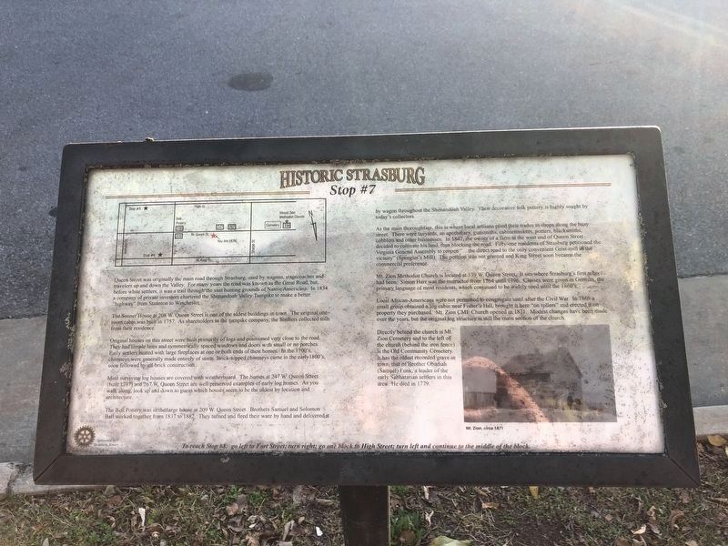
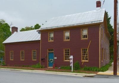
The Sonner House at 208 W. Queen Street is one of the oldest buildings in town. The original one-room cabin was built in 1757. As shareholders in the turnpike company, the Sonners collected tolls from their residence.
Original houses on this street were built primarily of logs and positioned very close to the road. They had simple lines and symmetrically spaced windows and doors with small or no porches. Early settlers heated with large fireplaces at one end or both ends of their homes. In the 1700's, chimneys were generally made entirely of stone. Brick topped chimneys came in the early 1800's, soon followed by all-brick construction.
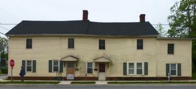
Most surviving log houses are covered with weatherboard. The homes at 247 W. Queen Street (built 1797) and 267 W. Queen Street are well preserved examples of early log homes. As you walk along, look up and down to guess which houses seem to be the oldest by location and architecture.
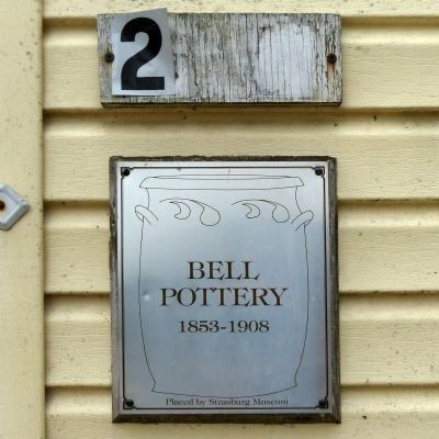
The Bell Pottery was in the large house at 209 W. Queen Street. Brothers Samuel and Soloman Bell worked together from 1837 to 1882. They turned and fired their ware by hand and delivered it by wagon throughout the Shenandoah Valley. Their decorative fold pottery is highly sought by today's collectors.
As the main thoroughfare, this is where local artisans plied their trades in shops along the busy street. There were tanyards, an apothecary, gunsmiths, cabinetmakers, potters, blacksmiths, cobblers and other businesses. In 1842, the owner of a farm at the west end of Queen Street decided to cultivate his land, thus blocking the road. Fifty-one residents of Strasburg petitioned the Virginia General Assembly to reopen “…the direct road to the only convenient Grist-mill in the vicinity” (Spenger's Mill). The petition was not granted and King Street soon became the commercial preference.
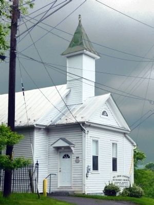
Mt. Zion Methodist Church is located at 339 W. Queen Street. It sits where Strasburg's first school had been. Simon Harr was the instructor from 1764 until 1796. Classes were given in German, the primary language of most residents, which continued to be widely used until the 1860's.
Local African-Americans were not permitted to congregate until after the Civil War. In 1869 a small group obtained a log cabin near Fisher's Hill, brought it here “on rollers” and erected on the property they purchased. Mt. Zion CME Church opened in 1871. Modest changes have been made over the years, but the original log structure is still the main section of the church.
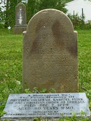
Directly behind the church is Mt. Zion Cemetery and to the left of the church (behind the iron fence) is the Old Community Cemetery. It has the oldest recorded grave in town, that of Brother Obadiah (Samuel) Funk, a leader of the early Sabbatarian settlers in this area. He died in 1779.
Erected by Strasburg Rotary. (Marker Number 7.)
Topics and series. This historical marker is listed in these topic lists: African Americans • Industry & Commerce • Man-Made Features • Roads & Vehicles. In addition, it is included in the Christian Methodist Episcopal (CME) Church series list. A significant historical year for this entry is 1834.
Location. 38° 59.333′ N, 78° 21.885′ W. Marker is in Strasburg, Virginia, in Shenandoah County. Marker is on West Queen Street west of South Fort Street, on the right when traveling west. Touch for map. Marker is at or near this postal address: 208 W Queen Street, Strasburg VA 22657, United States of America. Touch for directions.
Other nearby markers. At least 8 other markers are within walking distance of this marker. Sonner House (within shouting distance of this marker); Open House (about 500 feet away, measured in a direct line); a different marker also named Historic Strasburg (about 500 feet away); a different marker also named Historic Strasburg (about 800 feet away); a different marker also named Historic Strasburg (approx. 0.2 miles away); Saint Paul’s Lutheran Church (approx. 0.2 miles away); a different marker also named Historic Strasburg (approx. 0.2 miles away); Stonewall's Surprise (approx. 0.2 miles away). Touch for a list and map of all markers in Strasburg.
Credits. This page was last revised on January 23, 2022. It was originally submitted on May 23, 2014, by Allen C. Browne of Silver Spring, Maryland. This page has been viewed 1,001 times since then and 52 times this year. Last updated on January 22, 2022, by Carl Gordon Moore Jr. of North East, Maryland. Photos: 1. submitted on November 7, 2020, by Devry Becker Jones of Washington, District of Columbia. 2, 3, 4, 5, 6, 7. submitted on May 23, 2014, by Allen C. Browne of Silver Spring, Maryland. • J. Makali Bruton was the editor who published this page.
