Coopers Rock State Forest in Monongalia County, West Virginia — The American South (Appalachia)
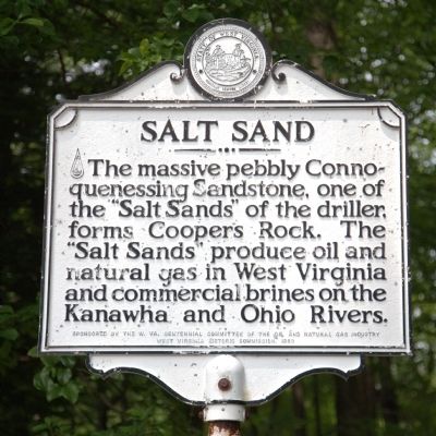
Salt Sand
Erected 1963 by West Virginia Historic Commission. Sponsored by the W. Va. Centennial Committee of the oil and natural gas industry.
Topics and series. This historical marker is listed in these topic lists: Environment • Industry & Commerce • Natural Features • Natural Resources. In addition, it is included in the West Virginia Archives and History series list.
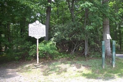
Location. 39° 38.217′ N, 79° 48.824′ W. Marker is in Coopers Rock State Forest, West Virginia, in Monongalia County. Marker is on County Line Drive (Local Route 73/12) south of Exit 15 (Interstate 68), on the left. It is at the parking lot at the end of the road, near the concession stand. Touch for map. Marker is at or near this postal address: 61 County Line Drive, Bruceton Mills WV 26525, United States of America. Touch for directions.
Other nearby markers. At least 8 other markers are within 3 miles of this marker, measured as the crow flies. The CCC: Creating a Lasting Monument to Conservation (about 400 feet away, measured in a direct line); Fueling a Community: The Henry Clay Iron Furnace (approx. 0.9 miles away); Henry Clay Iron Furnace (approx. 0.9 miles away); Henry Clay Furnace (approx. 1.2 miles away); Clean Water Comes To Morgantown (approx. 2.8 miles away); A Small Dam and a Big "Bowl" Meet the Need for Clean Water (approx. 2.8 miles away); Prehistoric Garden (approx. 2.8 miles away); Strong Men and Horses Build the Basin (approx. 2.9 miles away). Touch for a list and map of all markers in Coopers Rock State Forest.
Credits. This page was last revised on June 16, 2016. It was originally submitted on June 18, 2014, by J. J. Prats of Powell, Ohio. This page has been viewed 538 times since then and 49 times this year. Photos: 1, 2, 3, 4. submitted on June 18, 2014, by J. J. Prats of Powell, Ohio.


