Sadsbury Township near Conneaut Lake in Crawford County, Pennsylvania — The American Northeast (Mid-Atlantic)
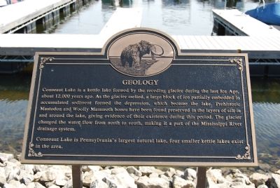
Geology
Conneaut Lake is Pennsylvania's largest natural lake, four smaller kettle lakes exist in the area.
Topics. This historical marker is listed in these topic lists: Paleontology • Science & Medicine • Waterways & Vessels.
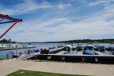
Location. 41° 36.225′ N, 80° 18.056′ W. Marker is near Conneaut Lake, Pennsylvania, in Crawford County. It is in Sadsbury Township. Marker can be reached from Grand Army of the Republic Highway (U.S. 6). Marker is located in Ice House Park in Conneaut Lake Borough. Touch for map. Marker is at or near this postal address: 125 Water St, Conneaut Lake PA 16316, United States of America. Touch for directions.
Other nearby markers. At least 8 other markers are within 6 miles of this marker, measured as the crow flies. The Ice Industry and the Ice Houses (within shouting distance of this marker); The Railroads (within shouting distance of this marker); To the Memory of the Brave (about 400 feet away, measured in a direct line); This Tablet (about 600 feet away); This Carousel (approx. 2.3 miles away); Blue Streak (approx. 2.3 miles away); Erie Extension Canal (approx. 4.3 miles away); a different marker also named Erie Extension Canal (approx. 5.1 miles away). Touch for a list and map of all markers in Conneaut Lake.
Credits. This page was last revised on February 7, 2023. It was originally submitted on June 20, 2014, by Mike Wintermantel of Pittsburgh, Pennsylvania. This page has been viewed 585 times since then and 32 times this year. Photos: 1, 2. submitted on June 20, 2014, by Mike Wintermantel of Pittsburgh, Pennsylvania.

