Eau Claire in Eau Claire County, Wisconsin — The American Midwest (Great Lakes)
"The Log Flume"
Dells Pond to Half Moon Lake
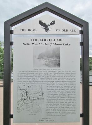
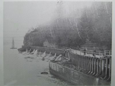
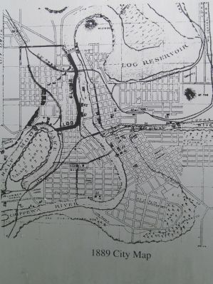
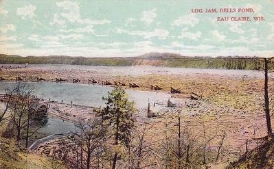
For 19th century lumbermen, the key to logging in the Chippewa Valley was getting pine logs to go where they wanted them to go. In 1879, the Eau Claire Dells Improvement Company dammed the Chippewa River and created a huge log holding pond, but the task of transporting logs to sawmills remained. Floating them down river created too much congestion in the heart of the city, so mill owners Daniel Shaw, Orrin Ingram, William Carson and others devised a combination flume-canal-tunnel to bring logs the 1.2 miles from Dells Pond to Half Moon Lake. The 8' x 10' wooden flume ran along the rock wall of the river's west bank. A planked cat-walk was constructed on top of the flume which allowed workers to monitor the flume for jams or damage. In addition, a "Tainter gate" was installed at the beginning of the flume which acted as a giant water shut-off valve. South of the Omaha railroad bridge the flume turned inland and fed five feet of water into a canal parallel to the river. The canal brought logs to the corner of Mappa and Randall streets where they dropped 18 feet into a 1,000 foot long tunnel which extended to Half Moon Lake.
Completed in April 1880, the novel contraption attracted sightseers and invited unintended uses. Neighborhood housewives found the canal convenient for doing laundry. Mill hands used it to bathe. Tragically, the uncovered canal also took the lives of many careless children. When the sawmills closed, the flume was left to rot. The tunnel served as a beer cooler and shortcut for braver residents until it to began to deteriorate and had to be sealed. In 1990, city workers finally filled the tunnel after its disintegration ruptured sewer lines and collapsed houses.
Hobbs Foundation
Erected by the Eau Claire Landmark Commission; Hobbs Foundation. (Marker Number 19.)
Topics. This historical marker is listed in these topic lists: Industry & Commerce • Man-Made Features • Waterways & Vessels. A significant historical month for this entry is April 1880.
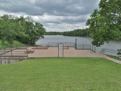
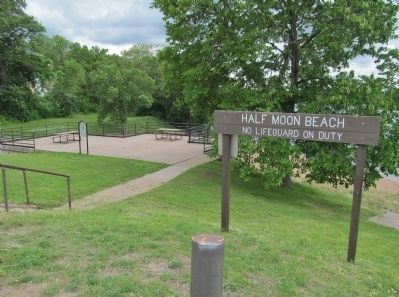
Location. 44° 48.839′ N, 91° 30.887′ W. Marker is in Eau Claire, Wisconsin, in Eau Claire County. Marker can be reached from Randall Street west of Whipple Street, on the left when traveling west. Marker is at Half Moon Beach. Touch for map. Marker is in this post office area: Eau Claire WI 54701, United States of America. Touch for directions.
Other nearby markers. At least 8 other markers are within walking distance of this marker. Waldemar Ager House (about 700 feet away, measured in a direct line); The "Flume" (about 800 feet away); Luther Midelfort: A History of Caring (approx. 0.2 miles away); Legend of Paul Bunyan (approx. 0.3 miles away); The Mittelstadt House (approx. 0.4 miles away); The Ice Industry on Half Moon Lake (approx. 0.4 miles away); Herman T. Lange House (approx. 0.4 miles away); Recreation on Half Moon Lake (approx. half a mile away). Touch for a list and map of all markers in Eau Claire.
More about this marker. photo captions:
• Log Flume Along The West Side of The Chippewa River
• 1889 City Map
Also see . . .
1. The Dells Dam. Eau Claire County GenWeb website entry (Submitted on June 23, 2014.)
2. "Lumbermen on the Chippewa". McMillan Memorial Library Digital Collections website entry (Submitted on June 23, 2014.)
Credits. This page was last revised on January 13, 2022. It was originally submitted on June 23, 2014, by Keith L of Wisconsin Rapids, Wisconsin. This page has been viewed 1,737 times since then and 84 times this year. Photos: 1, 2, 3, 4, 5, 6, 7, 8. submitted on June 23, 2014, by Keith L of Wisconsin Rapids, Wisconsin. 9. submitted on October 31, 2015.
