Near St. George in Tucker County, West Virginia — The American South (Appalachia)
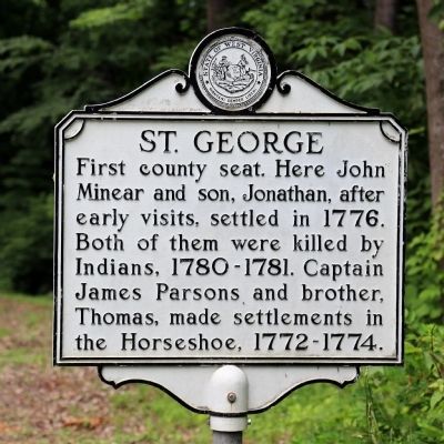
St. George
Topics and series. This historical marker is listed in these topic lists: Colonial Era • Native Americans • Political Subdivisions • Settlements & Settlers. In addition, it is included in the West Virginia Archives and History series list. A significant historical year for this entry is 1776.
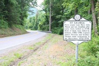
Location. 39° 9.716′ N, 79° 42.244′ W. Marker is near St. George, West Virginia, in Tucker County. Marker is on Cheat Valley Highway (West Virginia Route 72) east of Mountaineer Highway (West Virginia Route 28), on the right when traveling west. Touch for map. Marker is at or near this postal address: 5405 Cheat Valley Highway, Parsons WV 26287, United States of America. Touch for directions.
Other nearby markers. At least 8 other markers are within 5 miles of this marker, measured as the crow flies. Capture of St. George / Imboden’s Expedition (approx. 0.3 miles away); Saint George Academy (approx. 0.3 miles away); Jonathan Minear (approx. 2 miles away); Flood of November 4-5, 1985 Memorial (approx. 4.7 miles away); Tucker County Courthouse (approx. 4.7 miles away); Tucker County Bank Building (approx. 4.7 miles away); Corrick's Ford Battle (approx. 4.7 miles away); Tucker County Jail (approx. 4.7 miles away). Touch for a list and map of all markers in St. George.
More about this marker. Marker is across the river from St. George, but trees and foliage does not allow you to see the town.
Also see . . . Wikipedia Entry. Originally known as Fort Minear and then as Westernford, St. George was settled in 1774 by German immigrant John Minear and his son, Jonathan, after early scouting visits to the area. In 1856, an act creating the county specified that Tucker's county court was to be held on the lands of Enoch Minear, descendant of Jonathan Minear. The town was then renamed Saint George in honor of Henry St. George Tucker, Jr. (1828–63), the son of the county's namesake, Henry St. George Tucker, Sr. (1780–1848).
During the Tucker County Seat War, on the evening of August 1, 1893, vigilantes from Parsons seeking to move the county seat broke into the courthouse and stole the county records and the courthouse bell, moving the government of Tucker County to Parsons, where it has remained to this day. (Submitted on June 29, 2014.)
Credits. This page was last revised on July 18, 2020. It was originally submitted on June 29, 2014, by J. J. Prats of Powell, Ohio. This page has been viewed 697 times since then and 80 times this year. Photos: 1, 2. submitted on June 29, 2014, by J. J. Prats of Powell, Ohio.
Editor’s want-list for this marker. Photos of the town and of St. George Academy. • Can you help?

