Near Fredericksburg in Spotsylvania County, Virginia — The American South (Mid-Atlantic)
McCarty Farm
Battle of Chancellorsville - 1863
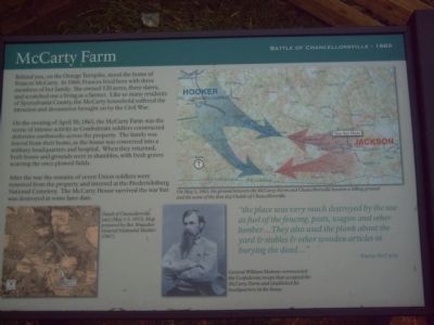
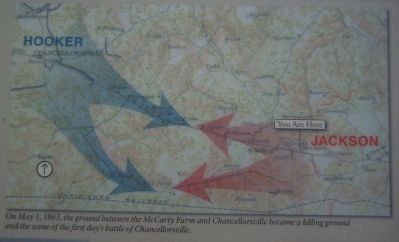
On the evening of April 30, 1863, the McCarty Farm was the scene of intense activity as Confederate soldiers constructed defensive earthworks across the property. The family was forced from their home, as the house was converted into a military headquarters and hospital. When they returned, both house and grounds were in shambles, with fresh graves scarring the once plowed fields.
After the war the remains of seven Union soldiers were removed from the property and interred at the Fredericksburg National Cemetery. The McCarty House survived the war but was destroyed at some later date.
”the place was very much destroyed by the use as fuel of the fencing, posts, wagon and other lumber…They also used the plank about the yard & stables & other wooden articles in burying the dead…”
Topics. This historical marker is listed in this topic list: War, US Civil. A significant historical date for this entry is April 30, 1879.
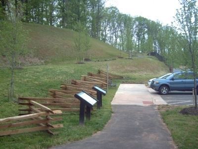
Location. 38° 17.62′ N, 77° 34.314′ W. Marker is near Fredericksburg, Virginia, in Spotsylvania County. Marker can be reached from Plank Road/Germanna Highway (Virginia Route 3) near Harrison Road. Touch for map. Marker is at or near this postal address: 5701 Plank Road, Fredericksburg VA 22407, United States of America. Touch for directions.
Other nearby markers. At least 8 other markers are within one mile of this marker, measured as the crow flies. Confederate Defense Turns to Offense (here, next to this marker); Earthworks (about 400 feet away, measured in a direct line); Roads Through the Battlefield (about 500 feet away); Opening of the Campaign (about 500 feet away); Spotswood’s Furnace (about 800 feet away); First Day at Chancellorsville (approx. 0.9 miles away); 11th United States Infantry (approx. one mile away); a different marker also named First Day at Chancellorsville (approx. one mile away). Touch for a list and map of all markers in Fredericksburg.
More about this marker. In the lower left of this marker is a map showing the "Detail of Chancellorville [sic] (May 1-3, 1853), Map prepared by Bvt. Brigadier General Nathanial Michler (1867)."
Regarding McCarty Farm. This marker is grouped with the markers along McLaws Drive, Furnace Road, Sickles Drive, East Jackson Trail, and others on the east side of the battlefield. See the First Days of the Battle of Chancellorsville Virtual
Tour by Markers in the links section for a listing of related markers on the tour.
Also see . . .
1. Battle of Chancellorsville. National Parks Service site. (Submitted on May 2, 2008, by Craig Swain of Leesburg, Virginia.)
2. First Days of the Battle of Chancellorsville Virtual Tour by Markers. This virtual tour by markers covers action from May 1-3, 1863. (Submitted on May 2, 2008, by Craig Swain of Leesburg, Virginia.)
Credits. This page was last revised on February 2, 2023. It was originally submitted on May 1, 2008, by Kevin W. of Stafford, Virginia. This page has been viewed 1,922 times since then and 53 times this year. Photos: 1, 2, 3, 4. submitted on May 1, 2008, by Kevin W. of Stafford, Virginia. • Craig Swain was the editor who published this page.


