St. Catharines in Niagara Region, Ontario — Central Canada (North America)
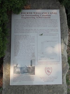
The Fourth Welland Canal
An Outstanding Canadian Engineering Achievement
The original project work was done under the supervision of Chief Engineers W.A. Bowden and Colonel A.E. Dubuc of the Federal Department of Railways and Canals, and Engineers-in-Charge of Construction J.L. Weller and A.J. Grant, MEIC.
* * * *
Canal lock gates are either strut- or cable-operated. The gates at the north (lower) end of this lock are strut-operated, those at the south end cable-operated. The pair of cast steel sheaves standing adjacent to this tablet is similar to ones used at the bottom (submerged) free end of a cable-operated gate. This assembly weighs approximately 2460 kg (5420 lbs.). A similar but differently-mounted pair of sheaves is located at the upper free end of each cable-operated gate. Two steel wire ropes pass over the sheaves to open and close the gate. Electrically driven counter-rotating drums activate the ropes - one drum reels in one rope as the second pays out the other, causing movement of the gate.
[Caption for lower photo:] The twin Flight Locks No.4, 5, and 6 where the ships climb the Niagara Escarpment, overcoming a vertical distance of 42.5m (139.5 ft.). The vessel on the left is downbound, the one on the right is upbound in Lock No.4 West. The twin bascule bridges carry main railway lines. the tall surge tank on the right stands behind the power house.
[Caption for diagram on right:] Schematic diagram showing the operation of a cable-operated lock gate. Only one gate leaf is shown, in a partially-closed position.
Presented to the St.Catharines Museum by The Engineering Institute of Canada and its Member Societies.
November 29, 1996
Erected 1996 by The Engineering Institute of Canada and its Member Societies.
Topics. This historical marker is listed in these topic lists: Man-Made Features • Waterways & Vessels. A significant historical year for this entry is 1913.
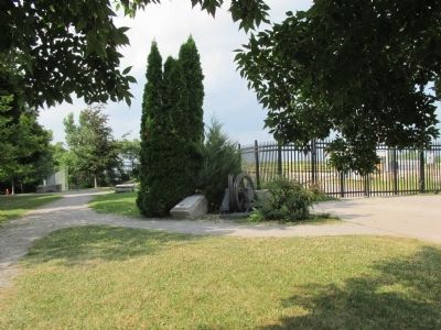
Location. 43° 9.371′ N, 79° 11.65′ W. Marker is in St. Catharines, Ontario, in Niagara Region. Marker can be reached from Welland Canals Trail. Marker is located on the grounds of the St. Catharines Museum & Welland Canals Centre. Marker is at the corner of the north end of the wide cement walkway parallel to the canal. It is at the beginning of an oval path along which are placed artifacts and markers. Touch for map. Marker is at or near this postal address: 1932 Welland Canals Parkway, St Catharines ON L2R7K6, Canada. Touch for directions.
Other nearby markers. At least 8 other markers are within walking distance of this marker. Cannon Barrel (a few steps from this marker); Bollard (a few steps from this marker); William Hamilton Merritt 1793 - 1862 (within shouting distance of this marker); Welland Ship Canal (within shouting distance of this marker); International Shipmasters' Association (within shouting distance of this marker); Early Welland Canals (within shouting distance of this marker); Spring Tooth Cultivator (within shouting distance of this marker); The Welland Canals and the St. Lawrence Seaway System (about 90 meters away, measured in a direct line). Touch for a list and map of all markers in St. Catharines.
Also see . . .
1. St. Catharines Museum & Welland Canal Centre. (Submitted on August 8, 2014, by Anton Schwarzmueller of Wilson, New York.)
2. Welland Canal - Wikipedia. (Submitted on August 8, 2014, by Anton Schwarzmueller of Wilson, New York.)
Credits. This page was last revised on September 27, 2019. It was originally submitted on August 8, 2014, by Anton Schwarzmueller of Wilson, New York. This page has been viewed 437 times since then and 32 times this year. Photos: 1, 2, 3. submitted on August 8, 2014, by Anton Schwarzmueller of Wilson, New York. • William J. Toman was the editor who published this page.


