Connellsville in Fayette County, Pennsylvania — The American Northeast (Mid-Atlantic)
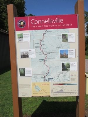
Connellsville
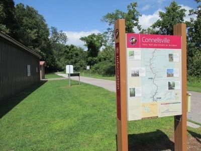
Trail Map and Points of Interest
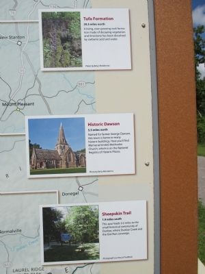
Tufa Formation, 20.5 miles north. A living, ever-growing rock formation made of decaying vegetation and limestone has been dissolved by carbonic acid and water. Photo by Betsy Mandarino.
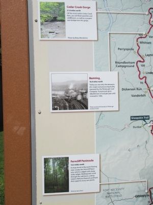
Banning, 16.9 miles north. Today you see only the remnants of a major coal processing facility operated by the Pittsburgh Coal Company. It processed up to 500,000 tons of coal per year until it closed in 1956. Photo courtesy of University of Pittsburgh Archives Center.
Historic Dawson, 5.5 miles north. Named for farmer George Dawson, this town is home to many historic buildings. Here you'll find Memorial United Methodist Church, which is on the National Register of Historic Places. Photo by Betsy Mandarino.
Sheepskin Trail, 1.9 miles south. This spur leads 2.2 miles to the small historical community of Dunbar, where Dunbar Creek and the Gist Run converge. Photograph courtesy of Trailbook. Ferncliff Peninsula, 16.5 miles south. A sharp bend in the north-flowing river creates the Ferncliff Peninsula, which is edged with steep, rocky ledges. Walking trails wind through the oak forest, a designated a National Natural Landmark that supports many rare plants. Photo by Stacie Faust.
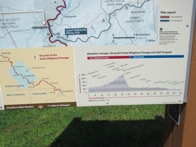
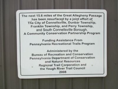
The Great Allegheny Passage is part of a trail system that connects Pittsburgh, Pennsylvania to Washington, D.C. Conceived in 1975, the 150-mile long Passage connects to the C&O Canal Towpath in Cumberland, Maryland. Together, they make up a significant segment of the Potomac Heritage National Scenic Trail, a component of the National Trail System.
25 miles to West Newton * 17 miles to Ohiopyle
Topics and series. This historical marker is listed in these topic lists: Architecture • Environment • Industry & Commerce • Waterways & Vessels. In addition, it is included in the National Natural Landmarks series list. A significant historical year for this entry is 1956.
Location. 40° 1.326′ N, 79° 36.203′ W. Marker is in Connellsville, Pennsylvania, in Fayette County. Marker can be reached from Great Allegheny Passage (North). Marker is at the trail head of the Great Allegheny Passage (north), Youghiogheny River Trail section, behind the Martin's grocery store plaza, address 800 Vanderbilt Rd. (PA Route 201), Connellsville, off of U.S. Route 119. There is a stationary caboose, painted B&O red, and free parking at the trail head. Touch for map. Marker is in this post office area: Connellsville PA 15425, United States of America. Touch for directions.
Other nearby markers. At least 8 other markers are within walking distance of this marker. A different marker also named Connellsville (here, next to this marker); Chestnut Ridge (a few steps from this marker); Braddock's Twelfth Camp (approx. 0.2 miles away); Home of Colonel William Crawford (approx. 0.2 miles away); The French And Indian War 1754 - 1763 (approx. 0.2 miles away); Connellsville, A River Runs Through It (approx. 0.2 miles away); a different marker also named Connellsville (approx. 0.3 miles away); a different marker also named Connellsville (approx. 0.3 miles away). Touch for a list and map of all markers in Connellsville.
More about this marker. The opposite side of the marker is "Connellsville - Gateway to the Laurel Highlands."
Regarding Connellsville. This section of trail is the railbed of the Pittsburgh, McKeesport & Youghiogheny Railroad, later part of the Pittsburgh & Lake Erie Railroad.
Also see . . .
1. Great Allegheny Passage. (Submitted on August 31, 2014, by Anton Schwarzmueller of Wilson, New York.)
2. Yough River Trail Council. (Submitted on August 31, 2014, by Anton Schwarzmueller of Wilson, New York.)
Credits. This page was last revised on September 3, 2023. It was originally submitted on August 31, 2014, by Anton Schwarzmueller of Wilson, New York. This page has been viewed 430 times since then and 10 times this year. Photos: 1, 2, 3, 4, 5, 6, 7. submitted on August 31, 2014, by Anton Schwarzmueller of Wilson, New York. • Bill Pfingsten was the editor who published this page.
