Tonawanda in Erie County, New York — The American Northeast (Mid-Atlantic)
The Dam
An Overview
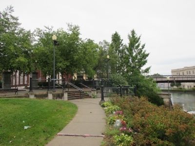
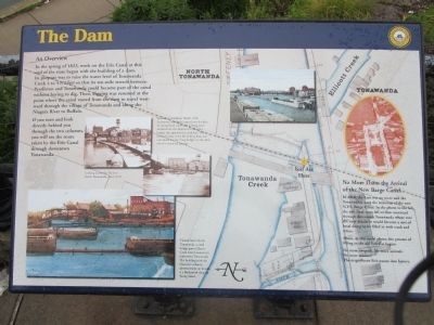
In the spring of 1823, work on the Erie Canal at this end of the state began with the building of a dam. Its purpose was to raise the water level of Tonawanda Creek 4 to 4 1/2 feet so that its ten-mile stretch between Pendleton and Tonawanda could become part of the canal without having to dig. Then, digging was resumed at the point where the canal veered from the dam to travel westward through the village of Tonawanda and along the Niagara River to Buffalo. If you turn and look directly behind you through the two columns, you will see the route taken by the Erie Canal through downtown Tonawanda.
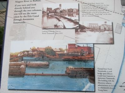
Looking across the Dam to North Tonawanda, circa 1910.
Runaway Canal Boat, March 1916. A runaway canal boat, carried over the dam by spring flood waters and melting snow, smashed into the abutments of the creek here. The railroad bridge at the left of this photo was unharmed, but the "long bridge" on the other side of it sustained damage.
Viewed from North Tonawanda, a canal bridge spans Ellicott Creek from Gastown to downtown Tonawanda. The building with the Discovery tobacco advertisement on its side is a blacksmith shop on Young Street.
No More Dam: the Arrival of the New Barge Canal
In 1918, the dam was no more and the Tonawandas were the terminus of the new
Above, in this aerial photo, the process of filling in the old Erie has begun.
No more towpath. No more animals. No more manure. The magnificent Erie passes into history.
Topics and series. This historical marker is listed in these topic lists: Man-Made Features • Waterways & Vessels. In addition, it is included in the Erie Canal series list. A significant historical month for this entry is March 1916.
Location. 43° 1.268′ N, 78° 52.669′ W. Marker is in Tonawanda, New York, in Erie County. Marker is at the intersection of Young Street and Main Street, on the right on Young Street. Marker is in an area called Tonawandas Gateway Harbor Overlook Plaza. Touch for map. Marker is in this post office area: Tonawanda NY 14150, United States of America. Touch for directions.
Other nearby markers. At least 8 other markers are within walking distance of this marker. Lumber Capital (here, next to this marker); Gateway to the West (a few steps from this marker); The Railroad (within shouting distance of this marker); Roll of Honor (within shouting distance of this marker); a different marker also named Roll of Honor (within shouting distance of this marker); Lumber Port (about 300 feet away, measured in a direct line); The Long Homestead (about 500 feet away); a different marker also named Long Homestead (about 500 feet away). Touch for a list and map of all markers in Tonawanda.
Regarding The Dam. The I-190 was built upon the abandoned Erie Canal from Tonawanda to Buffalo along the Niagara River.

Photographed By Anton Schwarzmueller, September 13, 2014
4. The Dam Marker
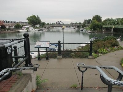
Reverse view (westward). The two columns at the left are mentioned in the text of the marker as the view of where the old Erie Canal left Tonawanda Creek; the Old Erie Canal is now Niagara Street. The back of the marker is at the black rail along the flower bed at right. The bridge at right is Main Street over Tonawanda Creek and the present Erie (Barge) Canal.
Credits. This page was last revised on June 16, 2016. It was originally submitted on September 21, 2014, by Anton Schwarzmueller of Wilson, New York. This page has been viewed 425 times since then and 41 times this year. Last updated on September 27, 2014, by Anton Schwarzmueller of Wilson, New York. Photos: 1, 2, 3, 4. submitted on September 21, 2014, by Anton Schwarzmueller of Wilson, New York. • Kevin W. was the editor who published this page.


