Jefferson in Coos County, New Hampshire — The American Northeast (New England)
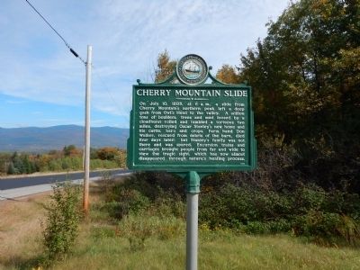
Cherry Mountain Slide
On July 10, 1885, at 6 a.m., a slide from Cherry Mountain's northern peak left a deep gash from Owl's Head to the valley. A million tons of boulders, trees and mud loosed by a cloudburst rolled and tumbled a tortuous two miles, destroying Oscar Stanley's new home and his cattle, barn and crops. Farm hand Don Walker, rescued from debris of the barn, died four days later; but Stanley's family was not there and was spared. Excursion trains and carriages brought people from far and wide to view the tragic sight, which has now almost disappeared through nature's healing process.
Erected 1985 by New Hampshire Division of Historical Resources. (Marker Number 152.)
Topics and series. This historical marker is listed in these topic lists: Agriculture • Animals • Disasters • Environment. In addition, it is included in the New Hampshire Historical Highway Markers series list. A significant historical month for this entry is July 1796.
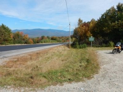
Location. 44° 21.616′ N, 71° 29.285′ W. Marker is in Jefferson, New Hampshire, in Coos County. Marker is on Owl's Head Highway (New Hampshire Route 115) 0.8 miles west of Meadows Road (New Hampshire Route 115A), on the right when traveling east. Touch for map. Marker is in this post office area: Jefferson NH 03583, United States of America. Touch for directions.
Other nearby markers. At least 8 other markers are within 8 miles of this marker, measured as the crow flies. Granny Stalbird (approx. 3.6 miles away); Thaddeus S. C. Lowe (approx. 6.2 miles away); Beecher's Pulpit (approx. 6˝ miles away); Zealand and James Everell Henry (approx. 6.6 miles away); The Crawford Family (approx. 6.9 miles away); The Mount Washington Hotel (approx. 7.6 miles away); Executive Councilor Raymond S. Burton (approx. 7.6 miles away); Mount Washington (approx. 7.6 miles away). Touch for a list and map of all markers in Jefferson.
More about this marker. Marker is located at the edge of the trailhead parking lot for Owl's Head trail.
Credits. This page was last revised on June 16, 2016. It was originally submitted on October 2, 2014, by Kevin Craft of Bedford, Quebec. This page has been viewed 1,041 times since then and 74 times this year. Photos: 1, 2. submitted on October 2, 2014, by Kevin Craft of Bedford, Quebec. • Andrew Ruppenstein was the editor who published this page.

