Near Spicer in Kandiyohi County, Minnesota — The American Midwest (Upper Plains)
Green Lake Mounds
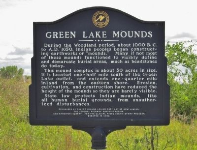
During the Woodland period, about 1000 B. C. to A. D. 1650, Indian peoples began constructing earthworks or "mounds." Many if not most of these mounds functioned to visibly define and demarcate burial areas, much as headstones do today.
This mound complex is about 50 acres in size. It is located one-half mile south of the Green Lake outlet, and extends one-quarter mile inland from the eastern shore. Erosion, cultivation, and construction have reduced the height of the mounds so they are barely visible.
State law protects Indian mounds, like all human burial grounds, from unauthorized disturbances.
the Federal Highway Administration,
and Kandiyohi County, for the Glacial Ridge Scenic Byway Project.
Erected in 2002.
Erected 2002 by Robert Ihlang Legion Post 537, the Federal Highway Administration, and Kandiyohi County.
Topics. This historical marker is listed in these topic lists: Cemeteries & Burial Sites • Native Americans.
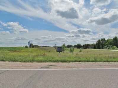
Location. 45° 15.413′ N, 94° 51.968′ W. Marker is near Spicer, Minnesota, in Kandiyohi County . Marker is at the intersection of 138th Avenue Northeast (County Road 98) and County Highway 4, on the right when traveling east on 138th Avenue Northeast. Marker is approximately ¾ miles south of the Green Lake outlet / Middle Fork Crow River. Touch for map. Marker is in this post office area: Spicer MN 56288, United States of America. Touch for directions.
Other nearby markers. At least 8 other markers are within 5 miles of this marker, measured as the crow flies. How Irving Township Got Its Start (approx. ¾ mile away); Indian Camp (approx. 1.2 miles away); First Missionary (approx. 1.9 miles away); Green Lake Village and Mill (approx. 3.4 miles away); Veterans Memorial (approx. 3.8 miles away); Spicer (approx. 3.8 miles away); Little Crow's Camp (approx. 4.1 miles away); Gates Homestead (approx. 4.2 miles away). Touch for a list and map of all markers in Spicer.
More about this marker. The marker has the Historic Site seal of the Kandiyohi County Historical Society · 1895.
Regarding Green Lake Mounds. The site is one of the largest Indian Mound complexes in Minnesota, extending one mile south of the lake outlet and one mile east of the shoreline.
source: Green Lake Property Owners Association
Credits. This page was last revised on June 16, 2016. It was originally submitted on October 18, 2014, by Keith L of Wisconsin Rapids, Wisconsin. This page has been viewed 1,056 times since then and 107 times this year. Photos: 1, 2, 3, 4. submitted on October 18, 2014, by Keith L of Wisconsin Rapids, Wisconsin.


