Yosemite National Park in Mariposa County, California — The American West (Pacific Coastal)
El Capitan
Inscription.
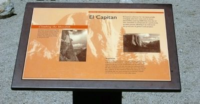
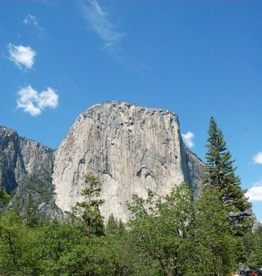
El Capitan is famous for its massive bulk of largely unbroken rock and its sheer, vertical face soaring 3,000 feet into the air. This monolith is composed of a particularly durable granite, allowing it to withstand the pressures of glaciers and erosion.
Climbing the monolith
El Capitan was first scaled in 1958. Since then, climbers have explored nearly a hundred climbing routes. If you look closely, you may see climbers, like tiny specks, inching up the granite wall.
Tutokanula
The Ahwahneechee name for the rock we now call El Capitan is Tutokanula. Ahwahneechee legend tells how El Capitan was created in the time of the animal people. As two bear cubs slept on a large flat rock near the river, the rock grew until the bears scratched their faces against the moon. The mother bear called on all the animals to rescue her babies, but none succeded until the lowly inchworm (tutokanula) crawled slowly to the top and led the cubs safely down.
Erected by Yosemite Fund.
Topics. This historical marker is listed in these topic lists: Environment • Exploration • Native Americans. A significant historical year for this entry is 1958.
Location. 37° 43.22′ N, 119° 38.939′ W. Marker is in Yosemite National Park , California, in Mariposa County. Marker is on Southside Drive, 0.2 miles east of Wawona Road, on the left when traveling east. Touch for map. Marker is in this post office area: Yosemite National Park CA 95389, United States of America. Touch for directions.
Other nearby markers. At least 8 other markers are within 4 miles of this marker, measured as the crow flies. Glaciers at the Gate (here, next to this marker); A Varied View (about 500 feet away, measured in a direct line); A View Through Time (about 500 feet away); Disappearing Waterfalls (approx. 0.3 miles away); President Theodore Roosevelt & John Muir Meeting Site (approx. 0.7 miles away); Rewards of Travel (approx. 1.6 miles away); The Ahwahneechee (approx. 3.4 miles away); The Journey to Yosemite (approx. 3˝ miles away). Touch for a list and map of all markers in Yosemite National Park.
Credits. This page was last revised on June 16, 2016. It was originally submitted on March 26, 2015, by Eric Polk of Lakewood, California. This page has been viewed 530 times since then and 15 times this year. Photos: 1, 2. submitted on March 26, 2015, by Eric Polk of Lakewood, California. • Syd Whittle was the editor who published this page.
Editor’s want-list for this marker. Wide area view of the marker and its surroundings. • Can you help?

