Downtown Ottawa , Ontario — Central Canada (North America)
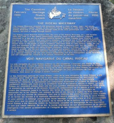
The Rideau Waterway
Voie navigable du canal Rideau
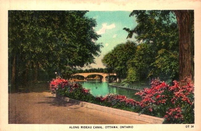
The Rideau Waterway stretches 202 kilometres through a chain of lakes, rivers and canals, linking Canada’s capital, Ottawa, to the historic city of Kingston on Lake Ontario. To follow the Rideau Waterway is not only a trip through some of the most picturesque countryside in eastern Ontario, but also a voyage through history.
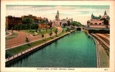
The Rideau Canal National Historic Site, the cour of the Rideau Waterway, was built between 1826 and 1832. It is the oldest continuously operated canal in North America, Originally conceived as a key part of a military defence system for Upper Canada (now Ontario), it soon became a route for local trade and luxury steamers. Considered one of the greatest engineering feats of the 19th century, 19 kilometres of canals and 45 locks raise vessels 83 metres from the Ottawa River to the height of land at Newboro, and lower them to Lake Ontario. Today, the log rafts and steamers of the 19th century have given way to pleasure craft, but the tradition of hand-operating the locks and swing bridges continues. Along the Rideau, one finds a unique blend of wildlife, city life and country life, of past and present, nature and culture. Designation of the Rideau Waterway as a Canadian Heritage River not only is testimony to its significance as a national treasure, but will also ensure stewardship and wise management of the waterway, and will safeguard the integrity of its resources for all time.
French:
La voie navigable du canal Rideau s’étend sur 202 kilomètres, traversant une chaine de lacs, de rivières et de canaux et reliant Ottawa, capitale du Canada, à la ville historique de Kingston sur le lac Ontario. Une promenade le long de la voie navigable du canal Rideau représente non seulement une excursion parmi certains des paysages les plus pittoresques de l’est de l’Ontario, mais aussi un voyage à travers l’histoire.
Le lieu historique national du canal Rideau, coeur de la voie navigable du canal Rideau, a été construit entre 1826 et 1832. Il est le plus vieux canal continuellement en exploitation en Amérique du Nord. À l’origine, le canal avait été conçu pour défendre le Haut-Canada (aujourd’hui l’Ontario) et représentait une composante essentielle du système de défense. Il est rapidement devenu une route pour le commerce local et les luxueux navires à vapeur. Le canal Rideau est considéré comme étant une des plus grandes réalisations technique du XIXᵉ siècle; 19 kilomètres de canaux et 45 écluses hissent les embarcations de 83 mètres à partier de la rivière des Outaouais jusqu’à la hauteur des terres de Newboro. et leur permettent de descendre sur le lac Ontario. Les radeaux de bois et les navires à vapeur du XIXᵉ siècle ont cédé la voie au navires de plaisance, bien que la tradition des ponts tournants et celle d’ouvrir et de fermer les écluses à la manivelle demeurent encore aujourd’hui. Le long de canal Rideau on peut admirer le mélange unique d’une faune sauvage, d’une vie rurale et d’un environnement urbain ainsi que du passé et du présent, de la nature et de la culture. La voie navigable du canal Rideau a été désigné rivière du Patrimoine canadien en témoignage de son importance en tant que trésor national. De ce fait, la bonne intendance de son environnement et sa gestion intelligente n’en seront qu’accentuerais et l’intégrité de ses ressources uniques sera sauvegardée à jamais.
Erected 2000 by The Canadian Heritage Rivers System / Le Réseau de rivières du patrimoine canadien.
Topics. This historical marker is listed in this topic list: Waterways & Vessels. A significant historical year for this entry is 1826.
Location. 45° 25.506′ N, 75° 41.765′ W. Marker is in Ottawa, Ontario. It is in Downtown Ottawa. Marker is on Canal Lane, on the right when traveling north. Touch for map. Marker is in this post office area: Ottawa ON K1A, Canada. Touch for directions.
Other nearby markers. At least 8 other markers are within walking distance of this marker. The Commissariat (within shouting distance of this marker); Wilfrid Laurier (within shouting distance of this marker); Mackenzie King (within shouting distance of this marker); Rideau Canal National Historic Site of Canada (within shouting distance of this marker); The Fight for Canada / La Lutte Pour Le Canada, 1812-1815 (about 90 meters away, measured in a direct line); Château Laurier / Le Château Laurier (about 90 meters away); Laura Secord, UE (about 90 meters away); Lieutenant Colonel Charles-Michel d’Irumberry de Salaberry, CB (about 90 meters away). Touch for a list and map of all markers in Ottawa.
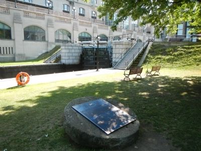
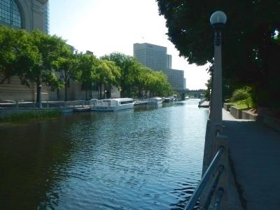
More about this marker. This marker is located beside the Rideau Canal, north of the Elgin - Rideau Streets Bridge. Access to the Canal is by-way-of a pedestrian pathway named Canal Lane.
Related marker. Click here for another marker that is related to this marker.
Credits. This page was last revised on January 24, 2022. It was originally submitted on May 18, 2015, by Barry Swackhamer of Brentwood, California. This page has been viewed 376 times since then and 27 times this year. Photos: 1, 2, 3. submitted on May 18, 2015, by Barry Swackhamer of Brentwood, California. 4, 5. submitted on May 24, 2015. • Andrew Ruppenstein was the editor who published this page.
