Montgomery in Montgomery County, Alabama — The American South (East South Central)
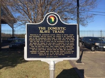
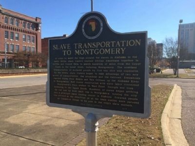
The Domestic Slave Trade / Slave Transportation to Montgomery
Beginning in the seventeenth century, millions of African people were kidnapped, sold into slavery, and shipped to the Americas as part of the Transatlantic Slave Trade. In 1808, the United States Congress banned the importation of slaves from Africa. At the same time, the high price of cotton and the development of the cotton gin caused the demand for slave labor to skyrocket in the lower South. The Domestic Slave Trade grew to meet this demand. Over the next fifty years, slave traders forcibly transferred hundreds of thousands of enslaved people from the upper South to Alabama and the lower South. Between 1808 and 1860, the enslaved population of Alabama grew from less than 40,000 to more than 435,000. Alabama had one of the largest slave populations in America at the start of the Civil War.
Side 2
In order to meet the high demand for slaves in Alabama in the early 1800s, slave traders chained African Americans together in coffles and forced them to march hundreds of miles from the upper South to the lower South, including Montgomery. The overland transportation of enslaved people by foot was slow and expensive. By the 1840s, slave traders began to take advantage of two new modes of transportation: the steamboat and the railroad. Steamboats carried slaves from Mobile and New Orleans up the Alabama River to Montgomery. Rail routes constructed with slave labor connected Montgomery’s train station to West Point, Georgia and lines extending to the upper South. hundreds of enslaved people began arriving by rail and by boat each day in Montgomery, turning the city into a principal slave trading center in Alabama. Enslaved people who arrived at the riverfront or at the train station were paraded up Commerce Street to be sold in the city’s slave markets.
Erected 2013 by Black Heritage Council, Equal Justice Initiative and the Alabama Historical Commission.
Topics and series. This historical marker is listed in these topic lists: African Americans • Industry & Commerce • Railroads & Streetcars • Waterways & Vessels. In addition, it is included in the Alabama Historical Commission series list. A significant historical year for this entry is 1808.
Location. 32° 22.871′ N, 86° 18.79′ W. Marker is in Montgomery, Alabama, in Montgomery County. Marker is at the intersection of Commerce Street and Water Street, on the left when traveling north on Commerce Street. Touch for map. Marker is at or near this postal address: 210 Water Street, Montgomery AL 36104, United States of America. Touch for directions.
Other nearby markers. At least 8 other markers are within walking
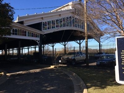
distance of this marker. Struggle For Colonial Empire (a few steps from this marker); Encanchata (within shouting distance of this marker); Rainbow Soldier (within shouting distance of this marker); Transportation and Commerce (about 300 feet away, measured in a direct line); Montgomery (about 300 feet away); Train Shed 1897 (about 300 feet away); High Red Bluff (about 300 feet away); Major Charles W. Davis, Infantry United States Army / "Above and Beyond" (about 300 feet away). Touch for a list and map of all markers in Montgomery.
Related markers. Click here for a list of markers that are related to this marker.
Credits. This page was last revised on February 20, 2021. It was originally submitted on December 11, 2013, by Mark Hilton of Montgomery, Alabama. This page has been viewed 3,804 times since then and 158 times this year. Last updated on July 29, 2015, by J. Makali Bruton of Accra, Ghana. Photos: 1, 2, 3, 4. submitted on December 11, 2013, by Mark Hilton of Montgomery, Alabama. • Kevin W. was the editor who published this page.


