Crow Agency in Big Horn County, Montana — The American West (Mountains)
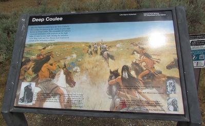
Deep Coulee
Little Bighorn Battlefield
After the brief encounter near the river, Custerís two companies retreat up the ravine to your right known as Deep Coulee. The remainder of Custerís command skirmishes with warriors on the high ridge ½ mile to your right. Seizing the initiative, Crow King, Gall, and Two Moons lead warriors in pursuit of the retreating soldiers.
“While Custerís firing at the cut bank was in progress, I saw no large body of Indians fording, but as soon as we began to retreat they must have swarmed across both above and below us, for we had not proceeded one-third of the way to the ridge before the Sioux were thick upon both our left and right flanks firing into us heavily.”
“The Indians rode in many small parties streaming northeast up the ravine toward the troops. ”
“Before fight started, we drove him (Custer) up a slope to a ridge and over to other side of it. Soldiers (were) mounted all (time) and kept going right along.”
Erected by National Park Service.
Topics. This historical marker is listed in these topic lists: Native Americans • Wars, US Indian.
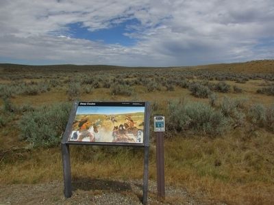
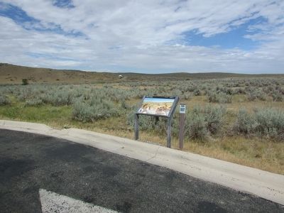
Location. 45° 32.963′ N, 107° 24.827′ W. Marker is in Crow Agency, Montana, in Big Horn County. Marker is on Little Bighorn Battlefield Road, on the right when traveling north. Marker is located on the Little Bighorn Battlefield. Touch for map. Marker is in this post office area: Crow Agency MT 59022, United States of America. Touch for directions.
Other nearby markers. At least 8 other markers are within one mile of this marker, measured as the crow flies. Medicine Tail Ford (here, next to this marker); Medicine Tail Coulee Ford (about 700 feet away, measured in a direct line); Indian Encampment (approx. 0.2 miles away); Medicine Tail Coulee (approx. half a mile away); Greasy Grass Ridge (approx. ĺ mile away); Lame White Man Charge (approx. 0.8 miles away); Calhoun Hill (approx. 0.9 miles away); a different marker also named Calhoun Hill (approx. one mile away). Touch for a list and map of all markers in Crow Agency.
More about this marker. The background of the marker contains a picture of Indians pursuing a group of retreating soldiers.
Also see . . . The Battle of the Little Bighorn, 1876. (Submitted on August 7, 2015, by Bill Coughlin of Woodland Park, New Jersey.)
Credits. This page was last revised on June 16, 2016. It was originally submitted on August 7, 2015, by Bill Coughlin of Woodland Park, New Jersey. This page has been viewed 802 times since then and 48 times this year. Photos: 1, 2, 3. submitted on August 7, 2015, by Bill Coughlin of Woodland Park, New Jersey.


