Crow Agency in Big Horn County, Montana — The American West (Mountains)
Calhoun Hill
Little Bighorn Battlefield
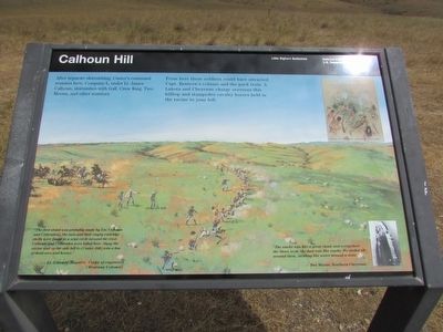
After separate skirmishing, Custer’s command reunites here. Company L, under Lt. James Calhoun, skirmishes with Gall, Crow King, Two Moons, and other warriors.
From here these soldiers could have attracted Capt. Benteen’s column and the pack train. A Lakota and Cheyenne charge overruns this hilltop and stampedes cavalry horses held in the ravine to your left.
“The first stand was probably made by Lts. Calhoun and Crittenden . . . . the men and their empty cartridge shells were found in a semi circle around the crest. Calhoun and Crittenden were killed here. Along the ravine and up the side hill to (Custer Hill) was a line of dead men and horses.”
(Montana Column).
“The smoke was like a great cloud, and everywhere the Sioux went, the dust rose like smoke. We circled all around them . . . swirling like water around a stone. ”
Erected by National Park Service.
Topics. This historical marker is listed in these topic lists: Native Americans • Wars, US Indian.
Location. 45° 33.66′ N, 107° 25.201′ W. Marker is in Crow Agency , Montana, in Big Horn County. Marker is on Little Bighorn Battlefield Road, on the right when traveling north. Marker is located on the Little Bighorn Battlefield. Touch for map. Marker is in this post office area: Crow Agency MT 59022, United States of America. Touch for directions.
Other nearby markers. At least 8 other markers are within walking distance of this marker. Lame White Man Charge (approx. 0.2 miles away); Greasy Grass Ridge (approx. 0.2 miles away); a different marker also named Calhoun Hill (approx. ¼ mile away); Companies F and I (approx. 0.4 miles away); Keogh – Crazy Horse Fight (approx. half a mile away); Cheyenne Warrior Markers (approx. half a mile away); Deep Ravine (approx. 0.6 miles away); a different marker also named Deep Ravine (approx. 0.6 miles away). Touch for a list and map of all markers in Crow Agency.
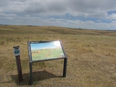
More about this marker. The background of the marker contains a picture of soldiers firing from a skirmish line.
Also see . . . The Battle of the Little Bighorn, 1876. (Submitted on August 8, 2015, by Bill Coughlin of Woodland Park, New Jersey.)
Credits. This page was last revised on June 16, 2016. It was originally submitted on August 8, 2015, by Bill Coughlin of Woodland Park, New Jersey. This page has been viewed 1,846 times since then and 181 times this year. Photos: 1, 2, 3, 4. submitted on August 8, 2015, by Bill Coughlin of Woodland Park, New Jersey.


