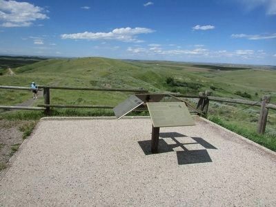
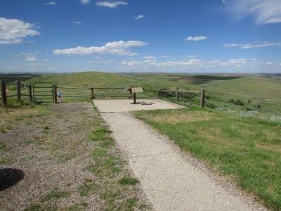
Banner in Sheridan County, Wyoming — The American West (Mountains)
Northern Plains Indian Wars
< Marker #1 : >
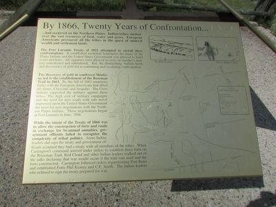
By 1866, Twenty Years of Confrontation . . .
. . . had occurred on the Northern Plains. Indian tribes clashed over the vast resources of food, water and grass. European Americans pressured all the tribes on the quest of mineral wealth and settlement lands.
The Fort Laramie Treaty of 1851 attempted to curtail these confrontations. It established territorial boundaries for many of the Plains Indians and the United States Government was allowed to build roads and forts. All signators were allowed to cross on another’s territory unmolested and unhindered. But the diminishing buffalo herds and discoveries of gold led to continuing and escalating confrontation.
The discovery of gold in southwest Montana led to the establishment of the Bozeman Trail in 1863. By the fall of 1865 numerous fights with the European Americans had allied the Sioux, Cheyenne and Arapaho. The Crow Indians supported the military against these tribes. The high cost of military campaigns and the need for new roads with safe travel impressed upon the United States Government the need for new negotiations with the Northern Plains Indians. These negotiations began at Fort Laramie in June, 1866.
While the intent of the Treaty of 1866 was to allow the construction of the forts and roads in exchange for bi-annual annuities, government officials failed to recognize the complexity of tribal policies. Some Indian leaders did not sign the treaty and government officials assumed they had a treaty with all members of the tribes. When Carrington’s command arrived under orders to establish three forts on the Bozeman Trail, Red Cloud and other Indian leaders walked out of the talks declaring that war would occur if the trail was used and the forts constructed. Carrington followed orders regarrisoning Fort Reno and established Forts Phil Kearny and C.F. Smith. The Indian leaders who refused to sign the treaty prepared for war.
< Marker #2 : >
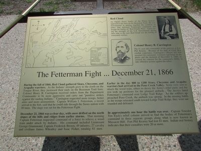
Red Cloud
An Oglala Sioux leader of the Plains Indians opposed to forts on the Bozeman Trail. He was instrumental in putting together the coalition of tribes that defeated Fetterman’s command and fought the battles of “Red Cloud’s War.” Upon seeing the strength of the U.S. Government during later trips to the east, Red Cloud saw the futility of continued warfare.
Colonel Henry B. Carrington
The 41 year old commander of the garrison at Fort Phil Kearny. Because of his lack of Civil War combat experience, Carrington’s officers felt him unsuited for command. Limited experience on the plains and the skirmish of December 6, 1866, increased his concern for the command’s ability to take offensive actions against the tribes.
The Fetteran Fight . . . December 21, 1866
During the fall of 1866, Red Cloud gathered Sioux, Cheyenne, and Arapaho warriors. As the Indians’ strength grew to the north on the Tongue River, they increased their raids on the Bozeman Trail forts. Colonel Henry B. Carrington received orders from the Department Commander to be more aggressive and carry out “punitive strikes against the raiding Indians.” Carrington requested more troops, better arms and more ammunition. Captain William J. Fetterman, a recent arrival to the fort, said that he could ride through the Sioux nation with 80 men. The stage was set for the Fetterman Fight.
December 21, 1866 was a clear day, with snow drifted on the north slopes of the hill and ridges from earlier storms. That morning Captain Fetterman requested command of a force to relieve a wood train under attack by Indians. His command included Lieutenant George Grummond , Captain Frederick Brown, 49 infantry, 27 cavalry and civilians James Wheatley and Issac Fisher, totaling 81 men.
Earlier in the day 800 to 1200 Sioux, Cheyenne and Arapaho warriors had arrived in the Peno Creek Valley. Some were sent to attack the wood train, others to decoy the Army’s relief party and the rest took up positions for the planned ambush. The decoys lured Fetterman’s command over Lodge Trail Ridge. As the soldiers approached Peno Creek, the ambush was sprung. In the ensuing battle, as the troops retreated south toward Lodge Trail Ridge, they were surrounded and defeated.
In approximately one hour the battle was over. Captain Tenodor Ten Eyck’s relief column arrived to find the bodies of Fetterman’s command in three separate groups along what is now known as Massacre Hill. Fort Phil Kearny had lost 81 men. Indian oral history indicates that their casualties were 20 or more.
< Marker #3 : >
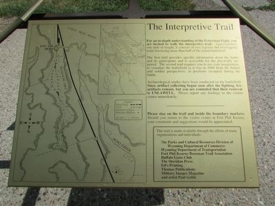
The Interpretive Trail
For an in-depth understanding of the Fetterman Fight, you are invited to walk the interpretive trail. Approximately one mile in length, it consists of two separate but overlapping trails traversing more than half of the actual battlefield.
The first trail provides specific information about the battle and its participants and is accessible for the physically impaired. The second trail requires you to use your imagination, to visualize the battlefield as it was in 1866 from the Indian and soldier perspectives, at positions occupied during the battle.
Archeological studies have been conducted on the battlefield. Since artifact collecting began soon after the fighting, few artifacts remain, but you are reminded that their removal is UNLAWFUL. Please report any findings to the visitor center immediately.
< Marker #4 : >
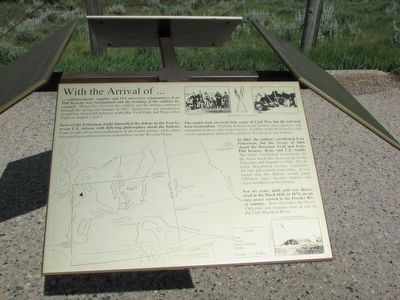
With the Arrival of . . .
. . . reinforcements, supplies and two successive commanders, Fort Phil Kearny was reorganized and the training of the soldiers increased. Skirmishes between the soldiers and the Indians continued through the spring and summer of 1867. Better arms and ammunition resulted in successful defenses at the Hay Field Fight and Wagon Box Fight on August 1 and 2.
News of the Fetterman Fight intensified the debate in the East between U.S. citizens with differing philosophies about the Indians. Some people advocated peaceful resolution of hostilities on the Western Plains.
The nation had survived four years of Civil War but the toll had been tremendous. Fighting Indians on the frontier was expensive and unpopular to those who wanted peace. Conflict in the West had created severe equipment and logistics problems for the post-war military.
In 1867, the military established Fort Fetterman, but the Treaty of 1868 closed the Bozeman Trail and Forts Phil Kearny, Reno and C.F. Smith. The treaty established reservations for the Sioux much like those set up for the Cheyenne and Arapaho in 1866. The Interior Department became responsible for care and control of the tribes. It was hoped that the Indians would adopt Christian ways, become farmers and cease hostilities on the frontier.
For six years, until gold was discovered in the
Black Hills in 1874, an uneasy peace existed in the Powder River country. Soon thereafter, the Sioux, Cheyenne and Arapaho were at war on the Little Big Horn River.
Topics. This historical marker is listed in these topic lists: Native Americans • Wars, US Indian. A significant historical month for this entry is June 1866.
Location. 44° 34.287′ N, 106° 50.466′ W. Marker is in Banner, Wyoming, in Sheridan County. Marker can be reached from Piney Creek Road. Touch for map. Marker is in this post office area: Banner WY 82832, United States of America. Touch for directions.
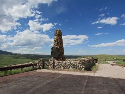
Other nearby markers. At least 8 other markers are within walking distance of this marker. Fetterman Massacre Memorial (a few steps from this marker); Fetterman Monument (a few steps from this marker); The Combatants: Soldiers (about 700 feet away, measured in a direct line); The Combatants: Warriors (approx. 0.2 miles away); Two Scenarios: Fetterman Fight, December 21, 1866 (approx. ¼ mile away); Weapons of the Fetterman Fight (approx. ¼ mile away); The Bozeman Trail 1863 – 1868 (approx. 0.4 miles away); As an Infantryman . . . (approx. 0.4 miles away). Touch for a list and map of all markers in Banner.
Credits. This page was last revised on June 16, 2016. It was originally submitted on August 19, 2015, by Bill Coughlin of Woodland Park, New Jersey. This page has been viewed 501 times since then and 17 times this year. Photos: 1, 2, 3, 4, 5, 6, 7. submitted on August 19, 2015, by Bill Coughlin of Woodland Park, New Jersey.
