Arromanches-les-Bains in Calvados, Normandy, France — Western Europe
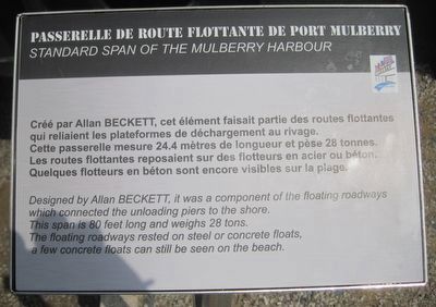
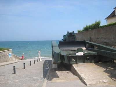
Passerell de Route Flottante de Port Mulberry
Standard Span of the Mulberry Harbor
Créé par Allan Beckett, cet élément faisait partie des routes flottantes qui reliaient les plateformes de déchargement au rivage.
Cette passerelle mesure 24.4 mètres de longueur et pèse 28 tonnes.
Les routes flottantes reposaient sur des flotteurs en acier ou béton.
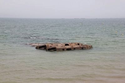
Quelques flotteurs en béton sont encore visibles sur la plage.
English:
Designed by Allen Beckett, it was a component of the floating roadways which connected the unloading piers to the shore.
This span is 80 feet long and weighs 28 tons.
The floating roadways rested on steel or concrete floats, a few concrete floats can still be seen on the beach.
Topics. This historical marker is listed in these topic lists: Roads & Vehicles • Waterways & Vessels.
Location. 49° 20.406′ N, 0° 37.202′ W. Marker is in Arromanches-les-Bains, Normandie (Normandy), in Calvados. Marker is on Cale Maréchal Montgomery just north of Place du Six Juin 1944, on the right when traveling north. Touch for map. Marker is in this post office area: Arromanches-les-Bains, Normandie 14117, France. Touch for directions.
Other nearby markers. At least 8 other markers are within walking distance of this marker. Allan Beckett Memorial (here, next to this marker); Mulberry Harbours Memorial (within shouting distance of this marker); Royal Logistics Corps Memorial (within shouting distance of this marker); L.S.T. & Landing Craft Association Memorial (within shouting distance of this marker); Merchant Navy Seamen Memorial (within shouting distance of this marker); Royal Air Force Beach Squadrons Memorial (within shouting distance of this marker); Arromanches-les-Bains : La Bataille d’Arromanches (about 90 meters away, measured in a direct line); Arromanches-les-Bains : Un village de pêcheurs (about 180 meters away). Touch for a list and map of all markers in Arromanches-les-Bains.
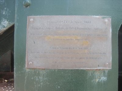
Regarding Passerell de Route Flottante de Port Mulberry. There is a plaque mounted on the span, detailing its use following the war and when it came to be placed here. It reads:
"Élément de chaussée flottante du Port d'Arromanches - Mulberry B"
Il fut installé en 1948 à Quincy-Landzécourt (Meuse) pour remplacer le pont détruit ou il restera en fonction jusqu'en 2004
Retour a Arromanches le 6 Juin 2004
Grace au concours du Ministere de la Defense, du Conseil General du Calvados, du Conseil Regional de Basse-Normandie, du Comite du Debarquement, et de la Commune d'Arromanches.
Its English translation is:
"Floating span element of the Port of Arromanches - Mulberry B"
It was installed in 1948 in Quincy-Landzécourt (Meuse Département) to replace the destroyed bridge, until being replaced in 2004.
It was returned to Arromanches on 6 June 2004.
Thanks to the support of Ministry of Defence, General Council of Calvados, the Regional Council of Lower Normandy, D-Day Landing Committee, and the Arromanches Community.
Credits. This page was last revised on January 5, 2020. It was originally submitted on September 13, 2015, by Kevin W. of Stafford, Virginia. This page has been viewed 373 times since then and 20 times this year. Photos: 1, 2, 3, 4. submitted on September 13, 2015, by Kevin W. of Stafford, Virginia.


