Near Catonsville in Baltimore County, Maryland — The American Northeast (Mid-Atlantic)
The River Makes Electricity
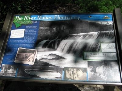
Bloede Dame
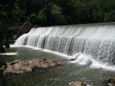
Bloede's company needed an innovative design that would not flood large areas upstream. They built the turbines and generating equipment inside a small dam, making Bloede Dam the world's first submerged hydroelectric plant. This cutting edge design has highly efficient in producing electricity.
While the dam's design solved one problem, it created another. Water intakes in the wall of the dam quickly became clogged with silt, because erosion of soil from the tree-less hillsides surrounding the river made the river run muddy. Tree roots help hold soil in place, especially on steep terrain.
Bloede became aware of the need to reforest the Patapsco Valley for his company to provide electricity to local residents, an indication that a conservationist mindset was growing among Baltimore's urban leaders. The Patapsco Forest Reserve, which is now Patapsco Valley State Park, was established in 1907 to begin reforestation.
"The steep slopes along the river that have been cultivated in years past have largely contributed to the accumulation of silt which has collected behind the dams" forcing operators to expend "large sums of money for dredging." - F.W. Besley, State Forester, 1915.
Text with main photo: Bloede Dam in the mid-1900s. The towers were added around 1915.
Text with middle left photo: A 1916 Board of Forestry photo shows silt collected behind Bloede Dam.
Text with lower left photo: Bloede Dam in 1907.
Text with lower right photo: An interior view of the dam.
Erected by Maryland Department of Natural Resources, Chesapeake Bay Gateways Network.
Topics. This historical marker is listed in these topic lists: Charity & Public Work • Environment • Horticulture & Forestry • Industry & Commerce • Waterways & Vessels. A significant historical year for this entry is 1907.
Location. 39° 14.861′ N, 76° 45.619′ W. Marker is near Catonsville, Maryland, in Baltimore County. Marker can be reached from the intersection of Washington Boulevard (U.S. 1) and South Street. Marker is within the Patapsco Valley State Park - Orange Grove area, on the northern side of the Patapsco River (Grist Mill Trail), about 1 mile west of the Swinging Bridge. Entrance to PVSP is about 300 feet north of the US 1 - South Street intersection near Elkridge. Touch for map. Marker is in this post office area: Catonsville MD 21228, United States of America. Touch for directions.
Other nearby markers. At least 8 other markers are within 2 miles of this marker, measured as the crow flies. The Changing River Valley (approx. ¼ mile away); Bringing Trade to Baltimore (approx. ¼ mile away); Building America's First Railroad (approx. half a mile away); Besley Demonstration Campsite (approx. 0.7 miles away); Orange Grove: A Small Neighborly Community (approx. 0.7 miles away); Back to Nature in the Patapsco Valley (approx. 0.7 miles away); Patapsco Superlative: (approx. ¾ mile away); The Destructive Power of the Patapsco (approx. 1.3 miles away). Touch for a list and map of all markers in Catonsville.
Credits. This page was last revised on January 10, 2020. It was originally submitted on July 6, 2008, by F. Robby of Baltimore, Maryland. This page has been viewed 1,660 times since then and 13 times this year. Photos: 1, 2. submitted on July 6, 2008, by F. Robby of Baltimore, Maryland.

