Near San Andrés in San Juan Opico, La Libertad, El Salvador — Central America (West Coast)
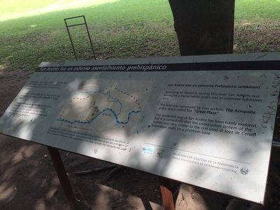
San Andrés was an extensive prehispanic settlement
San Andrés fue un extenso asentamiento prehispánico
Inscription.
El primero estaba constituido por dos sectores: La Gran Acrópolis y un espacio amplio llamado la “Gran Plaza”.
El área residencial de San Andrés ha sido poco explorada, pero se considera que el sistema constructivo de las viviendas era muy similar al empleado en Joya de Cerén: paredes de bahareque sobre una base de plataforma.
Pie de dibujo: Esquema que muestra la extensión del asentamiento prehispánico, durante esa época, el área actual del parque abarcaba la zona monumental.
According to research, during this time San Andrés was formed by a monumental center and an extensive habitation area.
The first was composed by two sectors: The Acropolis and a space called the “Great Plaza”.
The residential area at San Andrés has been barely explored, but it is considered that the constructive system of the houses was very similar to the one used at Joya de Ceren: bahareque walls on a platform base.
Caption:
Plan that shows the extension of the pre-Hispanic setttlement. The current area of the park includes the monumental zone.
Erected by Secretaría de Cultura de la Presidencia de El Salvador.
Topics. This historical marker is listed in these topic lists: Anthropology & Archaeology • Man-Made Features.
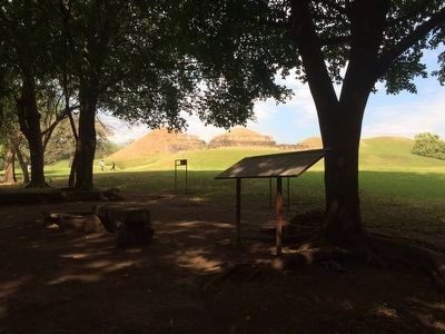
Location. 13° 47.997′ N, 89° 23.315′ W. Marker is near San Andrés, La Libertad, in San Juan Opico. Marker can be reached from Kilómetro 32 Carretera Panamericana. The marker is on the grounds of the San Andrés Archaeological Site, to the southeast of the Acrópolis at the end of the walking tour leaving the site. Touch for map. Marker is in this post office area: San Andrés, La Libertad 01514, El Salvador. Touch for directions.
Other nearby markers. At least 8 other markers are within 18 kilometers of this marker, measured as the crow flies. San Andrés Archaeological Site (within shouting distance of this marker); Abandonment of the San Andrés Archaeological Site (within shouting distance of this marker); Structure 7 at San Andrés Archaeological Site (about 90 meters away, measured in a direct line); Indigo Production at San Andrés (about 210 meters away); Joya de Cerén (approx. 4.7 kilometers away); The San Salvador Volcano Complex (approx. 6.5 kilometers away in San Salvador);
El Boqueron National Park (approx. 13.9 kilometers away); Santa Tecla Culture and Arts Center (approx. 17.5 kilometers away). Touch for a list and map of all markers in San Andrés.
Credits. This page was last revised on July 28, 2019. It was originally submitted on February 21, 2016, by J. Makali Bruton of Accra, Ghana. This page has been viewed 393 times since then and 7 times this year. Photos: 1, 2, 3. submitted on February 21, 2016, by J. Makali Bruton of Accra, Ghana.


