Waterfront in Buffalo in Erie County, New York — The American Northeast (Mid-Atlantic)
Waterfront Sites
From the LaSalle Park Gateway
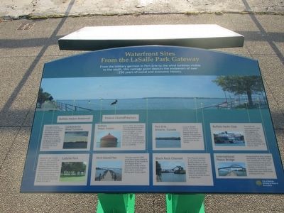
Waterfront Sites From the LaSalle Park Gateway
From the miltary garrison in Fort Erie to the wind turbines visible to the south, this vantagepoint depicts the endeavors of over 250 years of economic history.
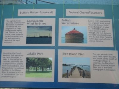
LaSalle Park. Named for the French explorer, this waterfront park was developed in 1931. It features picnic facilities, ball fields, and an amphitheater. LaSalle Park is connected to other historical and recreational facilities in the Niagara River Gateway by virtue of the Shoreline Trail that passes through it.
Lackawanna Wind Turbines. The eight turbines on the former Bethlehem Steel Plant site deliver 56,000 megawatts of clean energy to the region. The turbines not only create a new image for the Buffalo waterfront but also promise to revitalize the local economy.
Buffalo Water Intake Built in 1907, this building was originally known s the "Emerald Channel Water Intake Building". It takes in 125 million gallons of water each day and, through a 12 foot diameter concrete tunnel, delivers it to the Col. Ward Pumping Station just south of where you are standing.
Federal Channel Markers
Bird Island Pier This pier extends 2900 yards from Squaw Island to Bird Island at the mouth of the Niagara River. It separates the Black Rock Channel from the Niagara River and is a favorite fishing spot in the region.
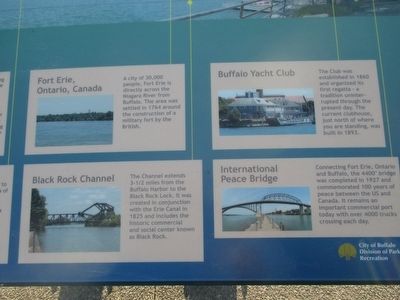
Fort Erie, Onario, Canada A city of 30,000 people, Fort Erie is directly across the Niagara River from Buffalo. Th earea was settled in 1764 around the construction of a military fort by the British.
Black Rock Channel. The Channel extends 3-1/2 miles from the Buffalo Harbor to the Black Rock Lock. It was creaed in conjunction with the Erie Canal in 1825 and includes the historic commercial and social center known as Black Rock.
Buffalo Yacht Club. The Club was established in 1860 and organized its first regatta - a tradition uninterrupted through the present day. The current clubhouse, just north of where you are standing, was built in 1893.
International Peace Bridge Connecting Fort Erie, Ontario and Buffalo, the 4400' bridge was completed in 1927 and commemorated 100 years of peace between the US and Canada. It remains an important commerical port today with over 4000 trucks crossing each day.
Erected by City of Buffalo Division of Parks & Recreation.
Topics. This historical marker is listed in these topic lists: Bridges & Viaducts • Environment • Waterways & Vessels. A significant historical year for this entry is 1931.
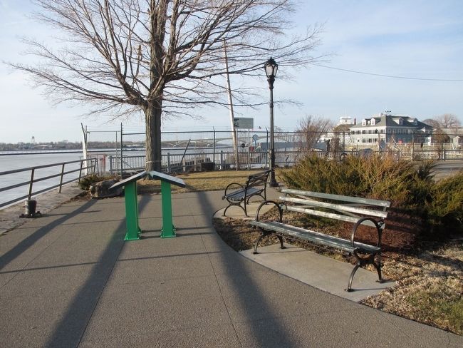
Location. 42° 53.787′ N, 78° 54.105′ W. Marker is in Buffalo, New York, in Erie County. It is in Waterfront. Marker can be reached from the intersection of Amvets Drive and Porter Avenue, on the right when traveling south. Marker is at the entrance to LaSalle Park at the foot of Porter Avenue. Touch for map. Marker is in this post office area: Buffalo NY 14202, United States of America. Touch for directions.
Other nearby markers. At least 8 other markers are within walking distance of this marker. "The Best Planned City" (here, next to this marker); Dedicated with Respect (approx. 0.2 miles away); Oliver Hazard Perry Monument (approx. 0.4 miles away); In Memory of 100th New York Volunteer Infantry (approx. 0.4 miles away); 28th U. S. Infantry (approx. half a mile away); Robert "Frankie" Franklin (approx. 0.6 miles away); American Doughboy "Over the Top" to Victory (approx. 0.6 miles away); St. Mary's-on-the-Hill (approx. 0.7 miles away). Touch for a list and map of all markers in Buffalo.
Also see . . .
1. Francis P. Ward Pumping Station - Buffalo as an Architectural Museum. (Submitted on March 12, 2016, by Anton Schwarzmueller of Wilson, New York.)
2. Peace Bridge - Wikipedia. (Submitted on March 12, 2016, by Anton Schwarzmueller of Wilson, New York.)
Credits. This page was last revised on February 16, 2023. It was originally submitted on March 12, 2016, by Anton Schwarzmueller of Wilson, New York. This page has been viewed 415 times since then and 11 times this year. Photos: 1, 2, 3, 4. submitted on March 12, 2016, by Anton Schwarzmueller of Wilson, New York.


