Broadnax in Brunswick County, Virginia — The American South (Mid-Atlantic)
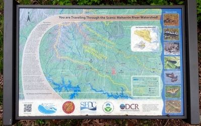
You are Traveling Through the Scenic Meherrin River Watershed!
Inscription.
Did you know… A raindrop falling in the Meherrin River Watershed will travel over 200 miles before reaching the Atlantic?!
Watersheds are the collective web of tributaries and surrounding land draining to a common waterbody, such as a major river. For example, many streams drain into the Meherrin River watershed, empties into the Chowan River, Albemarle Sound, and finally the Atlantic. With this perspective, it is easy to see how one’s actions can affect the watershed as a whole.
As raindrops run off the land, they can pick up pollutants from farming, logging and development which over time degrade water quality. However, smart farming practices help reduce nutrients, stream protection can prevent sediment erosion during logging, and tree planting around parking lots can increase rain absorption so less runoff occurs. Conservation of resources such as soil and water and the protection of wildlife are necessary to protect them for future generations.
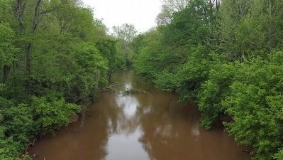
The Meherrin is designated a Scenic River for the natural, recreational, and historical features within the river corridor. Safeguarding this watershed starts with people like you and groups like us!
We are the Albemarle-Chowan Watershed Roundtable, a group dedicated to protecting the beauty and serenity of the watershed. Visit our Roundtable website at www.acrwrt.org or snap the QR code below to learn how you can join tour efforts. The Albemarle-Chowan Watershed Roundtable (captions)
The Chowan River Watershed
Watershed Wildlife
N. American River Otter Credit: U.S. Fish and Wildlife Service
Marbled Salamander Credit: Virginia Herpetological Society
Chowanoke Crayfish Credit: Chris Lukhaup
Ebony Jewelwing Damselfly Credit: D. Gordon Robertson
Wood Duck Credit: Olaf Oliviero Reimer
Eastern Tiger Swallowtail Credit: Vicki’s Nature
Roanoke Logperch Credit: Noel Burkhead
This project received funding from the Environmental Protection Agency's Section 319 Grant Program at the Virginia Department of Conservation and Recreation (DCR), grant number 319-2012-P06-PT.
Erected by The Albemarle-Chowan Watershed Roundtable.
Topics. This historical marker is listed in these topic lists: Environment • Waterways & Vessels.
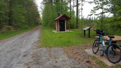
Location. 36° 44.073′ N, 77° 56.732′ W. Marker is in Broadnax, Virginia, in Brunswick County. Marker is on Tobacco Heritage Trail, 0.8 miles east of Evans Creek Road (County Route 623), on the right when traveling east. Touch for map. Marker is in this post office area: Brodnax VA 23920, United States of America. Touch for directions.
Other nearby markers. At least 8 other markers are within 5 miles of this marker, measured as the crow flies. Bridges of Brunswick County (approx. 0.2 miles away); Tobacco As a Way of Life (approx. ¾ mile away); The American Thoroughbred in Brunswick (approx. 3½ miles away); Hospital and School of the Good Shepherd (approx. 3.7 miles away); Rolling Post Office (approx. 3.7 miles away); Staunton River Raid (approx. 4.3 miles away); Native Americans and Fort Christanna (approx. 4.4 miles away); Fort Christanna: Established 1714 (approx. 4.4 miles away). Touch for a list and map of all markers in Broadnax.
Also see . . .
1. Complete Guide to the Tobacco Heritage Trail. Trying To Unwind website entry:
Everything You Need to Know Before You Visit this Virginia Rail Trail (Submitted on September 9, 2023, by Larry Gertner of New York, New York.)
2. Chowan River Basin. Albemarle-Chowan Watershed Roundtable PDF (Submitted on April 13, 2022, by Larry Gertner of New York, New York.)
Credits. This page was last revised on September 9, 2023. It was originally submitted on May 1, 2016, by Bernard Fisher of Richmond, Virginia. This page has been viewed 337 times since then and 20 times this year. Photos: 1, 2, 3. submitted on May 1, 2016, by Bernard Fisher of Richmond, Virginia.


