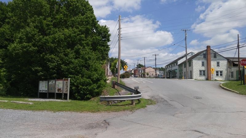
Williamsport in Washington County, Maryland — The American Northeast (Mid-Atlantic)
Welcome to Williamsport
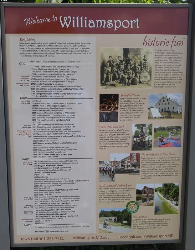
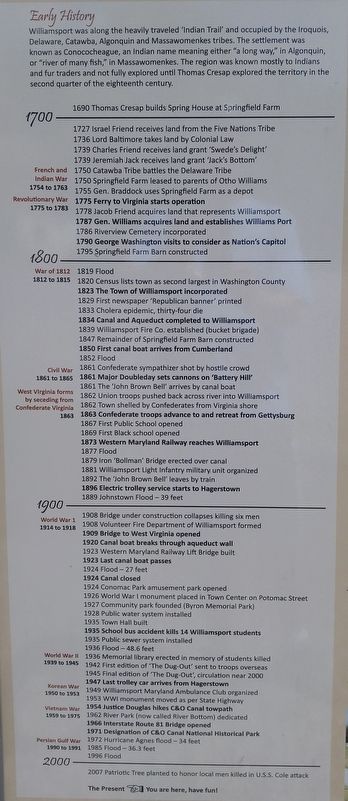
Williamsport was along the heavily traveled "Indian Trail" and occupied by the Iroquois, Delaware, Catawba, Algonquin and Massawomenkes tribes. The settlement was known as Conococheague, an Indian name meaning either "a long way," in Algonquin, or "river of many fish," in Massawomenkes. The region was known mostly to Indians and fur traders and not fully explored until Thomas Cresap explored the territory in the second quarter of the eighteenth century.
1690 Thomas Cresap builds Spring House at Springfield farm
1727 Israel Friend receives land from the Five Nations Tribe
1736 Lord Baltimore takes land by Colonial Law
1739 Charles Friend receives land grant "Swede's Delight"
1739 Jeremiah Jack receives land grant 'Jack's Bottom'
1750 Catawba Tribe battles the Delaware Tribe
1750 Springfield Farm leased to parents of Otto Williams
1755 Gen. Braddock uses Springfield Farm as a depot
1775 Ferry to Virginia starts operation
1778 Jacob Friend acquires land that represents Williams Port
1787 Gen. Williams acquires land and establishes Williams Port
1786 Riverview Cemetery incorporated
1790 George Washington visits to consider as Nation's Capitol
1795 Springfield Farm Barn constructed
1819 Flood
1820 Census lists town as second largest in Washington County
1823 The Town of Williamsport Incorporated
1829 First newspaper 'Republican banner' printed
1833 Cholera epidemic, thirty-four die
1834 Canal and Aqueduct completed to Williamsport
1839 Williamsport Fire Co. established (bucket brigade)
1847 Remainder of Springfield Farm Barn constructed
1850 first canal boat arrives from Cumberland
1852 Flood 1861 Confederate sympathizer shot by hostile crowd
1861 Major Doubleday sets cannons on 'Battery Hill'
1861 The 'John Brown Bell' arrives by canal boat
1862 Union troops pushed back across river into Williamsport
1862 Town shelled by Confederates from Virginia shore
1863 Confederate troops advance to and retreat from Gettysburg
1867 First Public School opened
1869 First Black School opened
1873 Western Maryland Railway reaches Williamsport
1877 Flood
1879 Iron 'Bollman Bridge' erected over canal
1881 Williamsport Light Infantry military unit organized
1892 The 'John Brown Bell' leaves by train
1896 Electric trolley service starts to Hagerstown
1889 Johnstown Flood - 39 feet
1908 Bridge under construction collapses killing six men
1908 Volunteer Fire Department of Williamsport formed
1909 Bridge to West Virginia opened
1920 Canal boat breaks through aqueduct wall
1923 Western Maryland
Railway Lift Bridge built
1923 Last canal boat passes
1924 Canal closed
1924 Conomac Park amusement park opened
1926 World War I monument placed in Town Center on Potomac Street
1927 Community park founded (Byron Memorial Park)
1928 Public water system installed
1935 Town Hall built
1935 School bus accident kills 14 Williamsport students
1935 Public sewer system installed
1936 Flood - 48.6 feet
1936 Memorial library erected in memory of students killed
1942 First edition of 'The Dug-Out' sent to troops overseas
1945 Final edition of 'The Dug-Out', circulation near 2000
1947 Last trolley car arrives from Hagerstown
1949 Williamsport Maryland Ambulance Club organized
1953 WWI monument moved as per State Highway
1954 Justice Douglas hikes C&O Canal towpath
1962 River Park (now called River Bottom) dedicated
1966 Interstate Route 81 bridge opened
1971 Designation of C&O Canal National Historic Park
1972 Hurricane Agnes flood - 34 feet
1985 Flood - 36.3 feet
1996 Flood
2007 Patriotic Tree planted to honor local men killed in U.S.S. Cole attack
Historic Fun
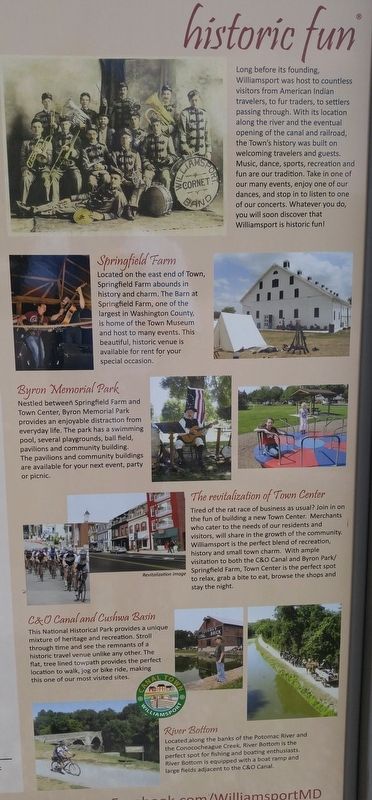
Long before its founding, Williamsport was host to countless visitors from American Indian travelers, to fur traders, to settlers passing through. With its location along the river and the
eventual opening of the canal and railroad, the Town's history was built on welcoming travelers and guests. Music, dance, sports, recreation and fun are our tradition. Take in one of our many events, enjoy one of our dances, and stop in to listen to one of our concerts. Whatever you do, you will soon discover that Williamsport is historic fun!
Springfield Farm
Located on the east end of Town, Springfield Farm abounds in history and charm. The Barn at Springfield Farm, one of the largest in Washington County, is home of the Town Museum and host to many events. This beautiful, historic venue is available for rent for your special occasion.
Byron Memorial Park
Nestled between Springfield Farm and Town Center, Byron Memorial Park provides an enjoyable distraction from everyday life. The park has a swimming pool, several playgrounds, ball field, pavilions and community building. The pavilions and community buildings are available for your next event, party or picnic.
The revitalization of Town Center
Tired of the rat race of business as usual? Join in on the fun of building a new Town Center. Merchants who cater to the needs of our residents and visitors, will share in the growth of the community. Williamsport is the perfect lend of recreation, history and small town charm. With ample visitation to both the C&O Canal
and Byron Park/Springfield Farm, Town Center is the perfect spot to relax, grab a bite to eat, and browse the shops and stay the night.
C&O Canal and Cushwa Basin
The Nationals Historic Park provides a unique mixture of heritage and recreation. Stroll through time and see the remnants of a historic travel venue unlike any other. The flat, tree lined towpath provides the perfect location to walk, jog or bike ride, making this one of our most visited sites.
River Bottom
Located along the banks of the Potomac River and Conococheague Creek, River Bottom is the perfect spot for fishing and boating enthusiasts, River Bottom is equipped with a boat ramp and large fields adjacent to the C&O Canal.
Topics. This historical marker is listed in these topic lists: Railroads & Streetcars • Settlements & Settlers • War, US Civil • Waterways & Vessels. A significant historical year for this entry is 1690.
Location. 39° 36.033′ N, 77° 49.556′ W. Marker is in Williamsport, Maryland, in Washington County. Marker can be reached from the intersection of Potomac Street (U.S. 11) and Commerce Street. Marker is just within the parking area for the C&O Canal National Historic Park, on the right side about 25 feet from the intersection. Touch for map. Marker is in this post office area: Williamsport MD 21795, United States of America. Touch for directions.
Other nearby markers. At least 8 other markers are
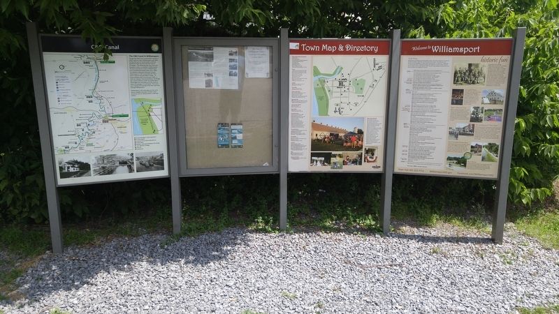
within walking distance of this marker. The C&O Canal in Williamsport (here, next to this marker); C&O Canal (within shouting distance of this marker); Life on the Canal (within shouting distance of this marker); a different marker also named C&O Canal (within shouting distance of this marker); a different marker also named Life on the Canal (about 400 feet away, measured in a direct line); Gettysburg Campaign (about 500 feet away); Cushwa Basin/Williamsport (about 500 feet away); Williamsport (about 500 feet away). Touch for a list and map of all markers in Williamsport.
Credits. This page was last revised on July 18, 2016. It was originally submitted on July 18, 2016, by F. Robby of Baltimore, Maryland. This page has been viewed 631 times since then and 35 times this year. Photos: 1, 2, 3, 4, 5. submitted on July 18, 2016, by F. Robby of Baltimore, Maryland.
