Newcastle in Weston County, Wyoming — The American West (Mountains)
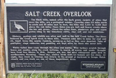
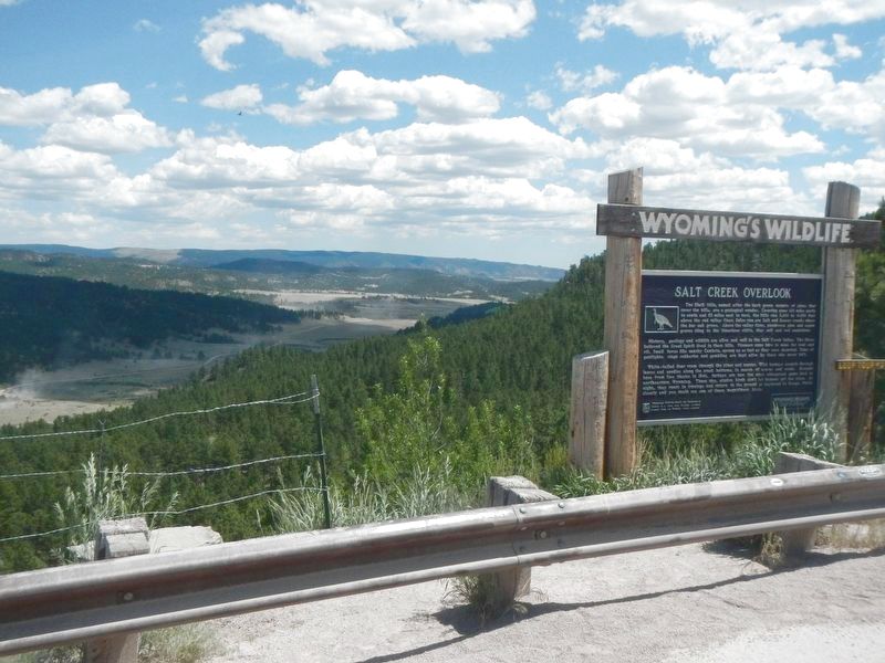
Salt Creek Overlook
History, geology and wildlife are alive and well in the Salt Creek Valley. The Sioux believed the Great Spirit lived in these hills. Pioneers come here to mine for coal and oil. Small towns like nearby Cambria, sprang up as fast as they were deserted. Tales of gunfights, stage robberies and gambling are kept alive by those who never left.
White-tailed deer roam through the pines and aspen. Wild turkeys scratch through leaves and needles along the creek bottoms, in search of acorns and seeds. Brought here from New Mexico in 1948, turkeys are now the most widespread game bird in northeastern Wyoming. These shy, elusive birds don’t let humans get too close. At night, they roost in treetops and return to the ground at daybreak to forage. Watch closely and you could see one of these magnificent birds.
Erected by Wyoming Fish and Game Department.
Topics. This historical marker is listed in these topic lists: Native Americans • Natural Features • Settlements & Settlers. A significant historical year for this entry is 1948.
Location. 43° 55.332′ N, 104° 10.884′ W. Marker is in Newcastle, Wyoming, in Weston County. Marker is on CanAm Highway (U.S. 85) near Pine Top Drive, on the left when traveling south. Touch for map. Marker is at or near this postal address: 23521 CanAm Highway, Newcastle WY 82701, United States of America. Touch for directions.
Other nearby markers. At least 8 other markers are within 8 miles of this marker, measured as the crow flies. Cambria (approx. 0.4 miles away); Flying V Cambria Inn (approx. 2.4 miles away); Cambria Salt Mine (approx. 4 miles away); Hanging of Diamond L. Slim Clifton (approx. 4.9 miles away); The Trains Power Newcastle (approx. 4.9 miles away); Cambria Powers the Trains (approx. 4.9 miles away); Accidental Oil Well (approx. 7.3 miles away); Site of Field City (approx. 7.7 miles away). Touch for a list and map of all markers in Newcastle.
Credits. This page was last revised on September 25, 2016. It was originally submitted on September 25, 2016, by Barry Swackhamer of Brentwood, California. This page has been viewed 597 times since then and 51 times this year. Photos: 1, 2. submitted on September 25, 2016, by Barry Swackhamer of Brentwood, California.

