Near Iatan in Buchanan County, Missouri — The American Midwest (Upper Plains)
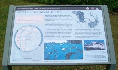
Wetland Habitats of the Past
Little Bean Marsh Conservation Area
— The Journey of Lewis & Clark —
July 4th Wednesday (1804)
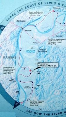
…proceeded on, passed the mouth of a Bayeau lading from a large Lake on the S.S. which has the appearance of being once the bed of the river & reaches parrelel for several Miles…
William Clark
Traveling up the Missouri River, Lewis and Clark found a complex river snaking its way from bluff to bluff. The river overflowed into backwaters and sloughs and refreshed the miles of marshes and wetlands bordering its path.
Little Bean Marsh is an example of river habitat that remains much like the wetlands noted in William Clark's journal. Amazed by the wildlife, he wrote of geese and other waterfowl nesting nearby in spring and summer.
An outstanding natural marsh, Little Bean is lush with river bulrush, cattails and bur reed. Nearby, the large leaves of American lotus nearly cover Cottonwood Slough, a river backwater with waters deeper than Little Bean Marsh. Surrounding those wetlands is a bottomland forest of towering bur and chinquapin oaks, ash, pawpaw, black walnut and pecan trees.
As they scouted the bottomlands, Lewis and Clark would have found additional species that still grow here - buttonbush, willows, cottonwood and blue flag iris thrive along the edges of the marshlands. Little Bean Marsh provides today's river explorers with a look back at Missouri River wetlands that have survived the changes of time.
Erected by Missouri Department of Conservation.
Topics and series. This historical marker is listed in these topic lists: Environment • Exploration • Waterways & Vessels. In addition, it is included in the Lewis & Clark Expedition series list. A significant historical month for this entry is July 1924.
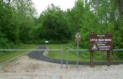
Location. 39° 29.862′ N, 95° 1.293′ W. Marker is near Iatan, Missouri, in Buchanan County. Marker is about 150 feet north of the parking lot at Little Bean Marsh Conservation Area. The parking lot is accessed off Westside Drive, south off of Missouri Route 45/273. Touch for map. Marker is in this post office area: Rushville MO 64484, United States of America. Touch for directions.
Other nearby markers. At least 8 other markers are within 7 miles of this marker, measured as the crow flies. Lewis and Clark in Missouri (approx. 3.4 miles away); The Lewis and Clark Expedition Across Missouri (approx. 3.4 miles away); a different marker also named The Lewis and Clark Expedition Across Missouri (approx. 3.4 miles away); The Lewis and Clark Expedition (approx. 3.9 miles away); Cow Island (approx. 3.9 miles away); Historic Fort Leavenworth (approx. 5.7 miles away in Kansas); Atchison Veterans Memorial (approx. 6.6 miles away in Kansas); USS Arizona Memorial (approx. 6.6 miles away in Kansas). Touch for a list and map of all markers in Iatan.
Also see . . .
1. Lewis and Clark National Historic Trail. National Park Service website entry (Submitted on July 12, 2011, by William Fischer, Jr. of Scranton, Pennsylvania.)
2. Journals of the Lewis and Clark Expedition. Website homepage (Submitted on July 13, 2011, by William Fischer, Jr. of Scranton, Pennsylvania.)
3. Little Bean Marsh Conservation Area. Missouri Department of Conservation website entry (Submitted on July 13, 2011, by William Fischer, Jr. of Scranton, Pennsylvania.)
Credits. This page was last revised on April 22, 2022. It was originally submitted on July 12, 2011, by William Fischer, Jr. of Scranton, Pennsylvania. This page has been viewed 824 times since then and 21 times this year. Photos: 1, 2, 3, 4. submitted on July 12, 2011, by William Fischer, Jr. of Scranton, Pennsylvania.


