Jenners Township near Jennerstown in Somerset County, Pennsylvania — The American Northeast (Mid-Atlantic)
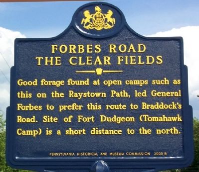
Forbes Road
The Clear Fields
Good forage found at open camps such as this on the Raystown Path, led General Forbes to prefer this route to Braddock's Road. Site of Fort Dudgeon (Tomahawk Camp) is a short distance to the north.
Erected 2005 by Pennsylvania Historical and Museum Commission.
Topics and series. This historical marker is listed in these topic lists: Colonial Era • Forts and Castles • Patriots & Patriotism • War, French and Indian. In addition, it is included in the Forbes Road, and the Pennsylvania Historical and Museum Commission series lists.
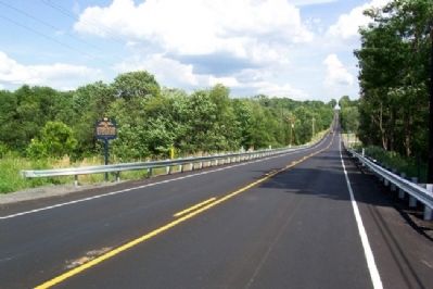
Location. 40° 9.99′ N, 79° 5.535′ W. Marker is near Jennerstown, Pennsylvania, in Somerset County. It is in Jenners Township. Marker is on Lincoln Highway (U.S. 30) near Willison Road, on the right when traveling west. Marker is about a mile west of Jennerstown. Touch for map. Marker is at or near this postal address: 1052 Lincoln Hwy, Boswell PA 15531, United States of America. Touch for directions.
Other nearby markers. At least 8 other markers are within 7 miles of this marker, measured as the crow flies. A different marker also named Forbes Road (approx. 0.2 miles away); Frederick S. Duesenberg (approx. one mile away); Log Grist Mill (approx. 1.7 miles away); Highway Attractions (approx. 1.7 miles away); Quecreek Mine Accident and Rescue (approx. 6.1 miles away); Walter's Mill Covered Bridge (approx. 6.6 miles away); c.1830s Log Farmstead (approx. 6.6 miles away); Bullet's Defeat (approx. 7 miles away). Touch for a list and map of all markers in Jennerstown.
Also see . . . Forbes Road - The Clear Fields. (Submitted on February 16, 2012, by William Fischer, Jr. of Scranton, Pennsylvania.)
Credits. This page was last revised on February 7, 2023. It was originally submitted on February 16, 2012, by William Fischer, Jr. of Scranton, Pennsylvania. This page has been viewed 988 times since then and 48 times this year. Photos: 1, 2. submitted on February 16, 2012, by William Fischer, Jr. of Scranton, Pennsylvania.

