Atotonilco in San Miguel de Allende, Guanajuato, Mexico — The Central Highlands (North America)
The Banner of Atotonilco
The Route of Hidalgo
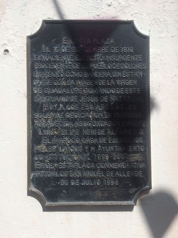
Hoy a los 250 años de su solemne dedicación, en memoria agradecida a su fundador V. Padre Luis Felipe Neri de Alfaro C.O.
El parraco, Casa de Ejercicios, fieles, laicos y H. Ayuntamiento Constitucional 1998-2000.
Erigen esta placa conmemorativa
Atotonilco San Miguel de Allende
20 de julio 1998
On the 250th anniversary of the solemn dedication of this Church, in grateful memory to its founder Father Luis Felipe Neri de Alfaro C.O.
The parish priest, House of Spritual Exercises, the faithful, laity and the Honorable and Constitutional City Council of 1998-2000
Erect this commemorative marker
Atotonilco, San Miguel de Allende
July 20, 1998
Erected 1998.
Topics. This memorial is listed in these topic lists: Churches & Religion • Colonial Era • Patriots & Patriotism • Wars, Non-US. A significant historical date for this entry is September 16, 1810.
Location. 21° 0.274′ N, 100° 47.661′ W. Marker is in Atotonilco, Guanajuato, in San Miguel de Allende. Memorial is on Calle Principal, on the right when traveling north. The marker and monument to the Route of Hidalgo are directly in front of the Sanctuary of Jesus the Nazarene of Atotonilco. Touch for map. Marker is in this post office area: Atotonilco GTO 37893, Mexico. Touch for directions.
Other nearby markers. At least 8 other markers are within 11 kilometers of this marker, measured as the crow flies. The Parish of Atotonilco and Miguel Hidalgo (here, next to this marker); The Marriage of Ignacio Allende and Maria de las Fuentes (here, next to this marker); Sanctuary of Jesus Nazarene of Atotonilco UNESCO World Heritage Site (within shouting distance of this marker); Félix Luna Romero (approx. 10.8 kilometers away); Captain Juan Aldama y González (approx. 11 kilometers away); The Francisco I. Madero Fountain (approx. 11.2 kilometers away); The Heroes' Bridge (approx. 11.2 kilometers away); Tribute to the Battle of Puebla (approx. 11.2 kilometers away). Touch for a list and map of all markers in Atotonilco.

Photographed By J. Makali Bruton, October 1, 2016
2. The Banner of Atotonilco additional marker on the monument's restoration
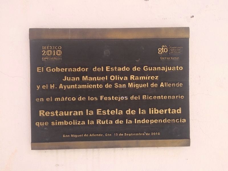
This monument to "The Route of Hidalgo" was restored in 2010 as part of the Mexican Independence bicentennial celebrations. This additional marker mentions that the Governor of Guanajuato State, Juan Manuel Oliva Ramírez, and the City Council of San Miguel de Allende were responsible for the restoration.

Photographed By J. Makali Bruton, October 1, 2016
3. The Banner of Atotonilco Marker
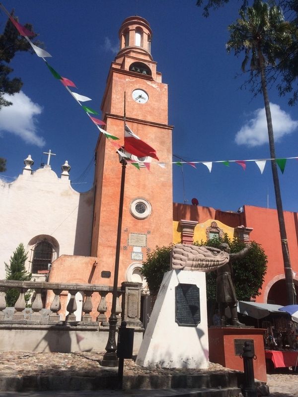
The marker is attached to one of 260 "Route of Hidalgo" monuments, originally placed in 1960 as part of the 150th anniversary celebrations of Mexican Independence. The monument is topped by an eagle's head with a banner emblazoned with the word "Liberty" (Libertad). The Sanctuary and additional markers can be seen in the background.
Credits. This page was last revised on September 1, 2020. It was originally submitted on November 28, 2016, by J. Makali Bruton of Accra, Ghana. This page has been viewed 226 times since then and 7 times this year. Photos: 1, 2, 3. submitted on November 28, 2016, by J. Makali Bruton of Accra, Ghana.
