New Alsace in Dearborn County, Indiana — The American Midwest (Great Lakes)
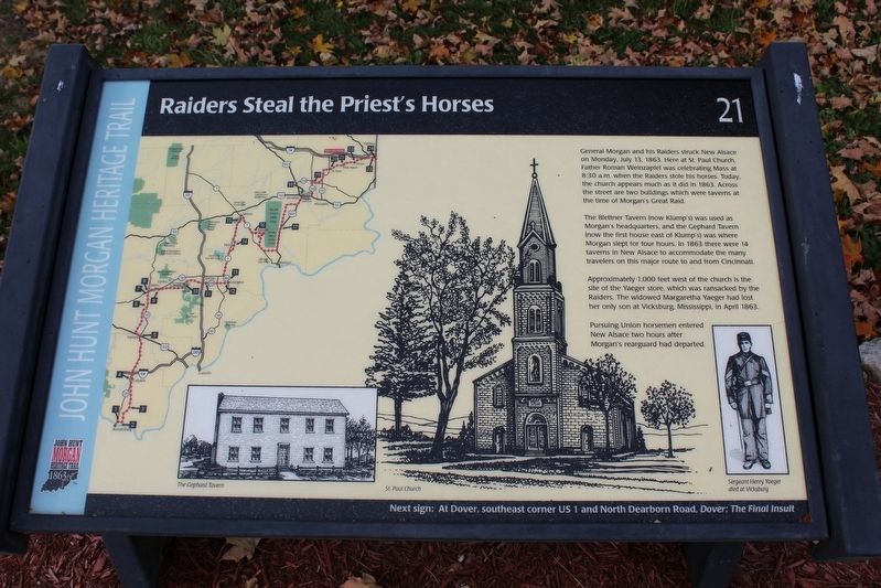
Raiders Steal the Priest’s Horses
John Hunt Morgan Heritage Trail
Photographed by Tom Bosse, October 14, 2016
1. Raider's Steal the Priest's Horses Marker
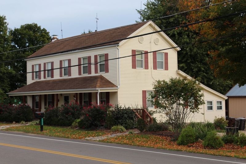
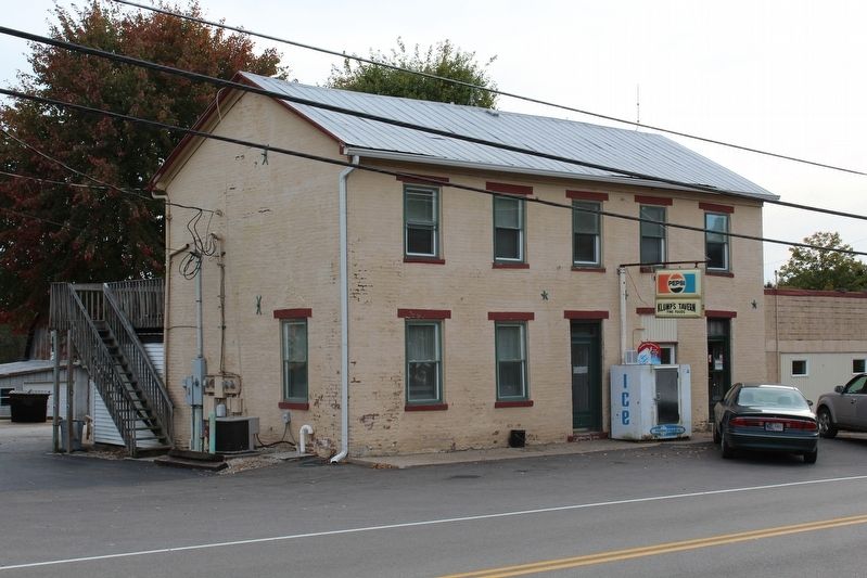
The Blettner Tavern (now Klump's) was used as Morgan's headquarters, and the Gephard Tavern (now the first house east of Klump's) was where Morgan slept for four hours. In 1863 there were 14 taverns in New Alsace to accommodate the many travelers on this major route from Cincinnati.
Approximately 1,000 feet west of the church is the site of the Yaeger store, which was ransacked by the the Raiders. The widowed Margaretha Yaeger had lost her only son at Vicksburg, Mississippi, in April 1863.
Pursuing Union horsemen entered New Alsace two hours after Morgan's rearguard had departed.
Erected by Historic Hoosier Hills RC&D. (Marker Number 21.)
Topics and series. This historical marker is listed in this topic list: War, US Civil. In addition, it is included in the John Hunt Morgan Heritage Trail in Indiana
this page online
Location. 39° 14.048′ N, 84° 59.945′ W. Marker is in New Alsace, Indiana, in Dearborn County. It is at the intersection of North Dearborn Road and Kildeer Lane, on the left when traveling east on North Dearborn Road. Marker in front of St. Paul Catholic Church. Touch for map. Marker is at or near this postal address: 9788 N Dearborn Rd, Guilford IN 47022, United States of America. Touch for directions.

Regionally, this marker is in Southern Indiana. It is also in the American Midwest, in the Ohio River Valley, and in the Corn Belt. Globally, it is in North America, the Western Hemisphere, the Western World, and the Anglosphere. Historically, it finds itself in what was once the territory of the Mississippian Culture and also the Northwest Territory.
Other nearby markers. At least 8 other markers are within 5 miles of this marker, measured as the crow flies: General John Morgan (about 700 feet away, measured in a direct line); Saint John Lutheran Church (approx. 2.7 miles away); Dover (approx. 2.8 miles away); a different marker also named General John Morgan (approx.
Photographed by Tom Bosse, October 14, 2016
2. The Gephard Tavern
Also see . . . Fr Roman Weinzapfel. (Submitted on November 29, 2016, by Tom Bosse of Jefferson City, Tennessee.)
Photographed by Tom Bosse, April 14, 2017
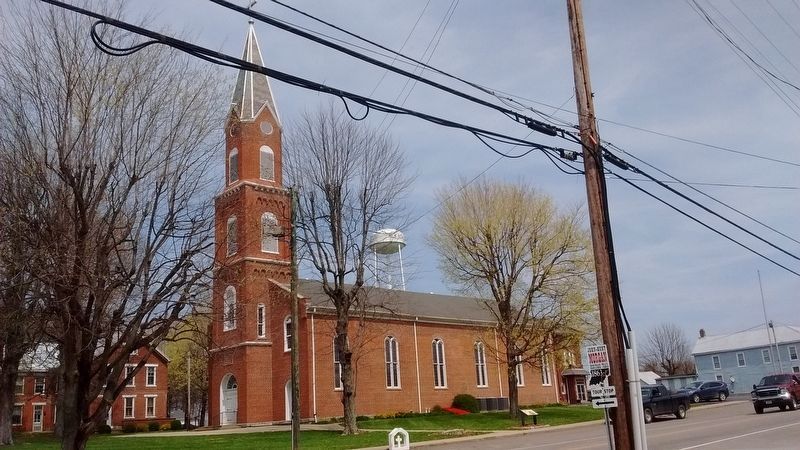
3. Raider's Steal the Priest's Horses Marker
Photographed by Tom Bosse, October 14, 2016
4. The Blettner Tavern
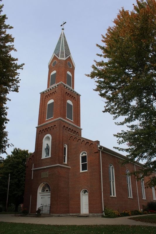
Photographed by Tom Bosse, October 14, 2016
5. St. Paul Catholic Church
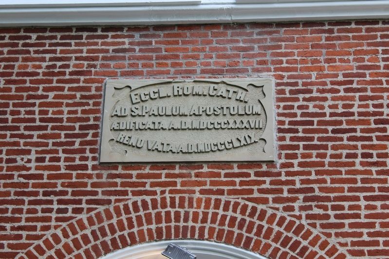
Photographed by Tom Bosse, October 14, 2016
6. St. Paul Catholic Church
Credits. This page was last revised on July 11, 2020. It was originally submitted on November 29, 2016, by Tom Bosse of Jefferson City, Tennessee. This page has been viewed 1,884 times since then and 126 times this year. Photos: 1, 2. submitted on November 29, 2016, by Tom Bosse of Jefferson City, Tennessee. 3. submitted on April 15, 2017, by Tom Bosse of Jefferson City, Tennessee. 4, 5, 6. submitted on November 29, 2016, by Tom Bosse of Jefferson City, Tennessee. • Bernard Fisher was the editor who published this page.
