Tequisquiapan, Querétaro, Mexico — The Central Highlands (North America)
Salvador Michaus Marroquín
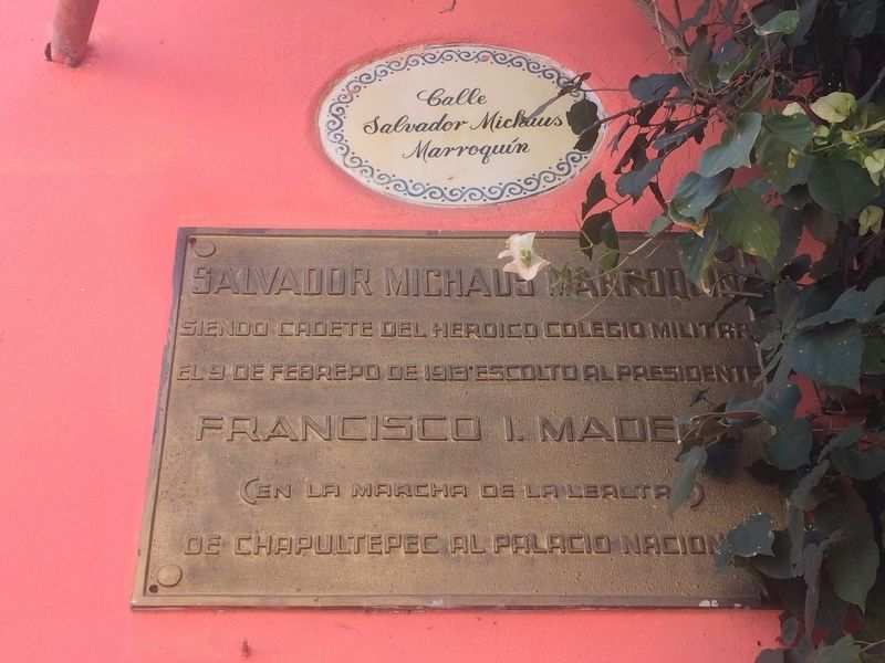
Photographed by J. Makali Bruton, November 6, 2016
1. Salvador Michaus Marroquín Marker
Note that the street is also named for this local hero.

Siendo cadete del Heroico Colegio Militar
el 9 de febrero de 1913 escolto al Presidente
Francisco I. Madero
(en la Marcha de la Lealtad)
de Chapultepec al Palacio Nacional
As a cadet of the heroic Military College
On February 9, 1913 he was part of the escort for
President Francisco I. Madero
(in the March of Loyalty)
from Chapultepec to the National Palace
Topics. This memorial is listed in these topic lists: Patriots & Patriotism • Wars, Non-US. A significant historical date for this entry is February 9, 1913.
Location. 20° 31.408′ N, 99° 53.47′ W. Memorial is in Tequisquiapan, Querétaro. It is at the intersection of Calle Salvador Michaus and Calle Independencia, on the right when traveling east on Calle Salvador Michaus. Touch for map. Memorial is at or near this postal address: 17B Calle Salvador Michaus, Tequisquiapan QUE 76750, Mexico. Touch for directions.

Regionally, this memorial is in Central Mexico and in the Bajío. Globally, it is in North America, specifically in Mesoamerica, on the Ring of Fire, and in the Western Hemisphere. Historically,
this page online
Other nearby markers. At least 8 other markers are within 8 kilometers of this marker, measured as the crow flies: Parish of Santa María de la Asunción (within shouting distance of this marker); Miguel Hidalgo y Costilla (about 120 meters away, measured in a direct line); Plaza Reforma (about 150 meters away); Municipal Auditorium (about 180 meters away); First Public Education in Tequisquiapan (about 180 meters away); The Legend of the Baroness (approx. 0.3 kilometers away); The Geographical Center of Mexico (approx. 0.4 kilometers away); La Trinidad Natural Protected Area (approx. 7.6 kilometers away). Touch for a list and map of all markers in Tequisquiapan.
Related marker. Click here for another marker that is related to this marker.
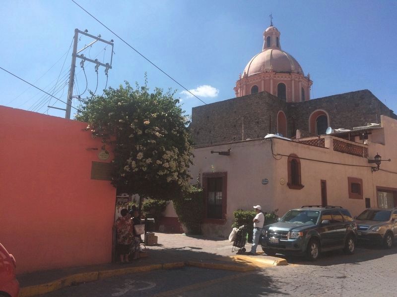
Photographed by J. Makali Bruton, November 6, 2016
2. Salvador Michaus Marroquín Marker
The dome of the Catholic Church of Tequisquiapan (Santa María de la Asunción) can be seen in the distance.
Credits. This page was last revised on February 9, 2018. It was originally submitted on December 6, 2016, by J. Makali Bruton of Washington, District of Columbia. This page has been viewed 500 times since then and 22 times this year. Photos: 1, 2. submitted on December 6, 2016, by J. Makali Bruton of Washington, District of Columbia.
