Volcano in Amador County, California — The American West (Pacific Coastal)
Volcano
Inscription.
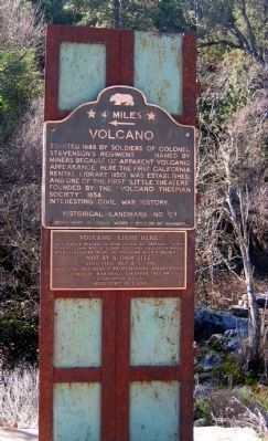
[Larger Marker]:
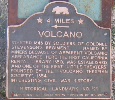
Started 1848 by soldiers of Colonel Stevensonís Regiment. Named by miners because of apparent volcanic appearance. Here the first California rental library, 1850, was established. And one of the first “Little Theaters” founded by the “Volcano Thespian Society”, 1854.
Interesting Civil War History.
[Smaller Marker]:
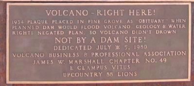
Erected 1980 by #1-Department of Public Works – Division of Highways. #2 Volcano Business & Prof. Assoc., James W, Marshall Chapter E Clampus Vitus, Upcountry 88 Lions. (Marker Number 29.)
Topics and series. This historical marker is listed in these topic lists: Landmarks • Natural Resources • Notable Places • Settlements & Settlers. In addition, it is included in the California Historical Landmarks, and the E Clampus Vitus series lists. A significant historical date for this entry is July 5, 1861.
Location. 38° 26.556′ N, 120° 37.882′ W. Marker is in Volcano, California, in Amador County . Marker is at the intersection of Main Street and Consolation Street, on the right when traveling north on Main Street. Touch for map. Marker is in this post office area: Volcano CA 95689, United States of America. Touch for directions.
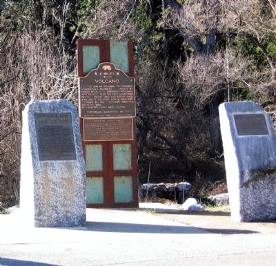
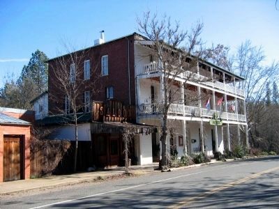
Other nearby markers. At least 8 other markers are within walking distance of this marker. Soldier Gulch (here, next to this marker); a different marker also named Volcano (here, next to this marker); Astronomical Observatory (a few steps from this marker); The Thomas Starr King Bell (within shouting distance of this marker); Carlo Andrea Dondero (within shouting distance of this marker); The Old Bavarian Brewery (within shouting distance of this marker); Union Hotel (within shouting distance of this marker); General Store (within shouting distance of this marker). Touch for a list and map of all markers in Volcano.
Regarding Volcano.
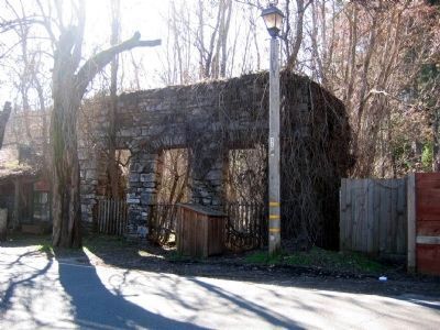
California Historical Landmark description: The spot was discovered in 1848 by Colonel Stevenson's men, who mined Soldiers Gulch in 1849. By 1853 the flats and gulches swarmed with men who named them picturesquely. Hydraulic operations, begun in 1855, brought thousands of fortune seekers to form a town of 17 hotels, a library, a theater, and courts of quick justice. During the Civil War, Volcano's gold served the Union - Volcano Blues smuggled the cannon 'Old Abe' in by hearse to quell rebels.
Also see . . .
1. Ghost Towns - Volcano. (Submitted on September 7, 2008, by Syd Whittle of Mesa, Arizona.)
2. The Virtual California Gold Country - Volcano. (Submitted on September 12, 2008.)
3. Wikipedia Account - Volcano. This has interesting facts regarding the cannon "Old Abe" (Submitted on September 7, 2008, by Syd Whittle of Mesa, Arizona.)
Additional commentary.
1. Steam Fire Truck
In the late 1870s King Pomare, the King of Tahiti
commissioned a Fire Truck to be built in San Francisco - Tahiti's first Fire Truck.
At that time there was shipping trade between Tahiti and San Francisco.
Before the Fire Truck was finished King Pomare died.
The new French Government did not have the funds to pay for the Fire Truck to be shipped to Tahiti.
Somehow it ended up in Volcano, Calif.
Have heard at one time there were scenes of Tahiti painted on the Fire Truck.
Joy Mau, Tahiti
— Submitted September 22, 2009.
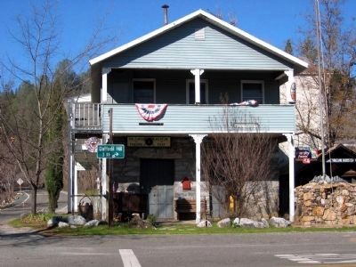
Photographed By Syd Whittle, January 23, 2006
5. Town Building - Adams Express Company
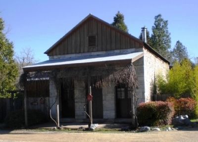
Built in 1854, first served as the Johnson and Ross Volcano News Depot, and then became the Adams Express building in 1856. After that it was the D.S. Boydston Drug Store. From 1871 to 1905, Sing Kee and his wife sold herbs, opium, and general merchandise there.
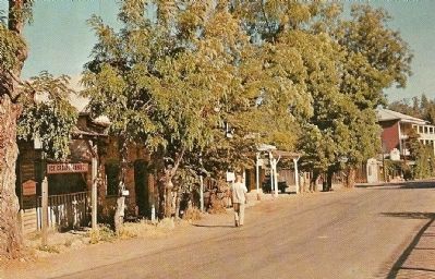
L.E. Lindholm, Published by Commercial Printers, Stockton, Ca.
7. Vintage Postcard of Main Street
The postcard includes this description:
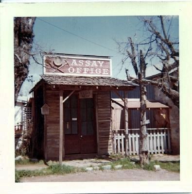
Scene of unsuccessful coup by Southern sympathizers to take Volcano for the Confederacy, 1863. Buildings shown include Assay Office, built 1870; Jug & Rose temperance house; General Store (continuous operation since 1850); old Cigar Emporium (now art gallery); St. George Hotel, built 1863
Scene of unsuccessful coup by Southern sympathizers to take Volcano for the Confederacy, 1863. Buildings shown include Assay Office, built 1870; Jug & Rose temperance house; General Store (continuous operation since 1850); old Cigar Emporium (now art gallery); St. George Hotel, built 1863
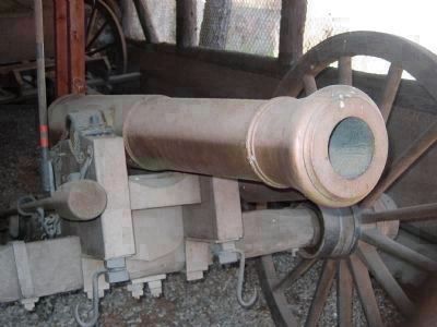
Photographed By Syd Whittle, January 23, 2006
9. "Old Abe"
Sign on building that houses "Old Abe" reads:
Union Square: Named to commemorate an event during Civil War days when the Unionist "Volcano Blues" confronted the Confederate "Knights of the Golden Circle" on this spot. With the help of the cannon, "Old Abe" the "Blues" effected a decisive victory over the "Knights."
P.S. The story goes that the enthusiastic "Blues" had overcharged the weapon. It would have exploded had it actually been fired.
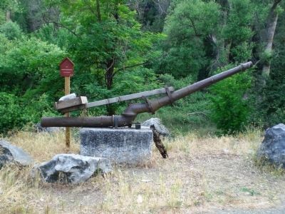
June 28, 2008
10. Hydraulic Mining Monitor (Nozzle), circa 1854
This (assuming the date is correct on the accompanying plaque) is a very early example of a hydraulic mining monitor, used in the Elephant hydraulic mine, about one mile north of Volcano. The monitor was used to direct a stream of water under very high pressure to literally dissolve the earth to wash out gold bearing ores. The monitor now stands about 100 feet to the north of the Volcano historical marker.
June 28, 2008
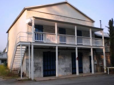
12. Volcano - Masonic Lodge, circa 1854
Originally was the office of the Volcano Weekly Ledger. In 1860 the building became jointly owned by the Oddfellows and the Masons. The building is located some 200 feet north of the Volcano historical marker (opposite the old jail) and is still used as a Masonic Lodge.
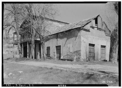
Photographed By Roger Sturtevant, Photographer, April 6, 1934
13. I.O.O.F and Masonic Lodge
Click for more information.
June 28, 2008
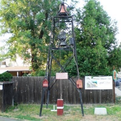
14. Starr King Bell, ca. 1863
According to the accompanying plaque, "The bell was donated to Volcano by Unitarian preacher Thomas Starr King, who was grateful to the town for its support of the Union and the election of Abraham Lincoln. The bell was originally located at the Methodist Cemetery. The bell is Vickers cast steel and was manufactured in Sheffield, England". The bell is located roughly 400 feet east of the Volcano historical marker.
January 31, 2009
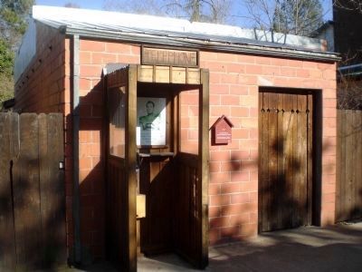
17. Volcano - Post Office and Telephone Exchange
Constructed in the 1930's of terra cotta tile and in operation until the 1960's, when it became a private residence. The sharp-eyed observer will note a Superman poster within the phone booth, reading "Please do not vandalize this phone booth. I have no place else to change clothes. - Superman" Building is located on Main Street, just to the north of the Whiskey Flat Saloon.
Photographed By Brian Smith
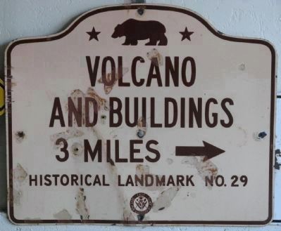
21. Volcano Road Directional Sign
This sign is part of the personal road sign collection of Brian Smith. He also contributed the following information:
Erected by the California Division of Highways in 1951 and is the second generation sign. The state took over signing state highways from the auto clubs in 1948 and introduced a new sign which is in the shape and format of the bronze tablet used by the state at historical sites.
Click for more information.
Credits. This page was last revised on December 22, 2016. It was originally submitted on September 7, 2008, by Syd Whittle of Mesa, Arizona. This page has been viewed 5,194 times since then and 46 times this year. Last updated on December 20, 2016, by Michael Kindig of Elk Grove, California. Photos: 1, 2, 3. submitted on September 7, 2008, by Syd Whittle of Mesa, Arizona. 4. submitted on September 11, 2008, by Syd Whittle of Mesa, Arizona. 5, 6, 7, 8, 9. submitted on September 7, 2008, by Syd Whittle of Mesa, Arizona. 10, 11, 12. submitted on September 10, 2008. 13. submitted on April 4, 2009, by Syd Whittle of Mesa, Arizona. 14. submitted on October 28, 2008. 15. submitted on February 2, 2009. 16. submitted on January 17, 2011, by Steve Rickman of Sunnyvale, Us. 17, 18, 19, 20. submitted on February 2, 2009. 21. submitted on June 8, 2009, by Syd Whittle of Mesa, Arizona.
