Ponte Vedra Beach in St. Johns County, Florida — The American South (South Atlantic)
Fort San Diego
(Diego Plains)
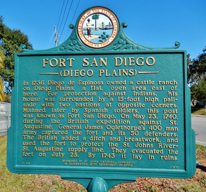
In 1736 Diego de Espinosa owned a cattle ranch on Diego Plains, a flat, open area east of here. For protection against Indians, his house was surrounded by a 15-foot high palisade with two bastions at opposite corners. Manned later by Spanish soldiers, this post was known as Fort San Diego. On May 23, 1740, during the British expedition against St. Augustine, General James Oglethorpe’s 400 man army captured the fort and its 50 defenders. The British added a ditch and breastwork, and used the fort to protect the St. Johns River-St. Augustine supply line. They evacuated the fort on July 25. By 1743 it lay in ruins.
Erected 1973 by St. Johns Historical Commission in Cooperation with Department of State. (Marker Number F-216.)
Topics. This historical marker is listed in these topic lists: Colonial Era • Forts and Castles • Hispanic Americans • Settlements & Settlers. A significant historical year for this entry is 1736.
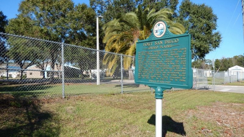
Location. 30° 9.791′ N, 81° 23.395′ W. Marker is in Ponte Vedra Beach, Florida, in St. Johns County. Marker is on Landrum Lane, 0.3 miles west of Palm Valley Road, on the right when traveling west. Marker is near entrance to Alice B. Landrum Middle School. Touch for map. Marker is at or near this postal address: 230 Landrum Lane, Ponte Vedra Beach FL 32082, United States of America. Touch for directions.
Other nearby markers. At least 8 other markers are within 6 miles of this marker, measured as the crow flies. Palm Valley (approx. 1.1 miles away); Mickler's Landing Park (approx. 1.9 miles away); Mickler's Landing (approx. 2 miles away); Mineral City (approx. 2 miles away); Jonathan Dickinson Shipwreck (approx. 3.7 miles away); Cattle Ranching (approx. 3.7 miles away); 30° 8' North Latitude (approx. 4.2 miles away); World War II Operation Pastorius / St. Johns County (approx. 5˝ miles away). Touch for a list and map of all markers in Ponte Vedra Beach.
More about this marker. Marker is in excellent condition. Both sides of the marker are identical.
Regarding Fort San Diego. There are no visible remains of the fort at this site.
Also see . . .
1. Siege of St. Augustine (1740). Wikipedia entry
In May 1740, Oglethorpe undertook an expedition to capture St. Augustine itself. In support of that objective, Oglethorpe first captured Fort San Diego, Fort Picolotta and Fort Mose, the first free black settlement in America. (Submitted on December 24, 2016, by Cosmos Mariner of Cape Canaveral, Florida.)
2. 1740 - Oglethorpe's Siege. National Park Service Fort Matanzas National Monument website entry (Submitted on November 20, 2023, by Larry Gertner of New York, New York.)
Credits. This page was last revised on November 20, 2023. It was originally submitted on December 24, 2016, by Cosmos Mariner of Cape Canaveral, Florida. This page has been viewed 965 times since then and 118 times this year. Photos: 1, 2. submitted on December 24, 2016, by Cosmos Mariner of Cape Canaveral, Florida. • Bill Pfingsten was the editor who published this page.

