Dzibilchaltún in Mérida, Yucatán, Mexico — The Southeast (Yucatan Peninsula)
Structure 36
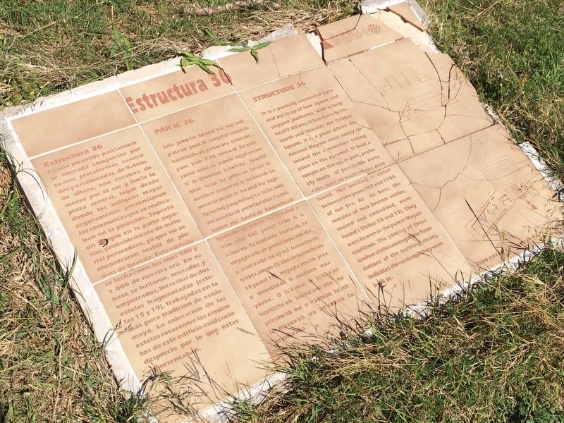
Estructura 36
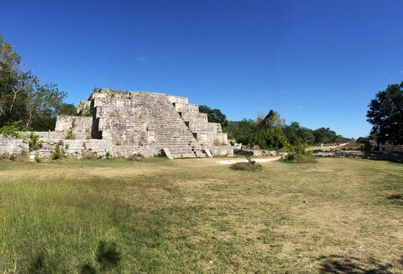
Es una pirámide parcialmente liberada compuesto por cuatro plataformas cuadradas y escalonadas, de 9.40 m. de altura, con escalera de acceso por el sur y hacia la plaza central, lugar desde donde los antiguos mayas seguramente presenciaron las ceremonias que se realizaban en la pirámide. Soportó un templo en la parte superior, probablemente de material perecedero, ya que no se encontraron restos de piedras de bóveda. Este edificio se fecha entre los años 900 y 1000 de nuestra era. En su base se hallaron, reusados y empotrados, los restos de dos estelas fragmentadas (estelas 18 y 19), trabajadas en la más pura tradición de estilo maya. La colocación de las estelas rotas de entre los restos de este edificio evidencia desprecio por lo que éstas representaban.
Maya-Yucateco:
Pak’il 36
Lela’ jump’eel ka’anal k’u’ naj óoli’ p’ata’an yaan ti’ kanp’eel táankab kant’itsilo’ob yéetel bey eebo’obe’, yaan ti’ob 9.40 metrosil ka’anlil, yeetel eebil tu yokolik nojol yéetel ti’ le chúumuk k’iiwikilo’, kúuchil kitak tu’uk ku yiliko’ob ka’ach le úuchben mayao’ob le ba’axo’ob ku meen ta’alo’ob te’ ka’anal k’u’ najo’. Tu kuchaj jump’éel naj k’u’tu ka’anlil, mii meenta’ab yeetel ba’al ku k’astal, tumen ma’ kaxta’ab káakacho’ob tuunichi’. Le pak’ila ku ts’a’abal u k’iin ichil 900 yéetel 1000 ti’ k k’iino’ob. Tu kaabalile’ kaxta’ab, ka’ meyajta’ ano’ob yéetel kapa’ano’obi’, u xóot’o’obil ka’ap’eel tuunicho’ob ts’úbta’ano’ob (Ts’iiba’an tuunicho’ob 18 yéetel 19), meyajta’ano’ob je’ex u meentko’ob le úuchben maayaobo’. U ts’a’abal le ts’iiba’an tuunicho’ob kacha’ano’obo’ ku ye’esiko’ob ma’ u k’áato’ob ka’ach le máaxo’ob wa ba’axo’ob ku ye’esiko’obo.
English:
Structure 36
It is a partially uncovered pyramid made up of four square and stepped platforms, with a height of 9.40 mts. It has stairs to the South and towards the Central Square. It is a place where Ancient Mayans most surely attended the ceremonies taking place on the pyramid. It held a temple on the upper part, probably made of perishable materials, since no vault stones were found. This building is dated between the years 900 and 1000 of our Era. At its base, the remains of two broken stelles, reused and embedded, were found (Stelles 18 and 19). They were hewen in the purest Mayan tradition. The placing of these broken stelles amongst the foundations of the building clearly indicates the contempt they were held in.
Erected by Instituto Nacional de Antropología e Historia (INAH).
Topics. This historical marker is listed in these topic lists: Anthropology & Archaeology • Native Americans • Notable Buildings.
Location.
21° 5.481′ N, 89° 35.805′ W. Marker is in Dzibilchaltún, Yucatán, in Mérida. The marker is located about 100 meters to the right after the entrance to the Dzibilchaltun Archaeological Zone. The park is off the road towards the small village of Dzilbilchaltun, to the east some 20 km north of Mérida on the Mérida-Progeso Highway (Hwy. 261). Touch for map. Marker is in this post office area: Dzibilchaltún YU 97300, Mexico. Touch for directions.
Other nearby markers. At least 8 other markers are within walking distance of this marker. The Open Chapel (within shouting distance of this marker); Central Square (within shouting distance of this marker); Substructure 38 (within shouting distance of this marker); Edifice 44 (about 120 meters away, measured in a direct line); Dzibilchaltún Archaeological Site (about 150 meters away); Sacbe 1 (about 180 meters away); The Habitational Complex (approx. 0.4 kilometers away); Adjoining Rooms (approx. 0.6 kilometers away). Touch for a list and map of all markers in Dzibilchaltún.

Photographed By J. Makali Bruton, January 11, 2017
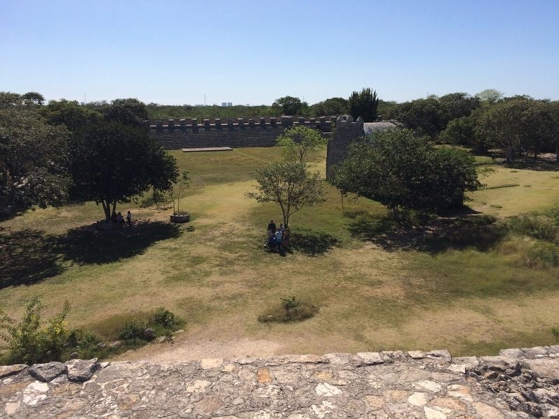
3. A view from the top of Structure 36
This view towards the south shows the plaza in front of the structure, with the post-Conquest Chapel near the center and Building 44 on the opposite side of the plaza. In the far distance can be seen buildings on the outskirts of modern Mérida.
Credits. This page was last revised on October 14, 2022. It was originally submitted on January 29, 2017, by J. Makali Bruton of Accra, Ghana. This page has been viewed 232 times since then and 19 times this year. Photos: 1, 2, 3. submitted on January 29, 2017, by J. Makali Bruton of Accra, Ghana.

