Dzibilchaltún in Mérida, Yucatán, Mexico — The Southeast (Yucatan Peninsula)
The Open Chapel
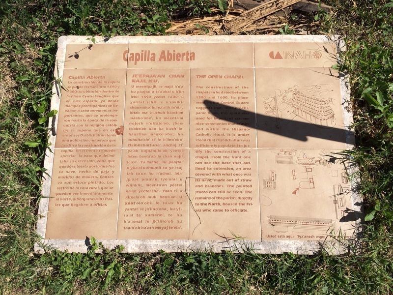
Capilla Abierta
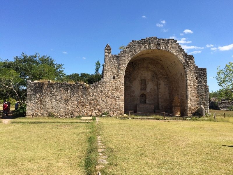
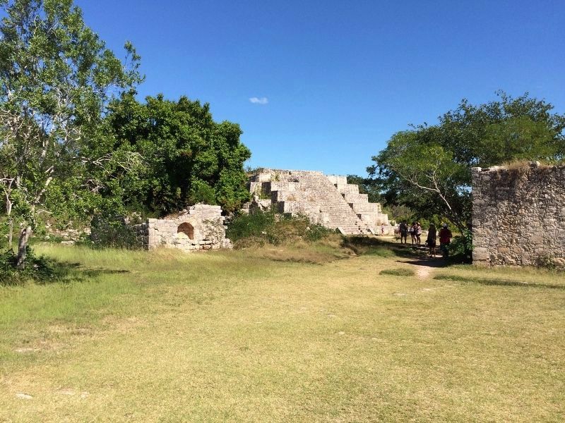
La construcción de la capilla se puede fechar entre 1590 y 1600; su ubicación dentro de la Plaza Central sugiere que en este espacio, ya desde tiempos prehispánicos se llevaban a cabo ceremonias importantes, que se prolongaron hasta la época de la conquista con la religión católica; se supone que en esta entonces Dzibilchaltún tenía una población numerosa que justificó la construcción de la capilla. En el frente se puede apreciar la base que delimitaba su extensión, zona que quedó cubierta por lo que fue su nave, hecha de paja y morillos de madera. Conserva aún estuco pintado. Los restos de la casa cural, que se pueden ver inmediatamente al norte, albergaron a los frailes que llegaban a oficiar.
Maya-Yucateco:
Je’epaja’an Chan Najil K’u’.
U meentpajlil le najil k’u’a’ ku páajtal u ts’a’abal u k’iin ichil 1590 yéetel 1600; u yantal ichil le k’iiwikil chúumuko’ ku ya’alik te’ela’, kitak ma’ k’uchuk káastlan máako’obe’, ku meenta’al nojoch k’ulta’jo’ob, jbeeta’abo’ob xan ka k’uch le káastlan máako’obo’; ku tukulta’ale’ ti’ le k’iino’obo’ Dzibilchaltune’ anchaj ti’ ya’ab kajnáalilo’ob yéetel leten beeta’ab le chan najil k’u’o’. Tu táane ku páajtal u yila’al u chuunil tu ye’esaj tak tu’uk ku k’uchul, lela’ jp’áat pixa’an tyo’olal u wiinklil, meenta’an yéetel xa’an yéetel che’. Yaan ti’ u xiixelo’ob luuk’ bona’an. U xóot’olo’obil le tu’ux ku yantal le jk’iino’obo’, ku yila’al te’ xamano’, te’ ku k’a’amal le jk’lino’ob ku taalo’ob ka’ach meyaj te’ela’.
English:
The Open Chapel
The construction of the chapel can be dated between 1590 and 1600. Its placement in the Central Square suggests that, since Pre-Hispanic times, this space was used for important ceremonies; ceremonies that continued within the Hispano-Catholic ritual. It is understood that Dzibilchaltun was sufficiently populated to justify the construction of a chapel. From the front one can see the baser that outlined its extension, an area covered with what once was its nave, made out of straw and branches. The painted stucco can still be seen. The remains of the parish, directly to the North, housed the Friars who came to officiate.
Erected by Instituto Nacional de Antropología e Historia (INAH).
Topics. This historical marker is listed in these topic lists: Churches & Religion • Colonial Era • Native Americans. A significant historical year for this entry is 1590.
Location. 21° 5.468′ N, 89° 35.828′ W. Marker is in Dzibilchaltún, Yucatán, in Mérida. The marker is located about 100 meters to the right after the entrance to the Dzibilchaltun Archaeological Zone. The park is off
the road towards the small village of Dzilbilchaltun, to the east some 20 km north of Mérida on the Mérida-Progeso Highway (Hwy. 261). Touch for map. Marker is in this post office area: Dzibilchaltún YU 97300, Mexico. Touch for directions.
Other nearby markers. At least 8 other markers are within walking distance of this marker. Central Square (within shouting distance of this marker); Structure 36 (within shouting distance of this marker); Substructure 38 (within shouting distance of this marker); Edifice 44 (within shouting distance of this marker); Dzibilchaltún Archaeological Site (about 180 meters away, measured in a direct line); Sacbe 1 (about 210 meters away); The Habitational Complex (approx. 0.4 kilometers away); Adjoining Rooms (approx. 0.6 kilometers away). Touch for a list and map of all markers in Dzibilchaltún.
Photographed By J. Makali Bruton, January 11, 2017
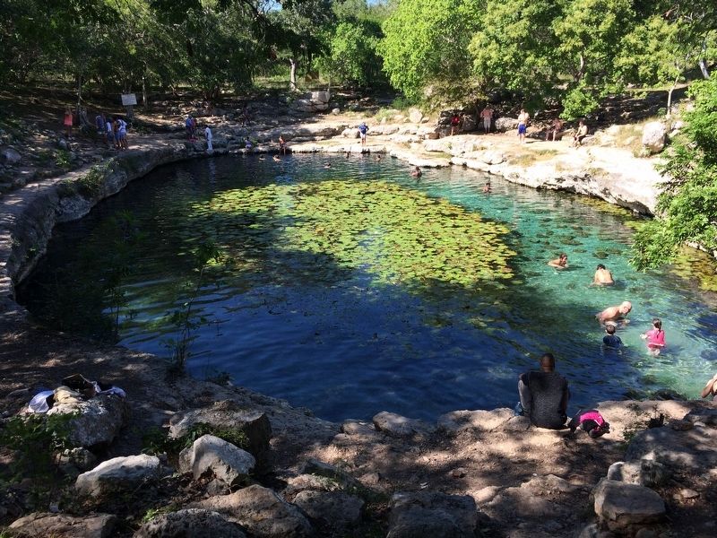
4. The Cenote at Dzibilchaltún
This cenote is some meters west of the Open Chapel. As the Yucatán has no rivers, cenotes (naturally formed sinkholes that are open to groundwater) were traditionally the main water sources for the Maya and early Spanish colonizers. This cenote is now used as a local swimming hole.
1970
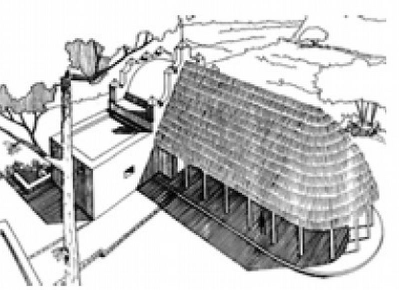
5. The Open Chapel at Dzibilchaltún
This image (which appears to be the image on the marker) shows how the chapel probably appeared. It was taken from "Folan, William. 1970. The Open Chapel of Dzibilchaltun, Yucatan. Middle American Research Institute. Publication 26: 181-199. Tulane University. New Orleans."
Credits. This page was last revised on October 14, 2022. It was originally submitted on January 29, 2017, by J. Makali Bruton of Accra, Ghana. This page has been viewed 205 times since then and 24 times this year. Photos: 1, 2, 3, 4, 5. submitted on January 29, 2017, by J. Makali Bruton of Accra, Ghana.
