Cumberland Township near Gettysburg in Adams County, Pennsylvania — The American Northeast (Mid-Atlantic)
The Ashland Virginia Artillery
Artillery Reserve - Longstreet's Corps
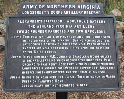
— Army of Northern Virginia —
Longstreet's Corps Artillery Reserve
Alexander's Battalion Woolfolk's Battery
The Ashland Virginia Artillery
Two 20 pounder Parrotts and Two Napoleons
July 2 Took position here 4:30 p.m. and opened fire. Joined soon in the advance of the infantry. During remainder of the day occupied position on the crest near Peach Orchard and was actively engaged in firing upon the new line of the Union forces.
July 3 In position near N.E. corner of Spangler's Woods on left of artillery line which occupied the ridge from Peach Orchard to that point. Took part in the cannonade preceding Longstreet's assault followed and supported it. Aided then in repelling sharpshooters and withdrew at midnight.
July 4 In position near here until 4 p.m. Then withdrew to Marsh Creek on Fairfield Road.
Losses heavy but not reported in detail.
Erected 1910 by Gettysburg National Military Park Commission.
Topics. This historical marker is listed in this topic list: War, US Civil. A significant historical month for this entry is July 1785.
Location. 39° 47.987′ N, 77° 15.356′ W. Marker is near Gettysburg, Pennsylvania, in Adams County. It is in Cumberland Township. Marker is at the intersection of West Confederate Avenue and Millerstown Road, on the left when traveling south on West Confederate Avenue. Located near stop six (Pitzer Woods) of the driving tour of Gettysburg National Military Park, just south of the Longstreet Observation tower. Touch for map. Marker is in this post office area: Gettysburg PA 17325, United States of America. Touch for directions.
Other nearby markers. At least 8 other markers are within walking distance of this marker. Longstreet Tower - South View (a few steps from this marker); Longstreet Tower - East View (a few steps from this marker); Freedom Threatened (within shouting distance of this marker); Lieut. General James Longstreet (within shouting distance of this marker); McLaws's Division (within shouting distance of this marker); The Bedford Virginia Artillery (within shouting distance of this marker); Carlton's Battery - Cabell's Battalion (about 300 feet away, measured in a direct line); Georgia (about 300 feet away). Touch for a list and map of all markers in Gettysburg.
Photographed By Craig Swain, April 12, 2008
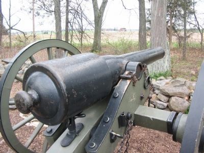
3. 20-pdr Parrott Rifle
The battery's pair of 20-pdr Parrott rifles were among the heaviest guns in the Confederate artillery park. The gun tubes alone weighed around 1,700 pounds, compared to 1,200 pounds for a 12-pounder Napoleon or 900 pounds for a 3-inch Rifled Cannon. However, the 20-pdr could launch a shell to a range of 4400 yards. The example here is a Confederate "copy," made by Tredegar Iron Works, of the basic Parrott rifle.
Photographed By Craig Swain, April 12, 2008
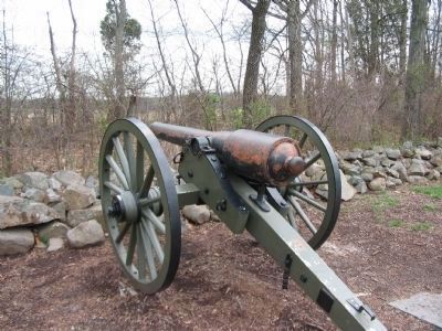
4. Tredegar 20-pdr Parrott
Tredegar Iron Works, in Richmond Virginia, produced a set of 20-pdr Parrott Rifles. Basically a copy of the Federal type (produced at West Point Foundry, New York), with a bore of 3.67 inches. The Tredegar guns have slightly longer and thicker reinforcing bands (over the breech). It is not recorded if the guns arming the Ashland Artillery were of U.S. or Confederate manufacture. The red color on this cannon is the primer weathering through the black paint.
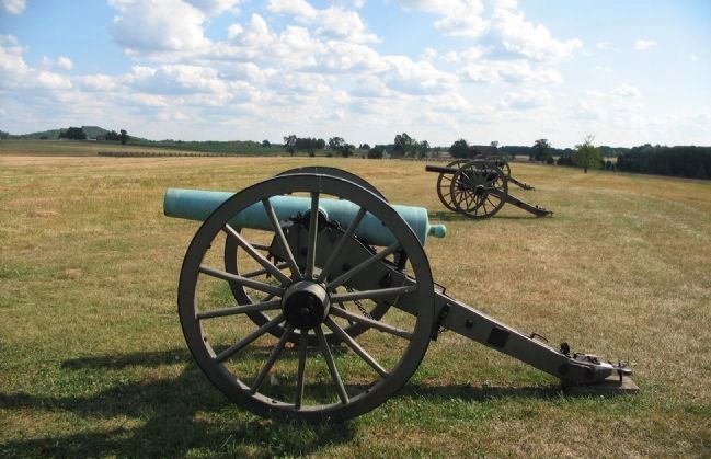
Photographed By Craig Swain, August 16, 2008
5. Woolfolk's Position - July 3
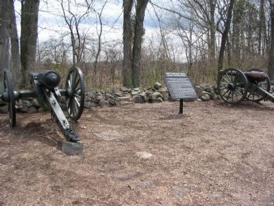
On July 3 the battery was moved to advanced positions in front of Spangler's Woods. The location is accessible today from a foot trail out from the Virginia Memorial. Two Confederate 12-pounder Napoleons and two reproduction Parrott rifles represent the battery.
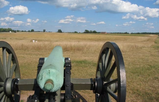
Photographed By Craig Swain, August 16, 2008
6. The Battery's View of Cemetery Ridge - July 3
Looking east over the barrel of a Confederate 12-pounder Napoleon. On the left of frame on the far ridge line is the white Brian Barn, behind which is the modern Cyclorama building. Scanning to the right are several monuments beside the copse of trees, which was the target for Longstreet's Assault. Almost in the center on the horizon is the U.S. Regulars Monument. The red barn of the Codori Farm is just right of that. Finally on the far right is the Pennsylvania Monument.
Credits. This page was last revised on February 7, 2023. It was originally submitted on August 10, 2008, by Craig Swain of Leesburg, Virginia. This page has been viewed 1,477 times since then and 29 times this year. Photos: 1, 2, 3, 4. submitted on August 10, 2008, by Craig Swain of Leesburg, Virginia. 5, 6. submitted on September 28, 2008, by Craig Swain of Leesburg, Virginia.
