Seymour in New Haven County, Connecticut — The American Northeast (New England)
The Falls
Generating Historic Moments
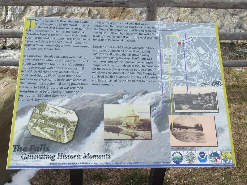
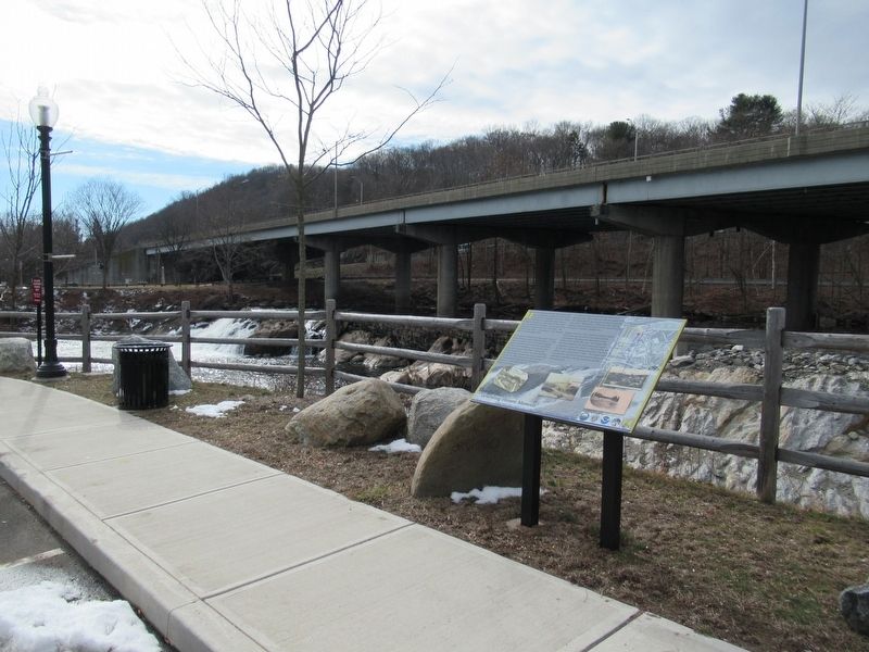
The Naugatuck River abounded with runs of migratory (diadromous) fish prior to the arrival of European colonists. These fish runs had been an important food source for Native Peoples for centuries and this exact spot — at the foot of a gorge — was known to be a popular fishing location for local tribes. The original town name — Chusetown — was named after the local Indian chief.
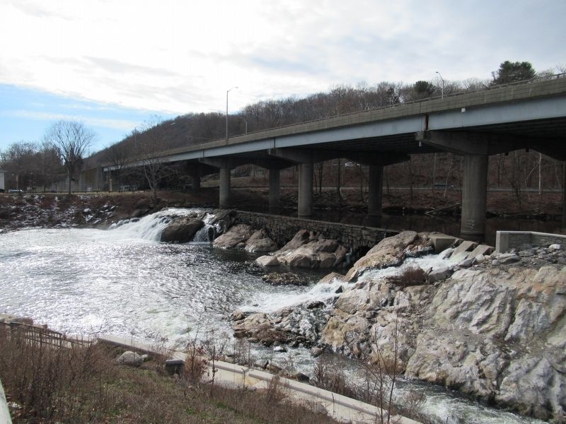
As Chusetown developed, dams were built to power mills and other local industries. In 1763, a dam was built on top of this site's bedrock gorge to provide water power for a gristmill. In 1803, David Humphrey, an aide-de-camp of General George Washington during the Revolutionary War, came to the area and built the nation's first woolen mill, using power from the dam. In 1804, Chusetown was renamed Humphreysville before being renamed to Seymour in 1850 after Governor Thomas H. Seymour.
In 1856, the large brick building that was to become the Tingue Mill was built as a paper mill. The Tingue family (pronounced Ting-U) acquired the mill in 1880 and by 1900 it was the nation's leading manufacturer of ‘plush,’ the wool covering for seats in Pullman railroad cars.
Disaster struck in 1955 when two back-to-back 3 hurricanes pummeled Connecticut causing catastrophic flooding that destroyed many of the towns along the river. The Tingue Mill was devastated by the flood and never again reopened. It was torn down in 1959 to make way for the new highway overpass portion of Route 8, which was constructed in 1966. The Tingue Dam survived the floods and construction of Route 8 and has remained as the last barrier to the fish runs upstream.
( right hand marker )
The Paul Pawlak, Sr. Fish Bypass & Park at Tingue Dam
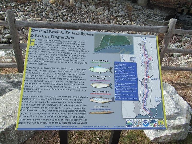
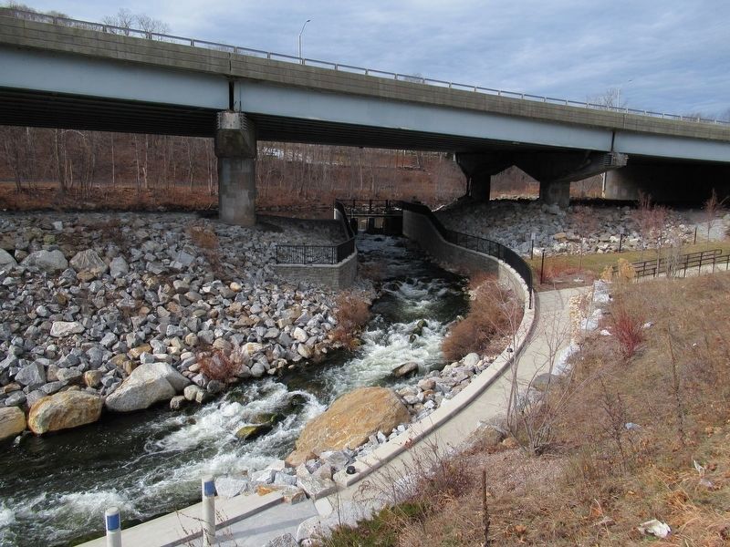
Fish need to swim upstream to access spawning and nursery habitats. Fishways are artificial structures that circumvent dams and allow fish to swim past them to continue their journeys upstream. There are many different kinds of fishways and each one is custom designed for each particular dam. The dam could not be removed due to its historic presence and the need to maintain the structural integrity of the Route 8 highway overpass piers. Instead, a nature-like bypass channel was built to allow a wide assortment of fish to swim up and around the dam. The bypass channel constructed here is one of the first and largest of its kind on the East Coast.
The bypass channel is approximately 500 feet long, an average of 25 feet wide, and has an average slope of 3%. The lower portion of the bypass channel was hammered out of solid bedrock while the upper portion was excavated out of soil. Rock riffles have been constructed on the bottom of the channel
to slow the water velocities and create hydraulic conditions and pools favorable to migrating fish. The bypass channel roughly resembles a natural stream but has been carefully designed by engineers and biologists to accommodate the needs of the targeted fish species, including the American shad.
The property you are standing on is owned by the Town of Seymour and the bypass channel itself will be maintained and operated by the CT Department of Energy & Environmental Protection's team of fisheries biologists. This facility is generally open to the public from April to November; however, please remember that this channel is a fully functioning and engineered project, and it is important to avoid any disruption of the migratory fish runs. The construction of the Paul Pawlak, Sr. Fish Bypass & Park at Tingue Dam reopened 25 miles of suitable upstream river habitat that had been blocked to fish passage for over 250 years!
Annual Fish Runs:
March- white suckers, some yellow perch and broodstock salmon
April- alewives and resident trout start of shad run
May- shad, blueback herring, sea lamprey, sea-run trout
June- smallmouth bass and various minnows, young American eels arrive
July- minnows, bass, sunfish are exploring new territories if not migrating
August- eels move upstream, adult eels ready to go to sea and spawn start moving
downstream
September- adult eels move upstream
October- young shad and river herring move downstream, trout move upstream
November- trout and broodstock salmon
December- most fish activity is done
Erected 2015.
Topics. This historical marker is listed in this topic list: Environment.
Location. 41° 23.612′ N, 73° 4.535′ W. Marker is in Seymour, Connecticut, in New Haven County. Marker is at the intersection of Wakeley Street and Deforest Street, on the right when traveling south on Wakeley Street. Touch for map. Marker is in this post office area: Seymour CT 06483, United States of America. Touch for directions.
Other nearby markers. At least 8 other markers are within walking distance of this marker. Seymour (about 500 feet away, measured in a direct line); Seymour Veterans Monument (about 500 feet away); Seymour School Bell (about 500 feet away); Seymour Soldiers Monument (approx. half a mile away); Seymour World War I – World War II Memorial (approx. half a mile away); Seymour Korean War Memorial (approx. half a mile away); Seymour Vietnam War Memorial (approx. half a mile away); Seymour Revolutionary War Memorial (approx. half a mile away). Touch for a list and map of all markers in Seymour.
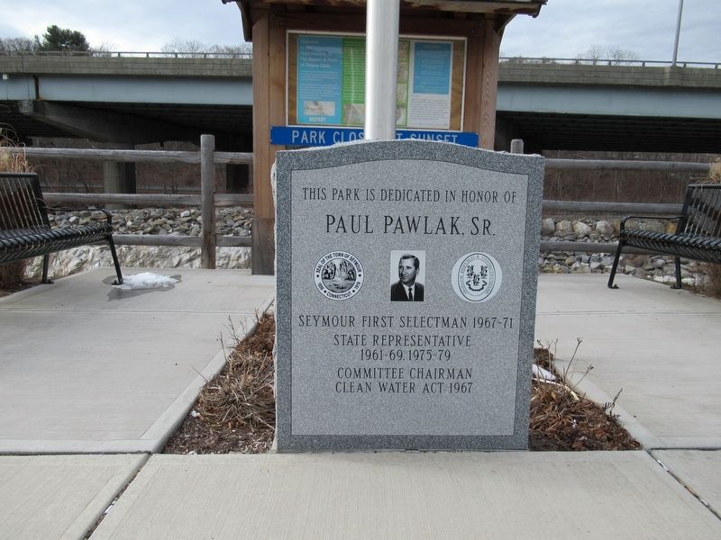
Regarding The Falls. Paul Pawlak, Sr. served Seymour as Selectman and Chairman of the Board of Education. He was elected to the State House of Representatives for a 12 year term. While serving in the State Legislature, Mr. Pawlak was the Chairman of the Water Resources Committee and an outspoken advocate for Connecticut's environment and its waterways. He helped to create the State's Clean Waters Act that mandated an end to industrial and residential pollution.
Credits. This page was last revised on February 12, 2017. It was originally submitted on February 12, 2017, by Michael Herrick of Southbury, Connecticut. This page has been viewed 620 times since then and 27 times this year. Photos: 1, 2, 3, 4, 5, 6. submitted on February 12, 2017, by Michael Herrick of Southbury, Connecticut.
