Chamberlain in Brule County, South Dakota — The American Midwest (Upper Plains)
Purple Heart Memorial Highway
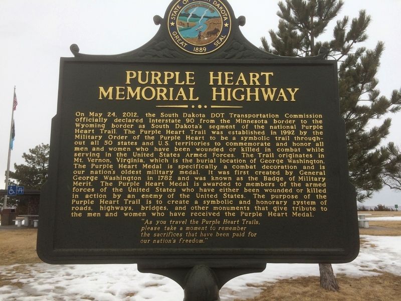
Photographed by Ruth VanSteenwyk, February 11, 2017
1. Purple Heart Memorial Highway Marker
On May 24, 2012, the South Dakota DOT Transportation Commission officially declared Interstate 90 from the Minnesota border to the Wyoming border as South Dakota's segment of the national Purple Heart Trail. The Purple Heart Trail was established in 1992 by the Military Order of the Purple Heart to be a symbolic trail throughout all 50 states and U.S. territories to commemorate and honor all men and women who have been wounded or killed in combat while serving in the United States Armed Forces. The Trail originates in Mt. Vernon, Virginia, which is the burial location of George Washington. The Purple Heart Medal is specifically a combat decoration and is our nations' oldest military medal. It was first created by General George Washington in 1782 and was known as the Badge of Military Merit. The Purple Heart Medal is awarded to members of the armed forces of the United States who have either been wounded or killed in action by an enemy of the United States. The purpose of the Purple Heart Trail is to create a symbolic and honorary system of roads, highways, bridges, and other monuments that give tribute to the men and
this page online
"As you travel the Purple Heart Trails, please take a moment to remember the sacrifices that have been paid for our nation's freedom."
Topics and series. This memorial is listed in this topic list: Roads & Vehicles. In addition, it is included in the Military Order of the Purple Heart series list.
Location. 43° 47.177′ N, 99° 20.345′ W. Memorial is in Chamberlain, South Dakota, in Brule County. It can be reached from Interstate 90 at milepost 264. Marker is at the parking lot of the rest area/overlook. Touch for map. Memorial is in this post office area: Chamberlain SD 57325, United States of America. Touch for directions.

Regionally, this memorial is in East River. It is also in the American Lewis & Clark Corridor, on the prairies, and on the Northern Plains. Globally, it is in North America, the Western Hemisphere, the Western World, and the Anglosphere. Historically, it finds itself in what was once Rupert’s Land and also the Louisiana Purchase.
Other nearby markers. At least 8 other markers are within walking distance
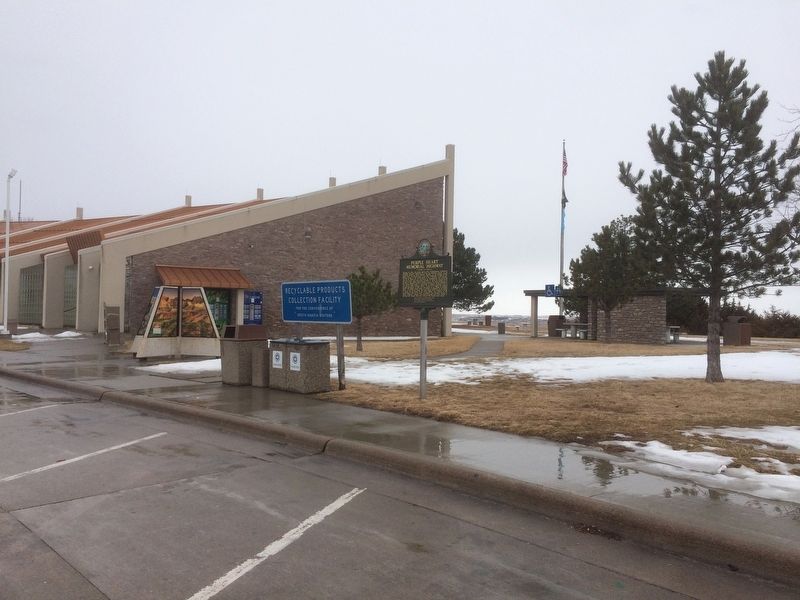
Photographed by Ruth VanSteenwyk, February 11, 2017
2. Purple Heart Memorial Highway Marker
Other markers no longer nearby. World's Only Corn Palace - Mitchell (was a few steps from this marker but has been permanently removed); State Capitol - Pierre (was a few steps from this marker but has been permanently removed); Mount Rushmore National Memorial (was a few steps from this marker but has been permanently removed); The Making & Meaning of Dignity (was within shouting distance of this marker but has been replaced with another marker now near it).
Credits. This page was last revised on February 13, 2017. It was originally submitted on February 13, 2017, by Ruth VanSteenwyk of Aberdeen, South Dakota. This page has been viewed 1,188 times since then and 58 times this year. Photos: 1, 2. submitted on February 13, 2017, by Ruth VanSteenwyk of Aberdeen, South Dakota. • Bill Pfingsten was the editor who published this page.
