Near Fort Oglethorpe in Catoosa County, Georgia — The American South (South Atlantic)
100th Illinois Infantry
Buell's Brigade
| — | Wood's Division | — |
Photographed by Dale K. Benington, August 1, 2012
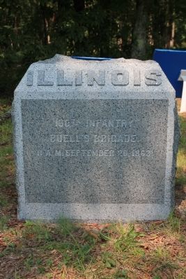
1. 100th Illinois Infantry Marker
100th Infantry.
Buell's Brigade.
11 A.M. September 20, 1863.
Erected 1899 by the State of Illinois. (Marker Number MT-718.)
Topics. This memorial is listed in this topic list: War, US Civil. A significant historical date for this entry is September 20, 1863.
Location. 34° 55.068′ N, 85° 15.747′ W. Memorial is near Fort Oglethorpe, Georgia, in Catoosa County. It is on Dyer Road west of Lafayette Road, on the left when traveling west. This historical monument is located just off the Dryer Road, on the west side of a split rail fence, between the split rail fence and the blue "Buell's Brigade" tablet. Touch for map. Memorial is in this post office area: Fort Oglethorpe GA 30742, United States of America. Touch for directions.

Regionally, this memorial is in Georgia’s Mountains. It is also in the American South and specifically in the Deep South. Globally, it is in North America, the Western Hemisphere, the Western World, and the Anglosphere. Historically, it finds itself in what was once the original Cherokee Nation, the territory of the Mississippian Culture, one of the original Thirteen Colonies, one of the Confederate States of America, and the Antebellum South.
Other nearby markers. At least 8 other markers are within walking distance of this marker: Buell's Brigade (here, next to this marker); Woods Division (a few steps from this marker); Negley's Division (a few steps from this marker); 6th Ohio Battery (within shouting distance of this marker); War Comes to the Brothertons (about 400 feet away, measured in a direct line); Confederate Breakthrough (about 400 feet away); Bledsoe's C.S.A. Missouri Battery (about 400 feet away); S. Beatty's Brigade (about 400 feet away). Touch for a list and map of all markers in Fort Oglethorpe.
More about this memorial. I used the "Chickamauga
this page online
Photographed by Dale K. Benington, August 1, 2012
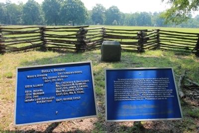
2. 100th Illinois Infantry Marker
View of the historical monument situated between the split rail fence on the west side of the Brotherton Field and the blue tablets for the Buell's Brigade.
Photographed by Dale K. Benington, August 1, 2012
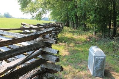
3. 100th Illinois Infantry Marker
View of the historical monument, looking south, along the split rail fence on the west side of the Brotherton Field.
Photographed by Dale K. Benington, August 1, 2012
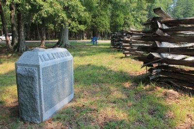
4. 100th Illinois Infantry Marker
View of the historical monument, looking north, along the split rail fence, toward the Dyer Road.
Credits. This page was last revised on October 30, 2019. It was originally submitted on January 15, 2013, by Dale K. Benington of Toledo, Ohio. This page has been viewed 779 times since then and 24 times this year. Last updated on February 26, 2017, by Byron Hooks of Sandy Springs, Georgia. Photos: 1, 2, 3, 4. submitted on January 15, 2013, by Dale K. Benington of Toledo, Ohio. • Bill Pfingsten was the editor who published this page.
