Grooverville in Brooks County, Georgia — The American South (South Atlantic)
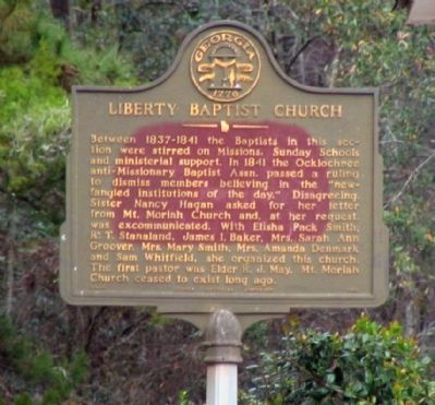
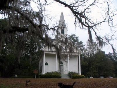
Liberty Baptist Church
Erected by Georgia Historical Commission. (Marker Number 014-4.)
Topics and series. This historical marker is listed in these topic lists: Churches & Religion • Women. In addition, it is included in the Georgia Historical Society series list. A significant historical year for this entry is 1837.
Location. 30° 43.328′ N, 83° 43.699′ W. Marker is in Grooverville, Georgia, in Brooks County. Marker can be reached from Liberty Church Road (County Route 94) 0 miles north of Grooverville Road (County Route 275), on the right when traveling west. Touch for map. Marker is in this post office area: Boston GA 31626, United States of America. Touch for directions.
Other nearby markers. At least 8 other markers are within 11 miles of this marker , measured as the crow flies. Grooverville Methodist Church (about 500 feet away, measured in a direct line); Olive Baptist Church (approx. 6.9 miles away in Florida); Bethlehem Primitive Baptist Church (approx. 8.4 miles away); West End Cemetery (approx. 10˝ miles away); Civil War Slave Conspiracy (approx. 10.9 miles away); Quitman Veterans Memorial (approx. 10.9 miles away); Brooks County (approx. 10.9 miles away); Our Confederate Dead (approx. 10.9 miles away).
Credits. This page was last revised on January 26, 2020. It was originally submitted on July 15, 2008, by David Seibert of Sandy Springs, Georgia. This page has been viewed 1,919 times since then and 13 times this year. Last updated on August 12, 2008, by Edwin C. King of Ormond Beach,, Florida. Photos: 1, 2. submitted on July 15, 2008, by David Seibert of Sandy Springs, Georgia. • Kevin W. was the editor who published this page.

