Kearney in Buffalo County, Nebraska — The American Midwest (Upper Plains)
The Watson Ranch
Photographed by Cosmos Mariner, August 3, 2013
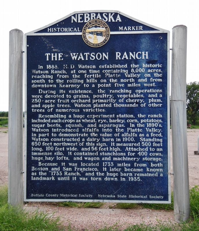
1. The Watson Ranch Marker
In 1888, H. D. Watson established the historic Watson Ranch, at one time containing 8,000 acres, reaching from the fertile Platte Valley on the south to the rolling hills on the north and from downtown Kearney to a point five miles west.
During its existence, the ranching operations were devoted to grains, poultry, vegetables, and a 250-acre fruit orchard primarily of cherry, plum, and apple trees. Watson planted thousands of other trees of numerous varieties.
Resembling a huge experiment station, the ranch included such crops as wheat, rye, barley, corn, potatoes, sugar beets, squash, and asparagus. In the 1890's, Watson introduced alfalfa into the Platte Valley. In part to demonstrate the value of alfalfa as a feed, Watson constructed a dairy barn in 1900. Standing 650 feet northwest of this sign, it measured 500 feet long, 100 feet wide, and 56 feet high. Attached to an immense silo, it contained stanchions for 400 cows, huge hay lofts, and wagon and machinery storage.
Because it was located 1,733 miles from both Boston and San Francisco, it later became known as the "1733 Ranch," and the huge barn remained
this page online
Erected by Buffalo County Historical Society & Nebraska State Historical Society. (Marker Number 178.)
Topics and series. This historical marker is listed in these topic lists: Agriculture • Industry & Commerce • Settlements & Settlers. In addition, it is included in the Nebraska State Historical Society series list. A significant historical year for this entry is 1888.
Location. 40° 41.962′ N, 99° 9.795′ W. Marker is in Kearney, Nebraska, in Buffalo County. It is at the intersection of U.S. 30 and 1733 Road, on the right when traveling east on U.S. 30. Marker is located on south side of U.S. 30, in a large pullout associated with the current ranch at this location. Touch for map. Marker is at or near this postal address: 6423 24th Road, Kearney NE 68845, United States of America. Touch for directions.

Regionally, this marker is in Central Nebraska and in the Platte River Valley. It is also in the American Midwest, in the Corn Belt, and on the prairies. Globally, it is in North America, the Western Hemisphere, the Western World, and the Anglosphere. Historically, it
Photographed by Cosmos Mariner, August 3, 2013
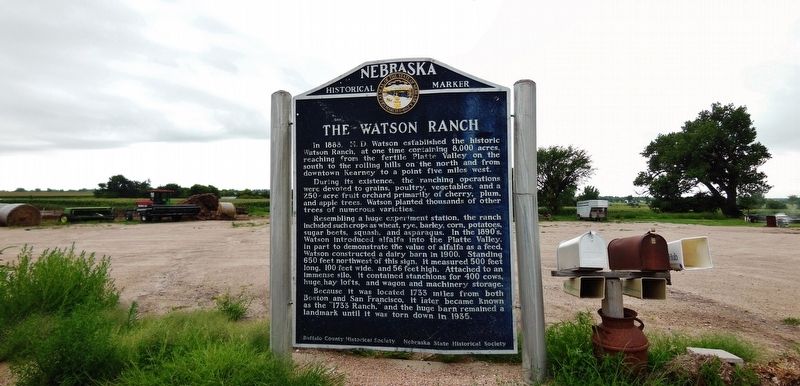
2. The Watson Ranch Marker (wide view)
Other nearby markers. At least 8 other markers are within 4 miles of this marker, measured as the crow flies: Kearney Cotton Mill (approx. 1.3 miles away); The Mormon Pioneer Trail / Frontier Mail Carriers (approx. 2 miles away); Kearney-Fort Kearny (approx. 2 miles away); Frontier Forts in Nebraska (approx. 2 miles away); The Frank House (approx. 2.9 miles away); The Great Plains (approx. 2.9 miles away); Buffalo County’s Lincoln Highway Seedling Mile (approx. 3.1 miles away); Hostetler Amphitheatre (approx. 3.4 miles away). Touch for a list and map of all markers in Kearney.
Credits. This page was last revised on November 14, 2020. It was originally submitted on March 9, 2017, by Cosmos Mariner of Cape Canaveral, Florida. This page has been viewed 1,199 times since then and 104 times this year. Photos: 1, 2. submitted on March 9, 2017, by Cosmos Mariner of Cape Canaveral, Florida. • Bill Pfingsten was the editor who published this page.
