Fort Shaw in Cascade County, Montana — The American West (Mountains)
Fort Shaw
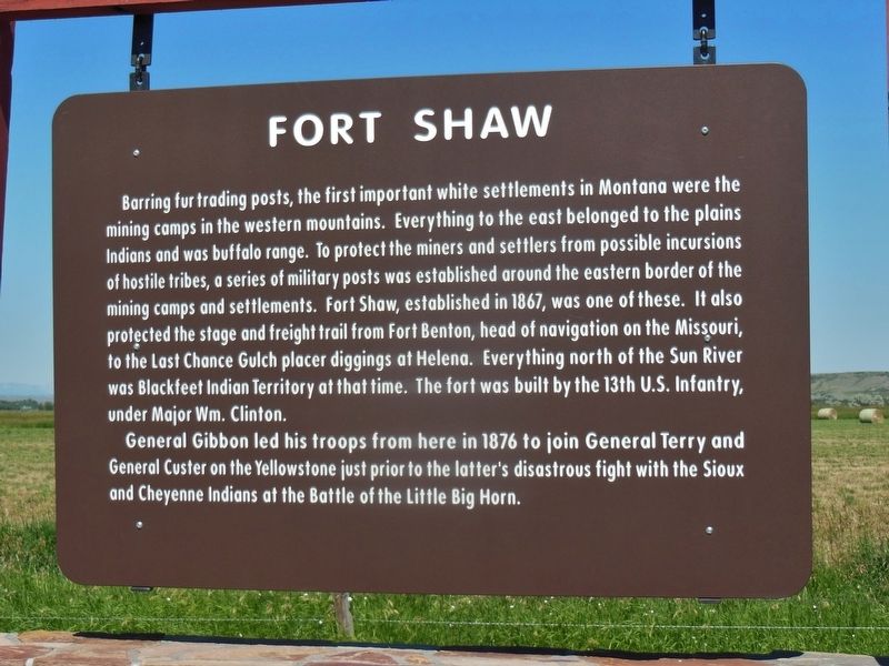
Barring fur trading posts, the first important white settlements in Montana were the mining camps in the western mountains. Everything to the east belonged to the plains Indians and was buffalo range. To protect the miners and settlers from possible incursions of hostile tribes a series of military posts was established around the eastern border of the mining camps and settlements. Fort Shaw established in 1867 was one of these. It also protected the stage and freight trail from Fort Benton, head of navigation on the Missouri, to the Last Chance Gulch placer diggings at Helena. Everything north of the Sun River was Blackfeet Indian territory at that time. The Fort was built by the 13th U.S. Infantry under Major Wm. Clinton.
General Gibbon led his troops from here in 1876 to join General Terry and General Custer on the Yellowstone just prior to the latter’s disastrous fight with the Sioux and Cheyenne Indians at the Battle of the Little Big Horn.
Topics. This historical marker is listed in these topic lists: Forts and Castles • Native Americans • Settlements & Settlers • Wars, US Indian. A significant historical date for this entry is June 30, 1867.
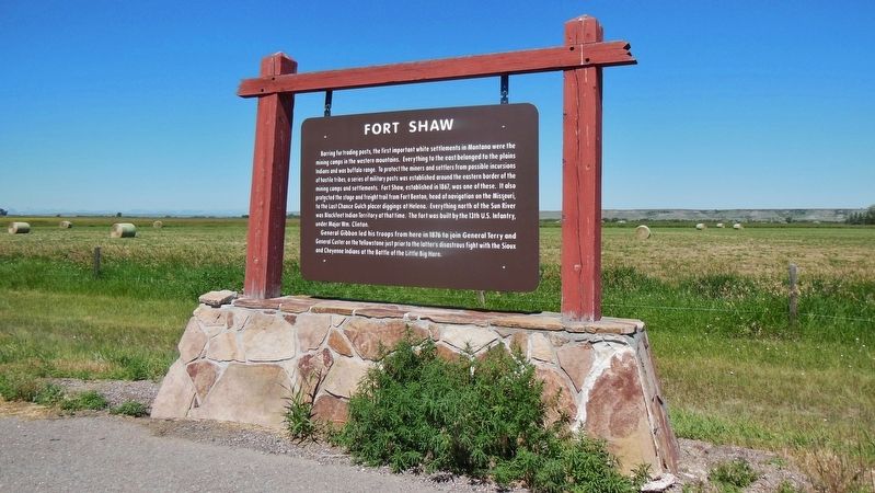
Location. 47° 30.01′ N, 111° 49.137′ W. Marker is in Fort Shaw, Montana, in Cascade County. Marker is on State Highway 200, 0.2 miles west of Dr Russell Road, on the right when traveling west. Marker is in a pullout on the north side of Montana Highway 200. Touch for map. Marker is in this post office area: Fort Shaw MT 59443, United States of America. Touch for directions.
Other nearby markers. At least 5 other markers are within 6 miles of this marker, measured as the crow flies. Commanding Officer's Quarters (approx. 0.6 miles away); a different marker also named Fort Shaw (approx. 0.6 miles away); Undisputed Champions (approx. 0.6 miles away); Fort Shaw Government Industrial Indian School (approx. 0.6 miles away); Sun River Crossing (approx. 5˝ miles away).
More about this marker. Marker is a plastic laminate placard hanging on a wooden frame.
Also see . . . Fort Shaw History.
Established 30 Jun 1867 as a U.S. Army Infantry post (Camp Reynolds) by Major William Clinton and four companies of the 13th U.S. Infantry to prevent the movement of hostile Indians into settled areas and to protect the Fort Benton-Helena stage route. Renamed Fort Shaw 1 Aug 1867 after Colonel Robert G. Shaw, 54th Massachusetts Volunteer Infantry, who was killed 18 Jul 1863 during the U.S. Civil War. Abandoned in 1891 and transferred to the Interior Department in 1892. (Submitted on March 10, 2017, by Cosmos Mariner of Cape Canaveral, Florida.)
Credits. This page was last revised on October 14, 2020. It was originally submitted on March 10, 2017, by Cosmos Mariner of Cape Canaveral, Florida. This page has been viewed 642 times since then and 63 times this year. Photos: 1, 2, 3, 4. submitted on March 10, 2017, by Cosmos Mariner of Cape Canaveral, Florida. • Bill Pfingsten was the editor who published this page.


