Canton Valley in Hartford County, Connecticut — The American Northeast (New England)
Collinsville, Town of Canton
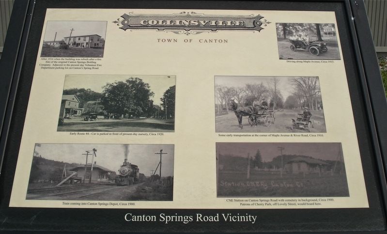
Canton Springs Road Vicinity
Inscription.
Driving along Maple Avenue, circa 1915
Some early transportation at the corner of Maple Avenue & River Road, circa 1910
CNE Station on Canton Springs Road with cemetery in the background, circa 1900
Patrons of Cherry Park, off Lovely Street, would board here.
Train coming into Canton Springs Depot, circa 1900.
Early Route 44- Car is parked in front of present-day nursery, circa 1920.
After 1916 when the building was rebuilt after a fire.
Site of the original Canton Springs Bottling Company.
Adjacent to the present day Volunteer Fire Department parking lot on Canton Springs Road
Topics. This historical marker is listed in these topic lists: Railroads & Streetcars • Roads & Vehicles. A significant historical year for this entry is 1916.
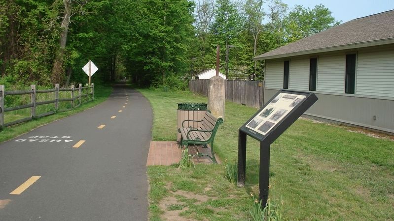
Location. 41° 49.349′ N, 72° 53.79′ W. Marker is in Canton, Connecticut, in Hartford County. It is in Canton Valley. Marker is on Canton Springs Road, on the right when traveling south. The marker is on the Farmington River Trail, 10 yards west of the crossing of Canton Springs Road. Touch for map. Marker is at or near this postal address: 15 Canton Springs Road, Canton, 06019, Canton CT 06019, United States of America. Touch for directions.
Other nearby markers. At least 8 other markers are within 2 miles of this marker, measured as the crow flies. Canton (approx. 0.2 miles away); a different marker also named Collinsville, Town of Canton (approx. 0.4 miles away); In Memory of Phoebe Humphrey (approx. 0.6 miles away); Constitution Oak (approx. 0.8 miles away); a different marker also named Collinsville, Town of Canton (approx. one mile away); a different marker also named Collinsville, Town of Canton (approx. 1.3 miles away); Canton Veterans Memorial (approx. 1˝ miles away); Canton Soldiers Memorial (approx. 1.6 miles away). Touch for a list and map of all markers in Canton.
Also see . . .
1. Collinsville, Town of Canton. (Submitted on March 29, 2017, by Alan M. Perrie of Unionville, Connecticut.)
2. Town of Canton homepage. Links to various area tours. (Submitted on March 29, 2017, by Alan M. Perrie of Unionville, Connecticut.)
Credits. This page was last revised on February 10, 2023. It was originally submitted on March 29, 2017, by Alan M. Perrie of Unionville, Connecticut. This page has been viewed 262 times since then and 21 times this year. Photos: 1, 2. submitted on March 29, 2017, by Alan M. Perrie of Unionville, Connecticut. • Bill Pfingsten was the editor who published this page.

