Near Williamsburg in James City County, Virginia — The American South (Mid-Atlantic)
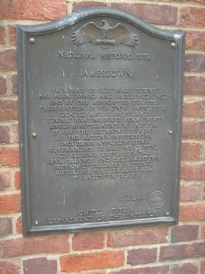
Jamestown
National Historic Site
Photographed by Bill Coughlin, August 14, 2008
1. Jamestown Marker
National Park Service
United States Department of the Interior
Erected by National Park Service, Department of the Interior.
Topics. This historical marker is listed in these topic lists: Colonial Era • Notable Places. A significant historical date for this entry is May 13, 1862.
Location. 37° 12.521′ N, 76° 46.692′ W. Marker is near Williamsburg, Virginia, in James City County. It can be reached from Colonial Parkway, on the right when traveling west. Marker is in the "Old Towne" section of the Historic Jamestown unit of Colonial National Historic Park. Touch for map. Marker is in this post office area: Williamsburg VA 23185,
this page online

Regionally, this marker is on Virginia’s Peninsula, in Coastal Virginia, and in the Hampton Roads Metropolitan Area. It is also in the American South, specifically in the Upper South, in the Tidewater, and on the Eastern Seaboard. Globally, it is in the North Atlantic Region, North America, the Western Hemisphere, the Western World, and the Anglosphere. Historically, it finds itself in what was once the territory of the Mississippian Culture, one of the original Thirteen Colonies, one of the Confederate States of America, and the Antebellum South.
Other nearby markers. At least 8 other markers are within walking distance of this marker: Fort Extension, Blockhouse (here, next to this marker); Pocahontas (a few steps from this marker); Jamestown Memorial Church (a few steps from this marker); The Tombstones (within shouting distance of this marker); Jamestown’s Churches (within shouting distance of this marker); In Memory of the Colonial Governors (within shouting distance of this marker); The Tombs of James and Sarah Blair (within shouting distance of this marker); Church Tower
Photographed by Bill Coughlin, August 14, 2008
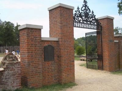
2. Marker in Colonial National Historic Park
The marker is near the gate to "Old Towne" or site of the original 1607 settlement at Jamestown.
Also see . . .
1. Historic Jamestowne. Colonial National Historic Park from National Park Service website. (Submitted on August 14, 2008, by Bill Coughlin of Woodland Park, New Jersey.)
2. Historic Jamestowne. Historic Jamestowne is the site of the first permanent English settlement in America. The site is jointly administered by APVA Preservation Virginia and the National Park Service. (Submitted on August 14, 2008, by Bill Coughlin of Woodland Park, New Jersey.)
Photographed by Bill Coughlin, August 14, 2008
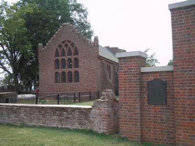
3. Historic James Towne
Behind the marker can be seen the Memorial Church, the only 17th century structure still standing at Jamestown.
Photographed by Bill Coughlin, August 14, 2008
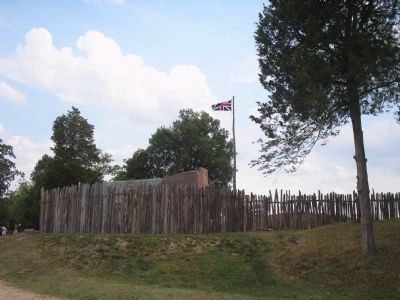
4. James Fort
This is a reconstruction of the original fort. It was built on the actual site of the original 1607 fort.
Credits. This page was last revised on June 16, 2016. It was originally submitted on August 14, 2008, by Bill Coughlin of Woodland Park, New Jersey. This page has been viewed 1,688 times since then and 45 times this year. Photos: 1, 2, 3, 4. submitted on August 14, 2008, by Bill Coughlin of Woodland Park, New Jersey.
