Near Homerville in Clinch County, Georgia — The American South (South Atlantic)
Guest Mill Pond
Photographed by David Seibert, January 16, 2012
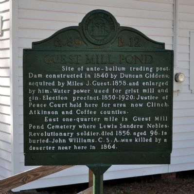
1. Guest Mill Pond Marker
Site of ante-bellum trading post. Dam constructed in 1840 by Duncan Giddens; acquired by Miles J. Guest.1858, and enlarged by him. Water power used for grist mill and gin. Election precinct.1850-1920; Justice of Peace Court held here for area now Clinch, Atkinson and Coffee counties.
East one-quarter mile is Guest Mill Pond Cemetery where Lewis Sanders Nobles, Revolutionary soldier, died 1856, aged 96, is buried. John Williams, C.S.A., was killed by a deserter near here in 1864.
Erected by Works Progress Administration. (Marker Number 89 B-12.)
Topics and series. This historical marker is listed in these topic lists: Cemeteries & Burial Sites • Industry & Commerce • Settlements & Settlers • War, US Civil. In addition, it is included in the Georgia Historical Society, and the Works Progress Administration (WPA) projects series lists. A significant historical year for this entry is 1840.
Location. 31° 11′ N, 82° 50.917′ W. Marker is near Homerville, Georgia, in Clinch County. It is on Guest Mill Pond Road (Private) 0.1 miles west of Pearson Highway (Route 441), on the left when traveling west. The marker
this page online

Regionally, this marker is on the Coastal Plain. It is also in the American South, specifically in the Deep South, and in the Wiregrass. Globally, it is in North America, the Western Hemisphere, the Western World, and the Anglosphere. Historically, it finds itself in what was once the territory of the Mississippian Culture, one of the original Thirteen Colonies, one of the Confederate States of America, and the Antebellum South.
Other nearby markers. At least 8 other markers are within 11 miles of this marker, measured as the crow flies: A different marker also named Guest Mill Pond (here, next to this marker); Salem Church (approx. 3.7 miles away); Kinnaird Trail (approx. 4.1 miles away); Bethany Baptist Church (approx. 5½ miles away); Atkinson Court House (approx. 7.8 miles away); Confederate Soldier Memorial (approx. 7.8 miles away); Minnie F. Corbitt Memorial Museum (approx. 8 miles away); First Court in Clinch County
Photographed by David Seibert, January 16, 2012
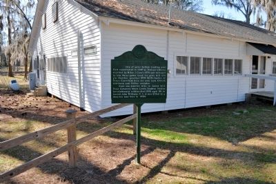
2. Guest Mill Pond Marker
More about this marker. The marker was erected in the late 1930s.
Photographed by David Seibert, January 16, 2012
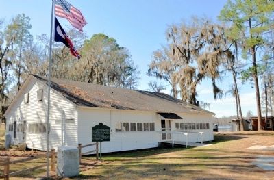
3. Guest Mill Pond Marker
Guest Mill Pond is visible in the distance, to the right of the building.
Credits. This page was last revised on March 8, 2024. It was originally submitted on March 7, 2012, by David Seibert of Sandy Springs, Georgia. This page has been viewed 2,740 times since then and 152 times this year. Last updated on April 11, 2017, by Greg Bennett of Blackshear, Georgia. Photos: 1, 2, 3. submitted on March 7, 2012, by David Seibert of Sandy Springs, Georgia. • Bernard Fisher was the editor who published this page.
Editor’s want-list for this marker. A view of the pond • Can you help?
