Near Spotsylvania Courthouse in Spotsylvania County, Virginia — The American South (Mid-Atlantic)
Civil War Earthworks
Preservation Message
— Fredericksburg and Spotsylvania National Military Park —
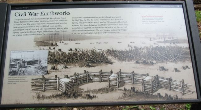
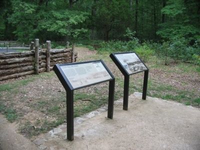
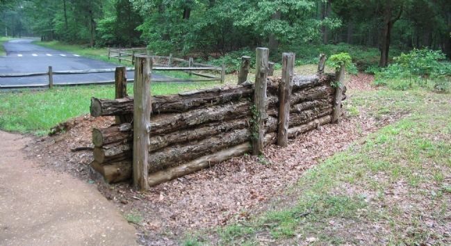
The gentle mounds that meander through Spotsylvania Court House battlefield once looked like the reconstructed earthwork in front of you. The armies built more than 12 miles of trenches here, using whatever tools they could find. Lee's last line, extending off to your right and left, was completed May 12, while fighting ranged at the Bloody Angle, a mile ahead of you. You can see original works on either side of the reconstruction.
Spotsylvania's earthworks illustrate the changing nature of the Civil War. By 1864 the tactics of maneuver and open-field fighting had given way to trench warfare. Whenever soldiers took position, they started digging. Shielded by earthworks, battle lines moved closer together; soldiers toiled under fire for days on end; attacks became more costly. The war became a daunting struggle to survive not just bullets but stress and exhaustion too.
Do not walk on the earthworks!
This reconstruction replaces original works obliterated by a road in the 1930s. The earthworks on either side are original and fragile.
Erected by National Park Service, U.S. Department of the Interior.
Topics. This historical marker is listed in this topic list: War, US Civil. A significant historical date for this entry is May 12, 1862.
Location. 38° 12.85′ N, 77° 36.463′ W. Marker is near Spotsylvania Courthouse, Virginia, in Spotsylvania County. Marker is on Anderson Drive, on the right when traveling south. Located beyond stop four (Harrison House) on the driving tour of Spotsylvania Battlefield unit of the Fredericksburg and Spotsylvania National Military Park. Touch for map. Marker is in this post office area: Spotsylvania VA 22553, United States of America. Touch for directions.
Other nearby markers. At least 8 other markers are within walking distance of this marker. Spotsylvania Campaign (a few steps from this marker); Grant's May 18th Attack (a few steps from this marker); a different marker also named Spotsylvania Campaign (a few steps from this marker); Lee's Last Line (approx. 0.2 miles away); Harrison House Site (approx. 0.3 miles away); Lee to the Rear! (approx. 0.3 miles away); The Harrison House (approx. 0.3 miles away); Fight for the Fences (approx. 0.4 miles away). Touch for a list and map of all markers in Spotsylvania Courthouse.
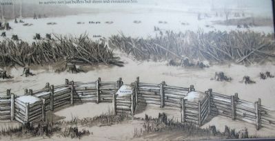
More about this marker. The background of the marker is a depiction of the field fortifications built during the Civil War. Indicted are examples of traverses, abatis, and rifle pits. An inset photo of Confederate log works at Spotsylvania is captioned Over the years the earthworks eroded, filling the ditch and creating the gentle mounds that you see today.
Credits. This page was last revised on December 6, 2022. It was originally submitted on August 15, 2008, by Craig Swain of Leesburg, Virginia. This page has been viewed 2,519 times since then and 52 times this year. Photos: 1, 2. submitted on August 15, 2008, by Craig Swain of Leesburg, Virginia. 3. submitted on August 25, 2008, by Craig Swain of Leesburg, Virginia. 4. submitted on August 15, 2008, by Craig Swain of Leesburg, Virginia.


