Santa Elena, Yucatán, Mexico — The Southeast (Yucatan Peninsula)
The Ballgame
El Juego de Pelota
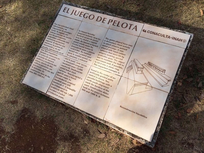
Fue una actividad ritual adivinatoria y de adquisición de prestigio social. Se jugaba con esferas macizas de caucho que los participantes golpeaban utilizando una vestimenta protectora especial. El objetivo era mantener la pelota en movimiento y, de ser posible, introducirla en el aro. Este importante ejemplo se encuentra en el centro de un patio nivelado de manera artificial y recubierto con estuco. Consta de dos edificios paralelos con orientación norte-sur, que lo delimitan. Su construcción data de los años 800-1000 d.C.
Pie de dibujo: Reproducción hipotética
Maya-Yucateco:
El Juego de Pelota
Le báaxal ka’acha’ jump’éel tsolante’ tu’ux ku beeta’al na’ato’ob yéetel tu’ux ku chukik u nojchil máak. Ku báaxta’al ka’ach yéetel wóolis saats’ ku k’o’olol ka’ach tumen le jbáaxalo’ob yaan u jela’an nook’o’obo’. Ku kaxta’al ka’ach ma’ u p’áatal xma’ péek le wóosilo yéetel, wa ku páajtale’, u yosa’al ichi le joolo’. Lela’ tya’an tu chúumukil jump’éel táankabil yaan 13,000 meetro’ob, táaxkuna’an yéetel kukul chich luk’ta’an. Yaan ka’ap’éel u pak’ilil yaan u táanil xaman-nojol, ku ts’o’oksiko’ob jump’eel táankab yaan 680 meetro’ob ti’. U betpajlile’ ku k’iimbesa’al tu ja’abilo’ob 800 tak 1,000 ts’o’okol u k’uchul ki’ichkelem yuum.
English:
The Ballgame
The game played here was a divinatory ritual activity in which players gained social prestige. It was played with hard rubber spheres that were hit by players wearing special protective gear. The object was to maintain the ball in movement and, if possible, to hit it into a stone ring. This important example is found in the center of an artificially graded patio coated in stucco. Two parallel buildings with a north-south alignment mark the borders of the court. Construction dates back to the years between 800 and 1000 A.D.
Caption translation: Hypothetical reproduction of the ball court.
Erected by Consejo Nacional para la Cultura y las Artes de México (CONACULTA)-INAH.
Topics. This historical marker is listed in these topic lists: Anthropology & Archaeology • Architecture • Native Americans • Sports.
Location. 20° 21.598′ N, 89° 46.263′ W. Marker is in Santa Elena, Yucatán. Marker can be reached from Route 261. The marker is just south of the ball court at the Uxmal Archaeological
Photographed By J. Makali Bruton, January 20, 2017
2. An additional Ballgame Marker
This additional marker is just northwest of the featured marker and Ballgame court. It is to the right as one walks south from the Quadrangle of the Nuns. It's text reads:
El Juego de Pelota
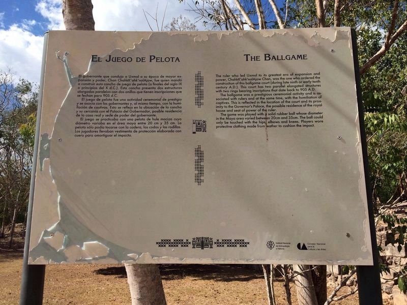
El gobernante que condujo a Uxmal a su época de mayor expansión y poder, Chan ChahkK’ahk’nalAjaw, fue quien mandó a construir esta cancha de juego de pelota (a finales del siglo IX o principios del X d.C.). Esta cancha presenta dos estructuras alargadas paralelas con dos anillos que tienen inscripciones que se fechan para 905 d.C.
El juego de pelota fue una actividad ceremonial de prestigio y se asocia con los gobernantes y, al mismo tiempo, con la humillación de cautivos. Esto se refleja en la ubicación de la cancha y su cercanía con el Palacio del Gobernador, posible residencia de la casa real y sede de poder del gobernante.
El juego se practicaba con una pelota de hule maciza cuya diámetro variaba en el área maya entre 20 cm y 35 cm. La pelota sólo podía tocarse con la cadera, los codos y las rodillas. Los jugadores llevaban vestimenta de protección elaborada con cuero para amortiguar el impacto.
English:
The Ballgame
The ruler who led Uxmal to its greatest era of expansión and power, ChahkK’ahk’nalAjaw Chan, was the one who ordered the construction of this ballgame court (during the late ninth or early tenth century A.D.). This court has two parallel elongated structures with two rings bearing inscriptions that date back to 905 A.D.
The ballgame was a prestigious ceremonial activity and is associated with rulers and at the same time, with the humiliation of captives. This is reflected in the location of the court and its proximity to the Governor’s Palace, the possible residence of the royal house and seat of power of the ruler.
The game was played with a solid rubber ball whose diameter in the Maya area varied between 20cm and 35cm. The ball could only be touched with the hips, elbows and knees. Players wore protective clothing made from leather to cushion the impact.
Other nearby markers. At least 8 other markers are within walking distance of this marker. The Columns Building or the East Portico (about 90 meters away, measured in a direct line); Architecture (about 120 meters away); Quadrangle of the Birds (about 150 meters away); The Governor's Palace (about 150 meters away); The Pillory Shrine (about 150 meters away); The Great Temple / Great Pyramid (about 180 meters away); The Throne of the Jaguar (about 180 meters away); West facade of the Chenes style Temple IV (about 210 meters away). Touch for a list and map of all markers in Santa Elena.
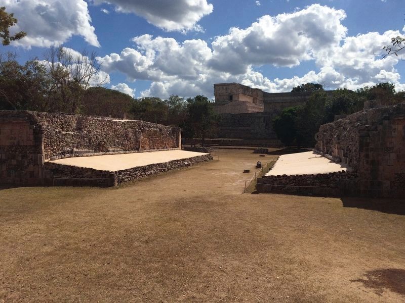
Photographed By J. Makali Bruton, January 20, 2017
4. The Ballgame Marker
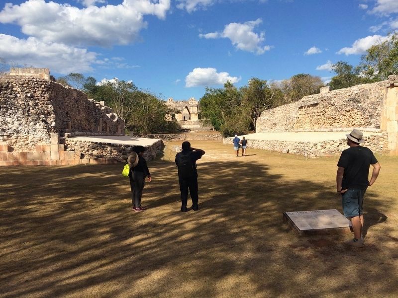
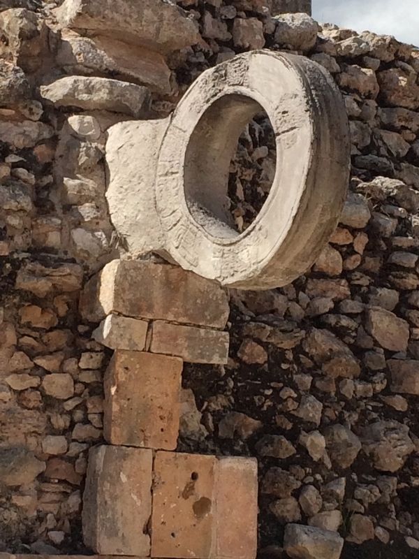
Note the two "goals", the stone hoops through which players were to place the ball. The featured marker can be seen in the distance, roughly between the two walls of the ball game court. The Governor's Palace can be seen in the distance to the south.
Credits. This page was last revised on December 18, 2017. It was originally submitted on April 16, 2017, by J. Makali Bruton of Accra, Ghana. This page has been viewed 241 times since then and 9 times this year. Photos: 1, 2, 3. submitted on April 23, 2017, by J. Makali Bruton of Accra, Ghana. 4, 5. submitted on April 16, 2017, by J. Makali Bruton of Accra, Ghana.
