Port Hueneme in Ventura County, California — The American West (Pacific Coastal)
La Jenelle
Photographed by Michael Herrick, April 21, 2017
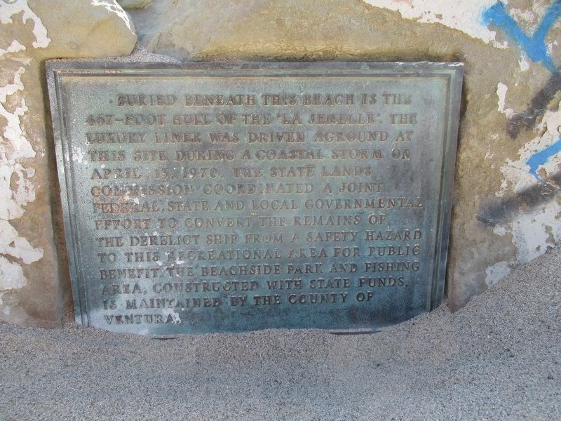
1. "La Jenelle" Marker
Buried beneath this beach is the 467–foot hull of the “La Jenelle”. The luxury liner was driven aground at this site during a coastal storm on April 13, 1970. The State Lands Commission coordinated a joint federal, state and local governmental effort to convert the remains of the derelict ship from a safety hazard to this recreational area for public benefit. This beachside park and fishing area, constructed with state funds is maintained by the County of Ventura.
Topics. This historical marker is listed in this topic list: Waterways & Vessels. A significant historical date for this entry is April 13, 1970.
Location. 34° 8.804′ N, 119° 12.962′ W. Marker is in Port Hueneme, California, in Ventura County. It can be reached from the intersection of Ocean Drive and Sawtelle Avenue, on the right when traveling south. Located on the beach at La Jenelle Park. Touch for map. Marker is in this post office area: Oxnard CA 93035, United States of America. Touch for directions.

Regionally, this marker is in Greater Los Angeles, on the Central Coast, and in the Transverse Ranges. It is also on the American Pacific Coast. Globally, it is
this page online
Other nearby markers. At least 8 other markers are within 2 miles of this marker, measured as the crow flies: Point Hueneme Lighthouse (approx. 0.4 miles away); Bank of Hueneme (approx. one mile away); Women’s Improvement Club (approx. 1.1 miles away); Gerberding/Moranda House (approx. 1.1 miles away); Bard Mansion (approx. 1.4 miles away); Bard Memorial (approx. 1.4 miles away); Goodspeed Street Marker (approx. 1.4 miles away); Alaska Flight 261 Memorial (approx. 1.4 miles away). Touch for a list and map of all markers in Port Hueneme.
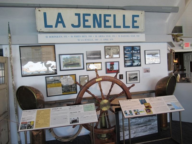
More about this marker. More information and artifacts from "La Jenelle" can bee seen at the Channel Islands Maritime Museum which generously aided in documenting this marker.
Regarding La Jenelle.
“La Jenelle” is known as the ship with five names. Launched in 1930 as the “Borinquen”, she operated from New York to islands in the Caribbean. Requisitioned during
Photographed by Michael Herrick, April 21, 2017
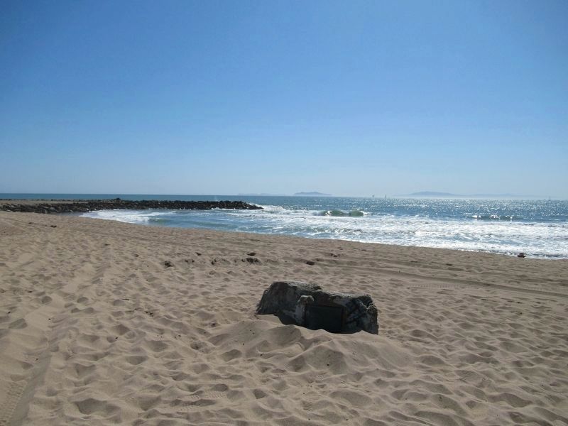
2. "La Jenelle" Marker
Also see . . .
1. Channel Islands Maritime Museum. Museum website (Submitted on October 22, 2020, by Larry Gertner of New York, New York.)
2. La Jenelle. California Wreck Divers website. (Submitted on October 22, 2020, by Larry Gertner of New York, New York.)
Photographed by Michael Herrick, April 21, 2017
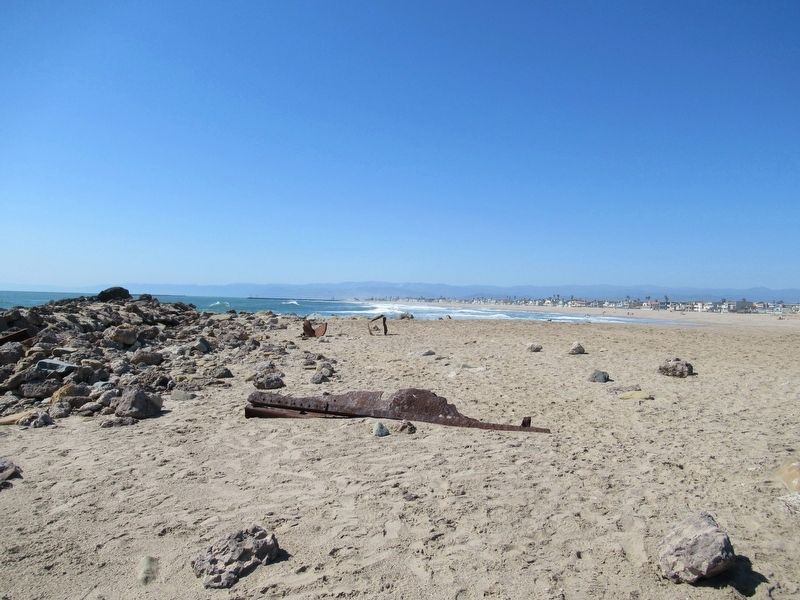
3. Parts of the Wreck are occasionally uncovered
Photographed by Michael Herrick, April 21, 2017
4. Artifacts from “La Jenelle” at the Channel Islands Maritime Museum
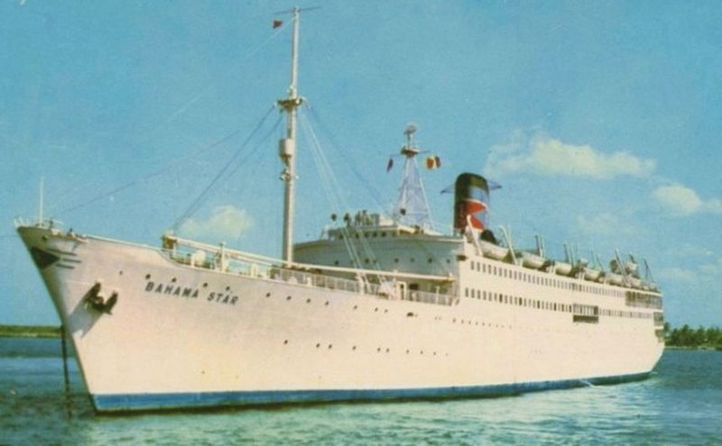
courtesy Maritime Matters
5. "La Jenelle" as "Bermuda Star"
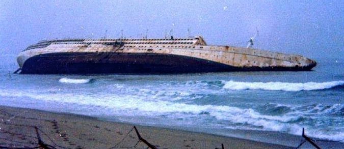
courtesy Maritime Matters
6. The wreck of "La Jenelle"
Credits. This page was last revised on November 26, 2024. It was originally submitted on April 22, 2017, by Michael Herrick of Southbury, Connecticut. This page has been viewed 1,610 times since then and 104 times this year. Photos: 1, 2, 3, 4. submitted on April 22, 2017, by Michael Herrick of Southbury, Connecticut. 5, 6. submitted on October 22, 2020, by Larry Gertner of New York, New York.
