Cabin John in Montgomery County, Maryland — The American Northeast (Mid-Atlantic)
At All Hours
Chesapeake and Ohio Canal National Historical Park
| — | National Park Service, U.S. Department of the Interior | — |
Photographed by Allen C. Browne, May 3, 2017
1. At All Hours Marker
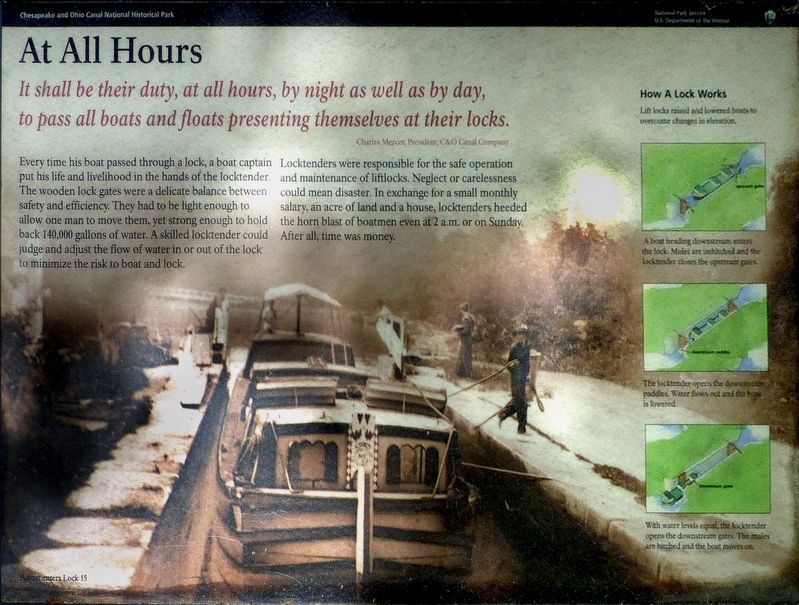
It shall be the duty, at all hours, by night as well as day, to pass all boats and floats presenting themselves at their locks. — Charles Mercer, President, C&O Canal Company
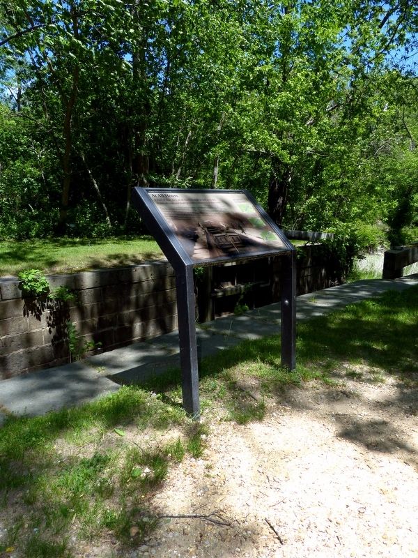
Every time his boat passed through a lock, a boat captain put his life and livelihood in the hands of the locktender. The wooden lock gates were a delicate balance between safety and efficiency. They had to be light enough to allow one man to move them, yet strong enough to hold back 140,000 gallons of water. A skilled locktender could judge and adjust the flow of water in or out of the lock to minimize the risk to boat and lock.
Locktenders were responsible for the safe operation and maintenance of liftlocks. Neglect or carelessness could mean disaster. In exchange for a small monthly salary, an acre of land and a house, locktenders heeded the horn blast of boatmen even at 2 a.m. or on Sunday. After all, time was money.
Erected by National Park Service, U.S. Department of the Interior.
Topics and series. This historical marker is listed in these topic lists: Industry & Commerce • Waterways & Vessels. In addition, it is included
this page online
Location. 38° 58.334′ N, 77° 10.111′ W. Marker is in Cabin John, Maryland, in Montgomery County. It can be reached from Clara Barton Parkway one mile east of Capital Beltway Inner Loop (Interstate 495). At Lock 10 in the Chesapeake & Ohio Canal National Historical Park. Touch for map. Marker is at or near this postal address: 8250 Clara Barton Parkway, Cabin John MD 20818, United States of America. Touch for directions.

Regionally, this marker is in the Washington Metropolitan Area. It is also in the American Mid-Atlantic. Globally, it is in North America, the Western Hemisphere, the Western World, and the Anglosphere. Historically, it finds itself in what was once one of the original Thirteen Colonies and also the Antebellum South.
Other nearby markers. At least 8 other markers are within 2 miles of this marker, measured as the crow flies: Drop Gate Locks (a few steps from this marker); Lockhouse 10 (within shouting distance of this marker); Swing-Gate Locks (approx. 0.2 miles away); The Lock-Keepers (approx. 0.2 miles away);
Photographed by Allen C. Browne, May 3, 2017
2. At All Hours Marker
Photographed by Allen C. Browne, May 3, 2017
3. How a Lock Works — Boat Heading Downstream
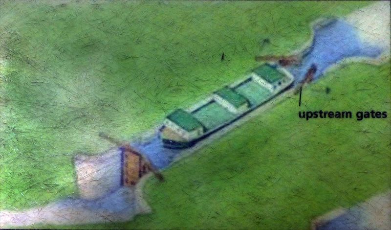
Lift locks raised and lowered boats to overcome changes in elevation.
A boat heading downstream enters the lock. Mules can be unhitched and the locktender closes the upstream gates.Close-up of image on marker
A boat heading downstream enters the lock. Mules can be unhitched and the locktender closes the upstream gates.
Photographed by Allen C. Browne, May 3, 2017
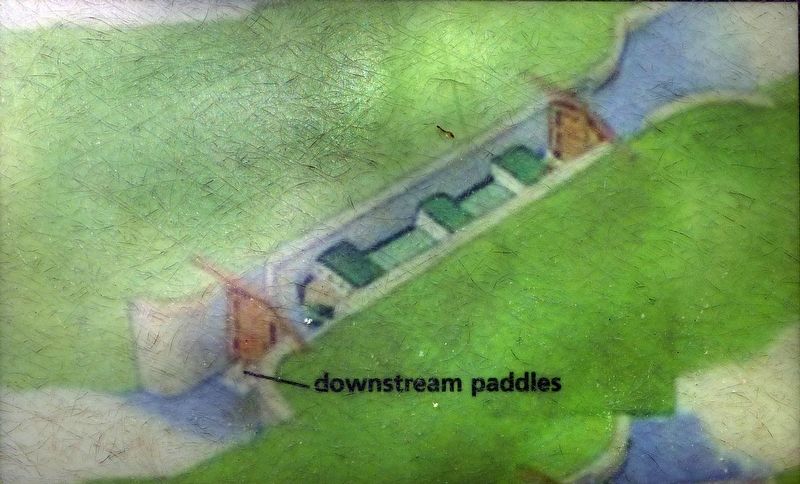
4. How a Lock Works — Lowering the Boat
The locktender opens the downstream paddles. Water flows out and the boat is lowered. Close-up of image on marker
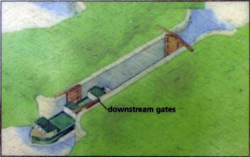
Photographed by Allen C. Browne, May 3, 2017
5. How a Lock Works — Boat Moves On
With water levels equal, the locktender opens the downstream gates. The mules are hitched and the boat moves on.Close-up of image on marker
Credits. This page was last revised on March 20, 2026. It was originally submitted on May 5, 2017, by Allen C. Browne of Silver Spring, Maryland. This page has been viewed 391 times since then and 19 times this year. Photos: 1, 2, 3, 4, 5. submitted on May 5, 2017, by Allen C. Browne of Silver Spring, Maryland. • Bill Pfingsten was the editor who published this page.
