Silk Hope in Savannah in Chatham County, Georgia — The American South (South Atlantic)
Battery Jones
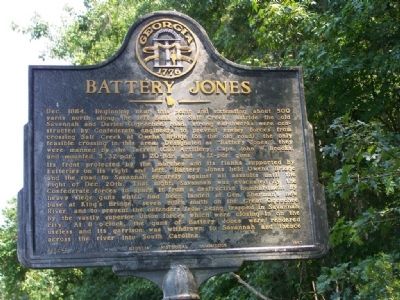
Photographed by Mike Stroud, August 2008
1. Battery Jones Marker
Dec. 1864. Beginning near this point and extending about 500 yards north along the left bank of Salt Creek, astride the old Savannah and Darien (Ogeechee) road, strong earthworks were constructed by Confederate engineers to prevent enemy forces from crossing Salt Creek at Owens' Bridge (on the old road), the only feasible crossing in this area. Designated as "Battery Jones," they were manned by the Terrell (Ga.) Artillery, Capt. John W. Brooks, and mounted 3 32-pdr., 1 20-pdr., and 4 12-pdr., guns.
Its front protected by the marshes and its flanks supported by batteries on its right and left, Battery Jones held Owens' Bridge and the road to Savannah securely against all assaults until the night of Dec. 20th. That night, Savannah was evacuated by the Confederate forces to spare it from a destructive bombardment by heavy siege guns which had been landed at Gen. Sherman's new base at King's Bridge, seven miles south on the Great Ogeechee River, and to prevent the defenders from being trapped in Savannah by the vastly superior Union forces which were closing in on the city. At 8 o'clock, the guns of Battery Jones were rendered
this page online
Erected 1957 by Georgia Historical Commission. (Marker Number 025-42.)
Topics and series. This historical marker is listed in these topic lists: Forts and Castles • War, US Civil. In addition, it is included in the Georgia Historical Society, and the Sherman’s March to the Sea series lists. A significant historical year for this entry is 1864.
Location. 32° 2.446′ N, 81° 11.848′ W. Marker is in Savannah, Georgia, in Chatham County. It is in Silk Hope. It is at the intersection of Ogeechee Road (U.S. 17) and Silk Hope Road when traveling north on Ogeechee Road. Touch for map. Marker is in this post office area: Savannah GA 31405, United States of America. Touch for directions.

Regionally, this marker is on the Coastal Plain and on the Georgia Coast and the Golden Isles. It is also in the American South, specifically in the Deep South, and on the Eastern Seaboard. Globally, it is in the North Atlantic Region, North America, the Western Hemisphere, the Western World, and the Anglosphere. Historically, it finds itself
Photographed by Mike Stroud, 2008
2. Battery Jones Marker
Other nearby markers. At least 8 other markers are within 6 miles of this marker, measured as the crow flies: Sherman's March To The Sea: (approx. 3.3 miles away); Pooler Station (approx. 3.7 miles away); St. Joseph's Hospital (approx. 4.6 miles away); Laurel Grove South Cemetery (approx. 5 miles away); Robert “Robbie” Robinson (approx. 5 miles away); Robert Sengstacke Abbott Boyhood Home (approx. 5.2 miles away); Jasper Spring (approx. 5.3 miles away); a different marker also named Jasper Spring (approx. 5.3 miles away). Touch for a list and map of all markers in Savannah.
Regarding Battery Jones. Battery Jones on the old Savannah-Darien road crossing of Salt Creek. These well armed batteries were the most active during the exchange with Federal gunners.
Also see . . . Battery Jones. The Siege of Savannah in December, 1864, and the Confederate Operations in Georgia and the Third Military District of South Carolina during General
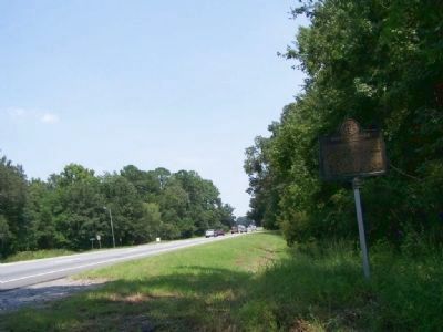
Photographed by Mike Stroud, 2008
3. Battery Jones Marker, Looking North on US 17
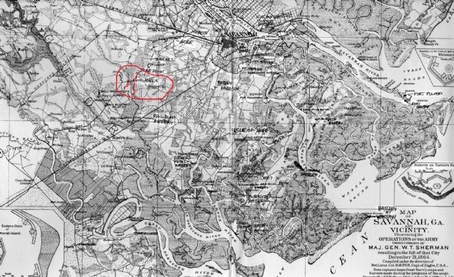
4. Battery Jones
Credits. This page was last revised on February 8, 2023. It was originally submitted on August 17, 2008, by Mike Stroud of Bluffton, South Carolina. This page has been viewed 3,208 times since then and 61 times this year. Photos: 1, 2, 3, 4. submitted on August 17, 2008, by Mike Stroud of Bluffton, South Carolina. • Craig Swain was the editor who published this page.
