Sumpango, Sacatepéquez, Guatemala — Central America (Central Highlands)
Tree of Saint Peter
Photographed by J. Makali Bruton, February 18, 2017
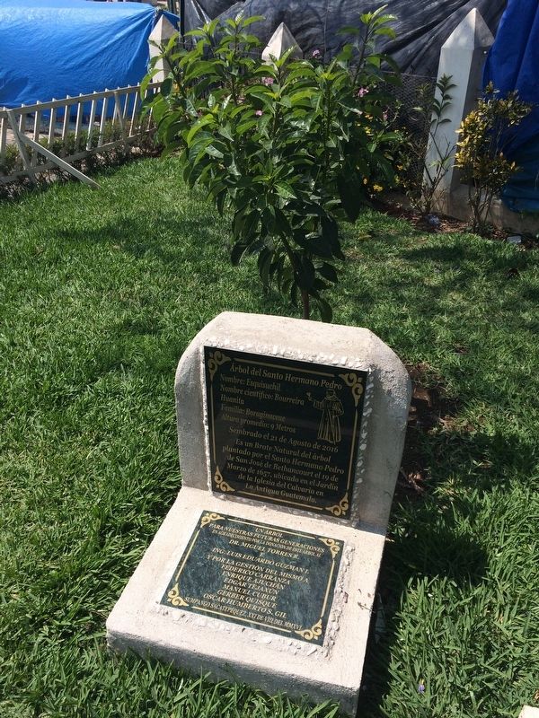
1. Tree of Saint Peter Marker
The tree is directly behind the marker.

Nombre: Esquisuchil
Nombre científico: Bourreira Huanita
Familia: Boraginaceae
Altura promedio: 9 Metros
Sembrado el 21 de Agosto de 2016
Es un Brote Natural del árbol
plantado por el Santo Hermano Pedro
de San José de Bethancourt el 19 de
Marzo de 1657, ubicado en el Jardín
de la Iglesia del Calvario en
La Antigua Guatemala.
Un árbol para nuestras futuras generaciones
en agradecimiento por la donación de este árbol al
Dr. Miguel Torres R. e
Ing. Luis Eduardo Guzman I.
y por la gestión del mismo a:
Federico Carranza · Enrique Ajuchan · Edgar Tejaxán · Manuel Cubur · Gerber Quisque · Oscar Humberto S. Gil
Sumpango Sacatepéquez, XXI de VIII del MMXVI
Name: Esquisuchil
Scientific name: Bourreira Huanita
Family: Boraginaceae
Average height: 9 Meters
Planted on August 21, 2016
This was a natural bud of the original tree
planted by the Holy Brother Peter
of Saint Joseph of Bethancourt on March 19, 1657, located in the Garden of The Church of the Calvary in
Antigua Guatemala.
A tree for our future generations
Gratitude for the donation of this tree to Dr. Miguel
this page online
and also to:
Federico Carranza · Enrique Ajuchan · Edgar Tejaxán · Manuel Cubur · Gerber Quisque · Oscar Humberto S. Gil
Sumpango Sacatepéquez, August 21, 2016
Erected 2016 by Dr. Miguel Torres R. e Ing. Luis Eduardo Guzman I.
Topics and series. This historical marker is listed in these topic lists: Charity & Public Work • Colonial Era • Religion & Religious Structures. In addition, it is included in the Historic Trees series list. A significant historical date for this entry is March 19, 1657.
Location. 14° 38.829′ N, 90° 44.202′ W. Marker is in Sumpango, Sacatepéquez. It can be reached from 0 Avenida just north of 2a Calle. The marker and tree are just west of the entrance to the Catholic Church of Saint Augustine of Sumpango, Sacatepéquez. Touch for map. Marker is in this post office area: Sumpango, Sacatepéquez 03004, Guatemala. Touch for directions.

Regionally, it is in North America, specifically in Central America, in Mesoamerica, on the Ring of Fire, in the Pacific Rim, and in the Western Hemisphere. Historically, it finds itself in what was once New Spain and also a Spanish
Photographed by J. Makali Bruton, February 18, 2017
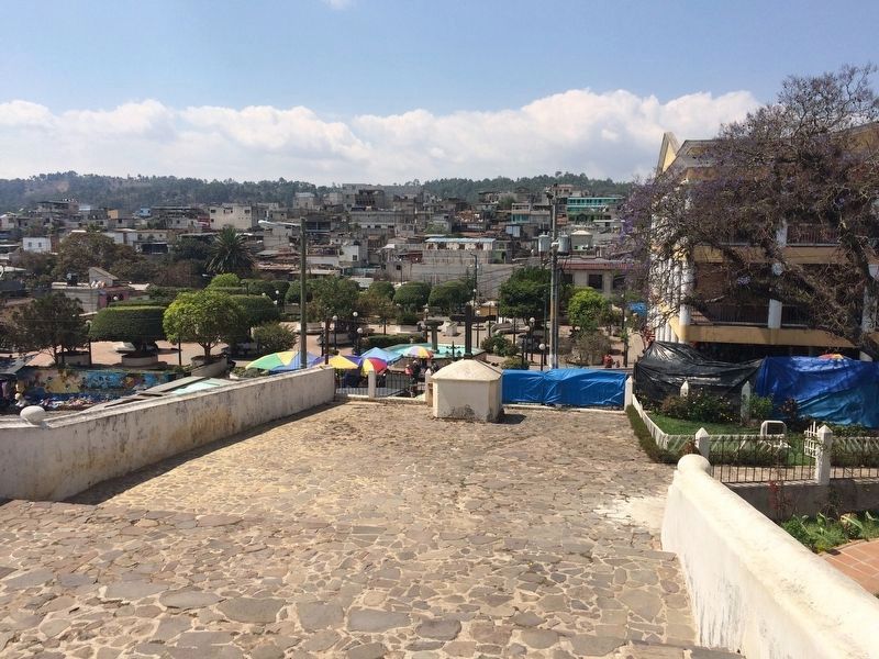
2. Tree of Saint Peter Marker
The marker and tree can be seen to the right in this view of the area to the west of the Catholic Church of Saint Augustine. A portion of the town of Sumpango can be seen in the distance.
Other nearby markers. At least 8 other markers are within 10 kilometers of this marker, measured as the crow flies: Parish of Santo Domingo Xenacoj (approx. 5.3 kilometers away); Saint Sebastian Catholic Church of El Tejar (approx. 5.9 kilometers away in Chimaltenango); Reconstruction After Guatemala's 1976 Earthquake (approx. 7.7 kilometers away); The 20th Anniversary of the Guatemalan Peace Accords (approx. 8.2 kilometers away in Chimaltenango); The Road Workers Monument (approx. 8.9 kilometers away); General Justo Rufino Barrios (approx. 9 kilometers away in Chimaltenango); José Simeon Cañas (approx. 9 kilometers away in Chimaltenango); Chimaltenango Memorial to the Victims of Guatemala's Armed Conflict (approx. 9 kilometers away in Chimaltenango).
Related marker. Click here for another marker that is related to this marker. This related marker shows the original tree mentioned in this marker's text.
Photographed by J. Makali Bruton, February 18, 2017
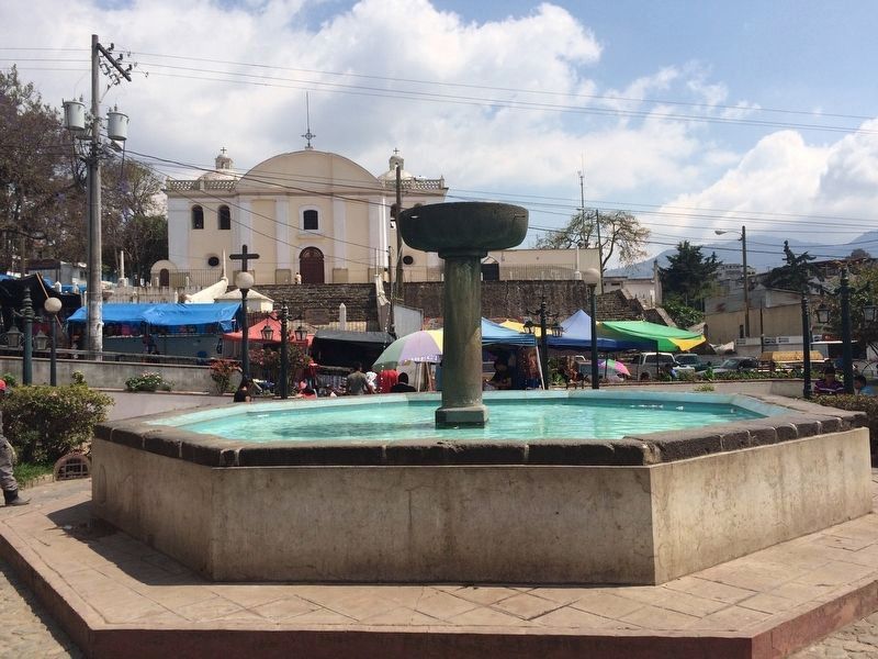
3. A view of an older fountain looking towards the east at Sumpango.
The marker and tree are roughly behind the blue tarps seen to the left. The Catholic Church of Saint Augustine can be seen in the background.
Photographed by J. Makali Bruton, February 18, 2017
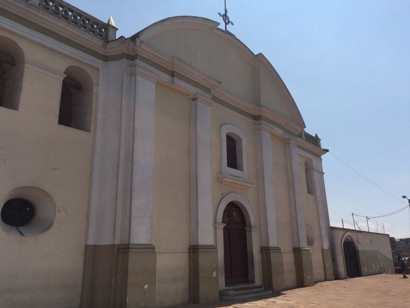
4. The Catholic Church of Saint Augustine of Sumpango.
Credits. This page was last revised on March 2, 2018. It was originally submitted on May 21, 2017, by J. Makali Bruton of Washington, District of Columbia. This page has been viewed 380 times since then and 14 times this year. Photos: 1, 2, 3, 4. submitted on May 21, 2017, by J. Makali Bruton of Washington, District of Columbia.
