Near Williamsburg in James City County, Virginia — The American South (Mid-Atlantic)
Fort Magruder
An Ugly Place to Have to Attack
— 1862 Peninsula Campaign —
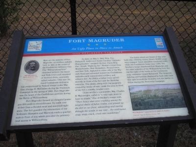
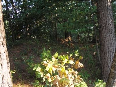
Fort Magruder formed an elongated pentagon 600 yards in circumference. Its walls rose 15 feet from a flooded moat and mounted eight guns. The fort guarded the intersection of the Yorktown – Hampton and Warwick roads a quarter-mile in front of you which provided the primary land access to Williamsburg.
At dawn on May 5, 1862, Brig. Gen. Richard H. Anderson’s South Carolina “Palmetto Sharpshooters” occupied the fort. Union Brig. Gen. Joseph “Fighting Joe” Hooker’s troops from Massachusetts, New Hampshire, Pennsylvania, and New York, deployed to either side of the Warwick Road and advanced toward the Confederate redoubts amid concentrated artillery and infantry fire. An abatis of felled trees spread directly in front of the fort and the flanking redoubts. The abatis, along with the quagmire created by weeks of rain, made the area in front of the fort a muddy, tangled mess.
Union artillery commander, Maj. Gen. Charles S. Wainwright, called it “a very ugly place to have to attack.” One of Hooker’s troops said, “Their heavy shot came crashing among the tangled abatis of fallen timber, and plowed up the dirt in our front, rebounding and tearing through the woods in our rear … the continuous snap, snap, crack, crack was murderous.”
The battle ebbed and flowed all day, with both sides claiming victory. Nearly 20,000 troops were engaged. Union casualties numbered 2,283, while the Confederate losses were 1,560. The Southern troops abandoned Fort Magruder and the other redoubts of the Williamsburg Line during the night of the battle as the Confederate army withdrew toward Richmond. The desperate fighting and heroism displayed by both sides near this spot foretold the brutality and the battles to follow during the Peninsula Campaign.
Erected by Virginia Civil War Trails.
Topics and series. This historical marker is listed in these topic lists: Forts and Castles • War, US Civil. In addition, it is included in the Virginia Civil War Trails series list. A significant historical date for this entry is May 5, 1862.
Location. 37° 15.845′ N, 76° 39.967′
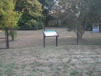
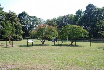
W. Marker is near Williamsburg, Virginia, in James City County. Marker is at the intersection of Penniman Road and Queens Creek Road, on the left when traveling north on Penniman Road. Touch for map. Marker is at or near this postal address: 1035 Penniman Rd, Williamsburg VA 23185, United States of America. Touch for directions.
Other nearby markers. At least 8 other markers are within walking distance of this marker. Confederate Soldiers and Sailors Monument (a few steps from this marker); a different marker also named Fort Magruder (a few steps from this marker); Vineyard Tract (about 500 feet away, measured in a direct line); Magruder’s Defenses (approx. half a mile away); Battle of Williamsburg (approx. half a mile away); Quarterpath Road (approx. 0.7 miles away); Peninsula Campaign (approx. 0.7 miles away); a different marker also named The Battle of Williamsburg (approx. 0.7 miles away). Touch for a list and map of all markers in Williamsburg.
More about this marker. The upper left of the marker contains a photograph of Maj. Gen. Richard Heron Anderson, CSA – Courtesy of the Library of Congress. The bottom right of the marker features a watercolor of “Fort Magruder” by Lt. Robert K. Sneden, Copyright Virginia Historical Society, 1997.
Also see . . .
1. Williamsburg, Fort Magruder, Civil War Virginia, May 5, 1862. American Civil War website. (Submitted on August 17, 2008, by Bill Coughlin of Woodland Park, New Jersey.)
2. Battle of Williamsburg, 5 May 1862. (Submitted on August 17, 2008, by Bill Coughlin of Woodland Park, New Jersey.)
3. The Peninsula Campaign of 1862. (Submitted on August 17, 2008, by Bill Coughlin of Woodland Park, New Jersey.)
4. Tidewater Virginia, The 1862 Peninsula Campaign. Civil War Traveler. (Submitted on August 17, 2008, by Bill Coughlin of Woodland Park, New Jersey.)
Credits. This page was last revised on March 2, 2021. It was originally submitted on August 17, 2008, by Bill Coughlin of Woodland Park, New Jersey. This page has been viewed 3,596 times since then and 90 times this year. Photos: 1, 2. submitted on August 17, 2008, by Bill Coughlin of Woodland Park, New Jersey. 3. submitted on August 8, 2015, by Brandon Fletcher of Chattanooga, Tennessee. 4. submitted on August 17, 2008, by Bill Coughlin of Woodland Park, New Jersey.


